
Howrah–Nagpur–Mumbai line
| Howrah–Nagpur–Mumbai line | |
|---|---|
| Overview | |
| Status | Operational |
| Owner | Indian Railway |
| Locale | West Bengal, Jharkhand, Odisha, Chhattisgarh, Maharashtra |
| Termini | |
| Service | |
| System | Electrified |
| Operator(s) | South Eastern Railway, South East Central Railway, Central Railway |
| History | |
| Opened | 1900 |
| Technical | |
| Line length | 1,968 km (1,223 mi) |
| Track gauge | 1676 Broad gauge |
| Operating speed | up to 160 km/h |
| Minor stations omitted | |||||||||||||||||||||||||||||||||||||||||||||||||||||||||||||||||||||||||||||||||||||||||||||||||||||||||||||||||||||||||||||||||||||||||||||||||||||||||||||||||||||||||||||||||||||||||||||||||||||||||||||||||||||||||||||||||||||||||||||||||||||||||||||||||||||||||||||||||||||||||||||||||||||||||||||||||||||||||||||||||||||||||||||||||||||||||||||||||||||||||||||||||||||||||||||||||||||||||||||||||||||||||||||||||||||||||||||||||||||||||||||||||||||||||||||||||||||||||||||||||||||||||
| |||||||||||||||||||||||||||||||||||||||||||||||||||||||||||||||||||||||||||||||||||||||||||||||||||||||||||||||||||||||||||||||||||||||||||||||||||||||||||||||||||||||||||||||||||||||||||||||||||||||||||||||||||||||||||||||||||||||||||||||||||||||||||||||||||||||||||||||||||||||||||||||||||||||||||||||||||||||||||||||||||||||||||||||||||||||||||||||||||||||||||||||||||||||||||||||||||||||||||||||||||||||||||||||||||||||||||||||||||||||||||||||||||||||||||||||||||||||||||||||||||||||||
| Source: Indian Railway Time Table and Make my trip | |||||||||||||||||||||||||||||||||||||||||||||||||||||||||||||||||||||||||||||||||||||||||||||||||||||||||||||||||||||||||||||||||||||||||||||||||||||||||||||||||||||||||||||||||||||||||||||||||||||||||||||||||||||||||||||||||||||||||||||||||||||||||||||||||||||||||||||||||||||||||||||||||||||||||||||||||||||||||||||||||||||||||||||||||||||||||||||||||||||||||||||||||||||||||||||||||||||||||||||||||||||||||||||||||||||||||||||||||||||||||||||||||||||||||||||||||||||||||||||||||||||||||
The Howrah–Nagpur–Mumbai line (also known as Mumbai-Kolkata line / Bombay-Calcutta line) is a railway line connecting Kolkata and Mumbai via Nagpur. The 1,968 km (1,223 mi) railway line was opened to traffic in 1900.
Sections
The 1,968 km (1,223 mi) long trunk line has been treated in more detail in smaller sections:
- Howrah-Kharagapur section
- Kharagpur-Tatanagar section
- Tatanagar-Bilaspur section
- Bilaspur-Nagpur section
- Nagpur-Bhusawal section
- Bhusawal-Kalyan section
- Kalyan-Mumbai CST section
Geography
The Howrah–Nagpur–Mumbai line cuts across the central parts of India in an east-west direction and traverses the plains of lower West Bengal, the southern part of Chota Nagpur Plateau, the Deccan Plateau, the Western Ghats and finally the Western Coastal Plains.[1][2][3]
History
The first train in India travelled from Mumbai to Thane on 16 April 1853. By May, 1854, Great Indian Peninsula Railway's Bombay-Thane line was extended to Kalyan. Bhusawal station was set up in 1860 and in 1867 the GIPR branch line was extended to Nagpur.[4]
While the entire Mumbai-Nagpur line was broad gauge, the next part from Nagpur to Rajnandgaon was meter gauge. The Nagpur Chattisgarh Railway started construction of the 240 km (149 mi) Nagpur-Rajnandgaon section in 1878, after surveys were started in 1871. The Nagpur-Tumsar Road section was opened in April 1880 and the Tumsar Road-Rajnandgaon section in December 1880.[5]
The GIPR and EIR, working jointly, completed the Howrah-Allahabad-Mumbai line thereby establishing connectivity between Kolkata and Mumbai in 1870.[6] The great famine of 1878 was an impetus for the fast completion of the Nagpur Chattisgarh Railway track, but by then the idea of a route from Mumbai to Kolkata, shorter than the one via Allahabad, had set in.[7]
The Bengal Nagpur Railway was formed in 1871. Amongst its major objectives were taking over of the Nagpur Chattisgarh Railway and its conversion to broad gauge and extension of its system by a 772 km (480 mi) line to Asansol on EIR’s main line. The entire task was completed by 1891 and Nagpur was connected to Asansol.[5] However, the line via Asansol was never seriously used as a link to Howrah for passenger traffic.
The Sini-Kharagpur-Kolaghat line was opened in 1898-99. The Kolaghat-Howrah section was completed in 1899-1900. The entire line was opened with the completion of the bridge across the Rupnarayan River, near Kolaghat, on 19 April 1900.[8]
-
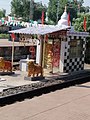 Kali Maa temple

Electrification
The entire line is electrified.[9]
Speed limits
The entire Howrah-Nagpaur-Mumbai line is classified as a “Group A” line which can take speeds up to 160 km/hr.[10]
Passenger movement
Howrah, Kharagpur, Tatanagar, Rourkela, Bilaspur, Raipur, Durg, Nagpur, Akola, Bhusawal, Nasik Road and Manmad on this line, are amongst the top hundred booking stations of Indian Railway.[11]
Golden quadrilateral
The Howrah–Nagpur–Mumbai line is a part of the golden quadrilateral. The routes connecting the four major metropolises (New Delhi, Mumbai, Chennai and Kolkata), along with their diagonals, known as the golden quadrilateral, carry about half the freight and nearly half the passenger traffic, although they form only 16 per cent of the length.[12]
References
- ^ "Chakradharpur Division". South Eastern Railway. Retrieved 2013-03-20.
- ^ "Sundergarh District". Geography and Physical Features. Sundergarh district administration. Retrieved 2013-03-20.
- ^ Ranade, Prabha Shastri. "Population dynamics in India". page 35. Google. Retrieved 2013-03-20.
- ^ Chronology of railways in India, Part 2 (1832 - 1865). "IR History: Early Days – I". Retrieved 2012-11-20.
{{cite web}}: CS1 maint: numeric names: authors list (link) - ^ a b "Nagpur Division" (PDF). Retrieved 2012-11-20.
- ^ "IR History: Early Days – II". Chronology of railways in India, Part 2 (1870 - 1899). Retrieved 2012-11-20.
- ^ "Number 1 Down Mail". Railways of the Raj. Retrieved 2012-11-20.
- ^ "Major Events in the Formation of S.E. Railway". South Eastern Railway. Retrieved 2012-11-20.
- ^ "Chakradharpur Division". South Eastern Railway. Retrieved 2012-11-10.
- ^ "Chapter II – The Maintenance of Permanent Way". Retrieved 2012-11-10.
- ^ "Indian Railways Passenger Reservation Enquiry". Availability in trains for Top 100 Booking Stations of Indian Railways. IRFCA. Retrieved 2012-12-30.
- ^ "Geography – Railway Zones". Major routes. IRFCA. Retrieved 5 March 2013.
External links
| External videos | |
|---|---|
- Trains at Kharagpur
- Trains at Tatanagar
- Trains at Rourkela
- Trains at Bilaspur
- Trains at Raipur
- Trains at Nagpur
- Trains at Bhusaval