National highways of India

The National highways in India are a network of trunk roads owned by the Ministry of Road Transport and Highways. It is constructed and managed by the Central Public Works Department (CPWD), the National Highways and Infrastructure Development Corporation Limited (NHIDCL), and the public works departments (PWD) of state governments. Currently, the longest National Highway in India is National Highway 44 at 4,112 km (2,555 mi).
The National Highways Authority of India (NHAI) and the National Highways and Infrastructure Development Corporation Limited (NHIDCL) are the nodal agencies responsible for building, upgrading, and maintaining most of the National Highways network. It operates under the Ministry of Road Transport and Highways. The National Highways Development Project (NHDP) is a major effort to expand and upgrade the network of highways. NHAI often uses a public–private partnership model for highway maintenance, and toll-collection. NHIDCL uses Engineering Procurement and Construction (EPC) model to build, develop and maintain strategic roads in International borders of the country.
In India, National Highways are at-grade roads, whereas Expressways are controlled-access highways where entrance and exit is controlled by the use ramps that are incorporated into the design of the expressway.National Highways follows standards set by Indian Roads Congress and Bureau of Indian Standards.
Characteristics


India has 151,019 km (93,839 mi) of National Highways as of March 2021.[1]
National Highways constituted 2.7% of India's total road network, but carried about 40% of road traffic, as of 2013.[2] In 2016, the government vowed to double the highway length from 96,000 to 200,000 km.[3]
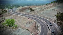
The majority of existing highways are now four-lane roads (two lanes in each direction), though much of this is being expanded to six or more lanes. Some sections of the network are toll roads. Only a few highways are built with concrete. Bypasses have been constructed around larger towns and cities to provide uninterrupted passage for highway traffic. Some existing roads have been reclassified as National Highways.
History
The National Highways Act, 1956[4] provided for public i.e. state investment in the building and maintenance of the highways.
The National Highways Authority of India was established by the National Highways Authority of India Act, 1988. Section 16(1) of the Act states that the function of NHAI is to develop, maintain, and manage the National Highways and any other highways vested in, or entrusted to, it by the Government of India.
In 1998 India launched a massive program of highway upgrades, called the National Highways Development Project (NHDP), in which the main north–south and east–west corridors and highways connecting the four metropolitan cities (Delhi, Mumbai, Chennai and Kolkata) have been fully paved and widened into four-lane highways. Some of the busier National Highway sectors in India were also converted to four- or six-lane limited-access highways.
National Highways and Infrastructure Development Corporation Limited started functioning w.e.f. 18 July 2014.[5] It is a fully owned company of Government of India under Ministry of Road Transport and Highways and was created to develop, maintain and manage the national highways, strategic roads and other infrastructure of India. It was dedicated to the task of promoting regional connectivity in parts of the country which share international boundaries. It is responsible for the development, maintenance and management of National Highways in hilly terrain of North-East part of India, Andaman & Nicobar Islands, Himachal Pradesh, Jammu & Kashmir, Ladakh and Uttarakhand. It works as a specialised agency in high altitude areas and border areas. Apart from highways, NHIDCL is constructing logictic hubs and transport related infrastructure e.g. multimodal transport hubs such as bus ports, container depots, automated multilevel car parking etc.
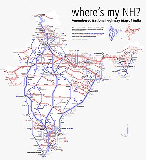
The Ministry of Road Transport and Highways adopted a new systematic numbering of National Highways in April 2010.[6] It is a systematic numbering scheme based on the orientation and the geographic location of the highway. The new system indicates the direction of National Highways whether they are east–west (odd numbers) or north–south (even numbers). It also indicates the geographical region where they are with even numbers increasing from east to west starting from NH2 and odd numbers increasing from north to south starting from NH1.[7]
Bharatmala, a centrally-sponsored and funded road and highways project of the Government of India[8] with a target of constructing 83,677 km (51,994 mi)[9] of new highways, has been started in 2018. Phase I of the Bharatmala project involves the construction of 34,800 km of highways (including the remaining projects under NHDP) at an estimated cost of ₹5.35 lakh crore (US$64 billion) by 2021-22.[10]
Network Length
| Year | Total Length in (KM) |
|---|---|
| 2021 - 2022 | |
| 2020 - 2021 | |
| 2019 - 2020 | |
| 2018 - 2019 | |
| 2017 - 2018 | |
| 2016 - 2017 | |
| 2015 - 2016 | |
| 2014 - 2015 | |
| 2013 - 2014 | |
| 2012 - 2013 | |
| 2011 - 2012 | |
| 2010 - 2011 | |
| 2009 - 2010 | |
| 2008 - 2009 | |
| 2007 - 2008 | |
| 2006 - 2007 | |
| 2005 - 2006 | |
| 2004 - 2005 | |
| 2003 - 2004 | |
| 2002 - 2003 | |
| 2001 - 2002 | |
| 1991 - 2001 | |
| 1981 - 1991 | |
| 1971 - 1981 | |
| 1961 - 1971 | |
| 1950 - 1961 |
| State / Union Territory | State PWD | NHAI | NHIDCL[15] | Total Length as on 31.03.2019 (km) |
|---|---|---|---|---|
| Andaman and Nicobar Islands | 87 | 331 | ||
| Andhra Pradesh | 6,912 | |||
| Arunachal Pradesh | 1,035 | 2,537 | ||
| Assam | 1,010 | 3,909 | ||
| Bihar | 5,358 | |||
| Chandigarh | 15 | |||
| Chhattisgarh | 3,605 | |||
| Dadra and Nagar Haveli | 31 | |||
| Daman and Diu | 22 | |||
| Delhi | 157 | |||
| Goa | 293 | |||
| Gujarat | 6,635 | |||
| Haryana | 3,166 | |||
| Himachal Pradesh | 320 | 2,607 | ||
| Jammu & Kashmir | 436 | 2,423 | ||
| Jharkhand | 3,367 | |||
| Karnataka | 7,335 | |||
| Kerala | 1,782 | |||
| Lakshadweep | 0 | |||
| Madhya Pradesh | 8,772 | |||
| Maharashtra | 17,757 | |||
| Manipur | 1,751 | 1,750 | ||
| Meghalaya | 823 | 1,156 | ||
| Mizoram | 372 | 1422.5 | ||
| Nagaland | 324 | 1,548 | ||
| Odisha | 5,762 | |||
| Puducherry | 27 | |||
| Punjab | 3,274 | |||
| Rajasthan | 10,342 | |||
| Sikkim | 595 | 463 | ||
| Tamil Nadu | 6,742 | |||
| Telangana | 3,795 | |||
| Tripura | 573 | 854 | ||
| Uttarakhand | 660 | 2,949 | ||
| Uttar Pradesh | 11,737 | |||
| West Bengal | 4 | 3,664 | ||
| India total | 48,590[16] | 7,990 | 132,500[17] |
Trivia
- The longest National Highway is NH44,[18] which runs between Srinagar in Jammu and Kashmir and Kanyakumari in Tamil Nadu, covering a distance of 3,806 km (2,365 mi).
- The shortest National Highway is NH766EE,[19][20] which spans 4.27 km (2.65 mi), from Hettikeri to Belekeri port in Karnataka.
- The Leh–Manali Highway connecting Leh in Ladakh to Manali in Himachal Pradesh is the world's second highest-altitude motorable highway.[citation needed]
See also
- List of National Highways in India by highway number
- List of National Highways in India by state
- List of National Highways in India by union territory
- India–Myanmar–Thailand Trilateral Highway
- Roads in India
References and notes
- ^ NATIONALHighways construction touches record 37 km per day: Gadkari The Hindu. Retrieved 29 August 2021
- ^ Mahapatra, Dhananjay (2 July 2013). "NDA regime constructed 50% of national highways laid in last 30 years: Centre". The Times of India. Retrieved 18 April 2015.
- ^ "National Highways road length to be increased from 96,000 km to 2,000,000 km: Nitin Gadkari". The Financial Express. 17 December 2016. Retrieved 27 June 2017.
- ^ "The National Highways Act, 1956". Archived from the original on 14 February 2012. Retrieved 2 December 2012.
- ^ "NHIDCL Ministry of RT&H".
- ^ "Rationalisation of Numbering Systems of National Highways" (PDF). New Delhi: Department of Road Transport and Highways. Archived from the original (PDF) on 16 August 2016. Retrieved 2 September 2012.
- ^ "New numbers for national highways". The Times of India. 21 October 2011. Retrieved 18 April 2015.
- ^ "Bharat Mala: PM Narendra Modi's planned Rs 14,000 crore road from Gujarat to Mizoram", The Economic Times, New Delhi, 29 April 2015
- ^ "Ministry proposes construction of 20,000 km of roads under Bharat Mala project", The Economic Times, New Delhi, 9 January 2016
- ^ "Bharatmala Pariyojana - A Stepping Stone towards New India | National Portal of India". www.india.gov.in. Retrieved 18 January 2018.
- ^ https://morth.nic.in/sites/default/files/Annual%20Report%20-%202021%20(English)_compressed.pdf [bare URL PDF]
- ^ https://morth.nic.in/sites/default/files/Annual%20Report_21-22-1.pdf [bare URL PDF]
- ^ "National Highways Summary - Ministry of Road Transport & Highways, Government of India". morth.nic.in. Retrieved 21 August 2017.
- ^ "Welcome to NHAI". www.nhai.org. Archived from the original on 15 February 2013. Retrieved 21 August 2017.
- ^ "Overview of All NHIDCL Projects" (PDF). nhidcl.com. 15 February 2017. Retrieved 19 December 2020.
- ^ http://nhai.gov.in/writereaddata/Portal/Images/pdf/AnnualReport201516.pdf [bare URL PDF]
- ^ https://morth.nic.in/sites/default/files/Summary-of-NHs_1.pdf [bare URL PDF]
- ^ "New numbers for national highways". Maps of India.
- ^ "List of highways in Karnatakaa". nhai.gov.in.
- ^ "National Highway 536". India9.com.


