
Danao, Cebu
Danao | |
|---|---|
 Aerial view of Danao | |
 Seal | |
 Map of Cebu with Danao highlighted | |
| Country | Philippines |
| Region | Central Visayas (Region VII) |
| Province | Cebu |
| District | 5th district of Cebu |
| Founded | 1570 (as ecomienda) 1609 (as a Recollect parish) 1773 (as municipality) |
| Cityhood | 1570 |
| Barangay | 42 (see § Barangays) |
| Government | |
| • Type | Sangguniang Panlungsod |
| • Mayor | Nito Durano (LP) |
| • Vice mayor | Mix Durano |
| • City Council | Members |
| • Representative | Red Durano |
| Area | |
| • Total | 107.30 km2 (41.43 sq mi) |
| • Cadastral | 121.78 km2 (47.02 sq mi) |
| Population (2020 census)[3] | |
| • Total | 156,321 |
| • Density | 1,500/km2 (3,800/sq mi) |
| • Voter (2022)[4] | 96,794 |
| • Language | Cebuano Tagalog |
| Time zone | UTC+8 (PHT) |
| ZIP code | 6004 |
| IDD : area code | +63 (0)32 |
| Income class | 3rd class |
| PSGC | 072223000 |
| Website | www |
Danao is a [[Template:PH plural of the Philippines#Income classification|3rd city income class component city]] in the province of Cebu, Philippines. According to the 2020 census, it has a population of 156,321.[3] Template:PH electorate
Danao lies within Metro Cebu area.[5]
History
The area of what is now Danao used to be the Cebuano Kingdom of Nahalin before the conquest of Cebu by the Spanish starting in 1565. In 1570 it became an ecomienda or a farmland controlled by certain Spanish officials, only to be abolished in the 18th century as abuses to the native workers became apparent. In 1609 Danao was made a parish by the Recollects, and much later in 1773 it officially became a municipality.
Much physical changes occurred in Danao as it went and passed through the 20th century. Mining, cement making and gun making industries made the once sleepy town of Danao so prosperous that in 1961 a national charter was passed to convert it into a city.
Barangays
Danao City comprises 42 barangays:[2]
| PSGC | Barangay | Population | ±% p.a. | Area | PD 2020 | |||||
|---|---|---|---|---|---|---|---|---|---|---|
| 2020[3] | 2010[6] | ha | acre | /km2 | /sq mi | |||||
| 072223001 | Baliang | 1.2% | 1,843 | 1,728 | 0.65% | 527 | 1,302 | 350 | 910 | |
| 072223002 | Bayabas | 0.5% | 714 | 609 | 1.60% | 220 | 544 | 320 | 840 | |
| 072223004 | Binaliw | 1.7% | 2,635 | 2,341 | 1.19% | 121 | 299 | 2,200 | 5,600 | |
| 072223006 | Cabungahan | 1.5% | 2,317 | 2,201 | 0.51% | 130 | 321 | 1,800 | 4,600 | |
| 072223007 | Cagat‑Lamac | 0.8% | 1,253 | 1,023 | 2.05% | 121 | 299 | 1,000 | 2,700 | |
| 072223008 | Cahumayan | 2.7% | 4,162 | 3,506 | 1.73% | 1,260 | 3,114 | 330 | 860 | |
| 072223009 | Cambanay | 2.3% | 3,526 | 2,818 | 2.27% | 336 | 830 | 1,000 | 2,700 | |
| 072223010 | Cambubho | 0.6% | 940 | 594 | 4.70% | 165 | 408 | 570 | 1,500 | |
| 072223011 | Cogon‑Cruz | 2.7% | 4,188 | 3,034 | 3.28% | 281 | 694 | 1,500 | 3,900 | |
| 072223012 | Danasan | 0.9% | 1,350 | 1,266 | 0.64% | 516 | 1,275 | 260 | 680 | |
| 072223013 | Dungga | 0.8% | 1,273 | 1,017 | 2.27% | 256 | 633 | 500 | 1,300 | |
| 072223014 | Dunggo‑an | 4.0% | 6,310 | 5,313 | 1.73% | 241 | 596 | 2,600 | 6,800 | |
| 072223015 | Guinacot | 3.1% | 4,853 | 4,089 | 1.73% | 300 | 741 | 1,600 | 4,200 | |
| 072223016 | Guinsay | 5.9% | 9,152 | 7,887 | 1.50% | 376 | 929 | 2,400 | 6,300 | |
| 072223017 | Ibo | 0.7% | 1,171 | 964 | 1.96% | 194 | 479 | 600 | 1,600 | |
| 072223018 | Langosig | 0.7% | 1,020 | 750 | 3.12% | 126 | 311 | 810 | 2,100 | |
| 072223019 | Lawaan | 1.1% | 1,679 | 1,352 | 2.19% | 418 | 1,033 | 400 | 1,000 | |
| 072223020 | Licos | 1.2% | 1,852 | 1,581 | 1.59% | 251 | 620 | 740 | 1,900 | |
| 072223021 | Looc | 6.1% | 9,543 | 9,200 | 0.37% | 305 | 754 | 3,100 | 8,100 | |
| 072223022 | Magtagobtob | 0.3% | 453 | 382 | 1.72% | 324 | 801 | 140 | 360 | |
| 072223023 | Malapoc | 0.8% | 1,256 | 974 | 2.57% | 153 | 378 | 820 | 2,100 | |
| 072223024 | Manlayag | 1.0% | 1,638 | 1,578 | 0.37% | 426 | 1,053 | 380 | 1,000 | |
| 072223025 | Mantija | 0.9% | 1,447 | 1,233 | 1.61% | 337 | 833 | 430 | 1,100 | |
| 072223026 | Masaba | 2.0% | 3,090 | 2,743 | 1.20% | 223 | 551 | 1,400 | 3,600 | |
| 072223027 | Maslog | 6.4% | 9,929 | 9,892 | 0.04% | 323 | 798 | 3,100 | 8,000 | |
| 072223028 | Nangka | 0.3% | 413 | 446 | −0.77% | 306 | 756 | 130 | 350 | |
| 072223029 | Oguis | 0.4% | 634 | 600 | 0.55% | 92 | 227 | 690 | 1,800 | |
| 072223030 | Pili | 0.5% | 777 | 677 | 1.39% | 184 | 455 | 420 | 1,100 | |
| 072223031 | Poblacion | 5.8% | 9,090 | 8,710 | 0.43% | 131 | 324 | 6,900 | 18,000 | |
| 072223032 | Quisol | 0.9% | 1,461 | 1,255 | 1.53% | 173 | 428 | 840 | 2,200 | |
| 072223033 | Sabang | 8.0% | 12,431 | 9,945 | 2.26% | 343 | 848 | 3,600 | 9,400 | |
| 072223034 | Sacsac | 0.4% | 618 | 514 | 1.86% | 184 | 455 | 340 | 870 | |
| 072223035 | Sandayong Norte | 1.0% | 1,490 | 1,454 | 0.24% | 71 | 175 | 2,100 | 5,400 | |
| 072223036 | Sandayong Sur | 2.0% | 3,069 | 2,808 | 0.89% | 404 | 998 | 760 | 2,000 | |
| 072223037 | Santa Rosa | 1.0% | 1,559 | 1,151 | 3.08% | 218 | 539 | 720 | 1,900 | |
| 072223038 | Santican | 0.8% | 1,218 | 1,014 | 1.85% | 290 | 717 | 420 | 1,100 | |
| 072223039 | Sibacan | 0.4% | 635 | 519 | 2.04% | 326 | 806 | 190 | 500 | |
| 072223040 | Suba | 4.8% | 7,523 | 6,785 | 1.04% | 40 | 99 | 19,000 | 49,000 | |
| 072223041 | Taboc | 3.5% | 5,482 | 4,880 | 1.17% | 126 | 311 | 4,400 | 11,000 | |
| 072223042 | Taytay | 2.5% | 3,914 | 3,618 | 0.79% | 31 | 77 | 13,000 | 33,000 | |
| 072223043 | Togonon | 1.0% | 1,619 | 1,394 | 1.51% | 1,100 | 2,718 | 150 | 380 | |
| 072223044 | Tuburan Sur | 4.4% | 6,944 | 5,407 | 2.53% | 229 | 566 | 3,000 | 7,900 | |
| Total | 156,321 | 119,252 | 2.74% | 10,730 | 26,514 | 1,500 | 3,800 | |||
Demographics
|
| ||||||||||||||||||||||||
| Source: Philippine Statistics Office[7][6][8] | |||||||||||||||||||||||||
Danao gun industry
Danao City is well known for its gun industry. The industry started around 1905–1906.[9] When World War II came, the Danao gunsmiths went underground, joined the guerrilla movement or were inducted into the USAFFE. Their main task was to re-chamber the Japanese Arisaka rifles to fit the US .30 caliber round or to keep the original Japanese rifle in good service.
The industry went on, still underground. In the 1960s, the term paltik was given to the homemade (and illegal) guns.[citation needed] In the early 1990s the industry was legalized by the government, with the creation of two organizations of local gunsmiths. The organization now left with proper permit is Workers League of Danao Multi-purpose Cooperative (World MPC), in Dungguan, Danao City.[10]
Gallery
-
 City hall opened 2013
 -
 Danao City market
 -
 Danao City Public Market


-
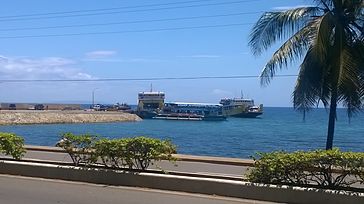 Port for ferries to Camotes and Leyte
 -
 Sto Tomas de Villanueva church


References
- ^ City of Danao | (DILG)
- ^ a b "Municipal: Danao, Cebu". PSGC Interactive. Quezon City, Philippines: Philippine Statistics Authority. Retrieved 8 January 2016.
- ^ a b c Census of Population (2020). "Region VII (Central Visayas)". Total Population by Province, City, Municipality and Barangay. Philippine Statistics Authority. Retrieved 8 July 2021.
- ^ "Number of Registered Voters by Sex : 2019 National and Local Elections" (PDF). Commission on Elections. 2019.
- ^ Sun–Star 2005.
- ^ a b Census of Population and Housing (2010). "Region VII (Central Visayas)" (PDF). Total Population by Province, City, Municipality and Barangay. National Statistics Office. Retrieved 29 June 2016.
- ^ Census of Population (2015). "Region VII (Central Visayas)". Total Population by Province, City, Municipality and Barangay. Philippine Statistics Authority. Retrieved 20 June 2016.
- ^ Censuses of Population (1903–2007). "Region VII (Central Visayas)". Table 1. Population Enumerated in Various Censuses by Province/Highly Urbanized City: 1903 to 2007. National Statistics Office.
{{cite encyclopedia}}: CS1 maint: numeric names: authors list (link) - ^ Rama 2007.
- ^ Sun–Star 2004.
Sources
- Rama, Karlon N. (24 April 2007). "Boboy and Danao's thunder things". Archived from the original on 14 October 2008. Retrieved 6 October 2007.
{{cite news}}: Invalid|ref=harv(help); Unknown parameter|deadurl=ignored (|url-status=suggested) (help) - Sun–Star, Oscar C. Pineda (20 January 2004). "Danao's gunmakers seek government aid". Archived from the original on 7 February 2004.
{{cite news}}: Invalid|ref=harv(help); Unknown parameter|deadurl=ignored (|url-status=suggested) (help) - Sun–Star (8 October 2005). "RDC enlarges Metro Cebu". Archived from the original on 30 September 2007. Retrieved 10 November 2015.
{{cite news}}: Invalid|ref=harv(help); Unknown parameter|deadurl=ignored (|url-status=suggested) (help)
External links
Places adjacent to Danao, Cebu | |
|---|---|
