Medak district: Difference between revisions
| Line 99: | Line 99: | ||
==References== |
==References== |
||
* For Election results and Analysis of Medak District - http://www.partyanalyst.com/districtPageAction.action?districtId=4&districtName=Medak |
|||
{{reflist}} |
{{reflist}} |
||
Revision as of 20:35, 21 January 2012
This article has multiple issues. Please help improve it or discuss these issues on the talk page. (Learn how and when to remove these messages)
No issues specified. Please specify issues, or remove this template. |

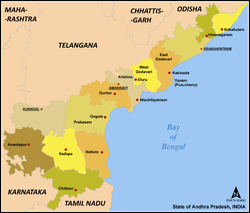
Medak District (Template:Lang-te) is located in the state of Andhra Pradesh, India. Sangareddy is the district headquarters of Medak. The district had a population of 2,670,097, of which 14.36% were urban as of 2001. [1]
History
Post-independence
Recently the district launched a grievance redressal model powered by ICT. The district's social development achievements & issues are available in real time.
The district is currently a part of the Red Corridor.[1]
Geography
Medak district occupies an area of approximately 9,700 square kilometres (3,700 sq mi),[2] comparatively equivalent to Canada's Prince Charles Island.[3] It is located at 18.03° N 78.27° E.[1] It has an average elevation of 442 metres (1450 feet).
Other big towns in the Medak district include Medak, Siddipet, Dubbaka, Narsapur, Ramayampet, Gajwel, Narayankhed, Zaheerabad, Jogipet, Patancheru, Sadasivpet, Sangareddy, Ramachandrapuram, and Gummadidala. IIT Hyderabad is also located in this district.[4]
Economy
In 2006 the Indian government named Medak one of the country's 250 most backward districts (out of a total of 640).[5] It is one of the thirteen districts in Andhra Pradesh currently receiving funds from the Backward Regions Grant Fund Programme (BRGF).[5]
Household indicators
In 2007–2008 the International Institute for Population Sciences interviewed 1169 households in 43 villages across the district.[6] They found that 89.6% had access to electricity, 96.2% had drinking water, 34.5% toilet facilities, and 27.5% lived in a pucca (permanent) home.[6] 28.9% of girls wed before the legal age of 18[7] and 87.4% of interviewees carried a BPL card.[6]
Divisions
Mandals
There are 45 mandals in Medak district.[8]
Demographics
According to the 2011 census Medak district has a population of 3,031,877 ,[9] roughly equal to the nation of Oman[10] or the US state of Iowa.[11] This gives it a ranking of 121st in India (out of a total of 640).[9] The district has a population density of 313 inhabitants per square kilometre (810/sq mi) .[9] Its population growth rate over the decade 2001-2011 was 13.55 %.[9] Medak has a sex ratio of 989 females for every 1000 males,[9] and a literacy rate of 62.53 %.[9]
Flora and fauna
Narsapur Forest, located 35 km from Hyderabad, is spread between Gummadidala and Narsapur. This forest covers 30 km². This has variety of trees, many lakes and supports wildlife. Lately, this has become a hotspot for Telugu film shootings.
Manjira Forest, located 75 km from Medak and 5 km from Sangareddy, is spread over 20 km². The average width of the sanctuary is 500 to 800 m. Nestling between Manjeera and Singoor barrages, the Manjira wild life sanctuary comprises nine small islands which are home to a number of resident and migratory birds in addition to marsh crocodiles and muggar.
Madyaragam which is quiet old with Gandhi statue inside, with 30 metres (98 ft) height which is located in the center of the city
Manjira River,The Devnoor, the village of Regode Mandal is very beautiful village over the medak dist. the river of manjeera is flows through the Devnoor.
References
- For Election results and Analysis of Medak District - http://www.partyanalyst.com/districtPageAction.action?districtId=4&districtName=Medak
- ^ "83 districts under the Security Related Expenditure Scheme". IntelliBriefs. 2009-12-11. Retrieved 2011-09-17.
- ^ Srivastava, Dayawanti et al. (ed.) (2010). "States and Union Territories: Andhra Pradesh: Government". India 2010: A Reference Annual (54th ed.). New Delhi, India: Additional Director General, Publications Division, Ministry of Information and Broadcasting (India), Government of India. pp. 1111–1112. ISBN 978-81-230-1617-7.
{{cite book}}:|access-date=requires|url=(help);|last1=has generic name (help) - ^ "Island Directory Tables: Islands by Land Area". United Nations Environment Program. 1998-02-18. Retrieved 2011-10-11.
Prince Charles Island 9,521
{{cite web}}: horizontal tab character in|quote=at position 22 (help) - ^ http://www.iith.ac.in/
- ^ a b Ministry of Panchayati Raj (September 8, 2009). "A Note on the Backward Regions Grant Fund Programme" (PDF). National Institute of Rural Development. Retrieved September 27, 2011.
- ^ a b c "District Level Household and Facility Survey (DLHS-3), 2007-08: India. Andhra Prades" (PDF). International Institute for Population Sciences and Ministry of Health and Family Welfare. 2010. Retrieved 2011-10-03.
- ^ "How Do I? : Obtain Marriage Certificate". National Portal Content Management Team, National Informatics Centre. 2005. Retrieved 2011-10-03.
To be eligible for marriage, the minimum age limit is 21 for males and 18 for females.
- ^ Medak district profile.APOnline
- ^ a b c d e f "District Census 2011". Census2011.co.in. 2011. Retrieved 2011-09-30.
- ^ US Directorate of Intelligence. "Country Comparison:Population". Retrieved 2011-10-01.
Oman 3,027,959
{{cite web}}: line feed character in|quote=at position 5 (help) - ^ "2010 Resident Population Data". U. S. Census Bureau. Retrieved 2011-09-30.
Iowa 3,046,355
{{cite web}}: line feed character in|quote=at position 5 (help)
External links
- Official site
- Template:Wikitravel
- Grievance redressal solution-Public grievance redressal solution
