
Catskill Mountains: Difference between revisions
Seolee6974 (talk | contribs) No edit summary Tags: Reverted references removed Disambiguation links added |
Reverted 2 edits by Seolee6974 (talk): Why did you restore a version of the article from 2016? |
||
| Line 1: | Line 1: | ||
{{short description|Mountains in southeastern New York State, U.S.}} |
|||
{{More footnotes|date=April 2009}} |
|||
{{Use American English|date = September 2019}} |
|||
{{Use mdy dates|date = September 2019}} |
|||
{{Infobox mountain range |
{{Infobox mountain range |
||
| name |
| name=Catskill Mountains |
||
| photo |
| photo=Central Catskills from Twin south summit.jpg |
||
| photo_size |
| photo_size=300 |
||
| photo_caption |
| photo_caption=[[Slide Mountain (Ulster County, New York)|Slide Mountain]] and nearby peaks as seen from [[Twin Mountain (New York)|Twin Mountain]] in the northern Catskills |
||
| country |
| country= United States |
||
| |
| subdivision1= [[New York (state)|New York]] |
||
| subdivision2_type= Region |
|||
| region =[[Hudson Valley]] |
|||
| subdivision2= [[Hudson Valley]] |
|||
| region1 = |
|||
| |
| subdivision3_type=[[County (United States)|Counties]] |
||
| subdivision3= {{enum|[[Delaware County, New York|Delaware]]|[[Greene County, New York|Greene]]|[[Schoharie County, New York|Schoharie]]|[[Sullivan County, New York|Sullivan]]|[[Ulster County, New York|Ulster]]}} |
|||
| district =[[Delaware County, New York|Delaware]] |
|||
| settlement_type=Communities |
|||
| district1 =[[Greene County, New York|Greene]] |
|||
| settlement= {{enum|[[Ellenville, New York|Ellenville]]|[[Fleischmanns, New York|Fleischmanns]]|[[Hunter (village), New York|Hunter]]|[[Liberty (village), New York|Liberty]]|[[Margaretville, New York|Margaretville]]|[[Hancock, New York]]|[[Palenville, New York|Palenville]]|[[Phoenicia, New York|Phoenicia]]|[[Shandaken, New York|Shandaken]]|[[Shokan, New York|Shokan]]|[[Tannersville, New York|Tannersville]]|[[Wawarsing, New York|Wawarsing]]|[[Windham, New York|Windham]]|[[Woodstock, New York|Woodstock]]}} |
|||
| district2 =[[Schoharie County, New York|Schoharie]] |
|||
| parent= [[Appalachian Mountains|Appalachian]] ([[Allegheny Plateau]]) |
|||
| district3 =[[Sullivan County, New York|Sullivan]] |
|||
| borders_on= {{enum|[[Pocono Mountains|Poconos]]|[[Shawangunk Ridge]]|[[Hudson Valley]]|[[Great Appalachian Valley]]|[[Mohawk Valley]]}} |
|||
| district4 =[[Ulster County, New York|Ulster]] |
|||
| subdivision4_type= Rivers |
|||
| city_type =Communities |
|||
| subdivision4= {{enum|[[Esopus Creek]]|[[Neversink River]]|[[Rondout Creek]]|[[Schoharie Creek]]}} |
|||
| city =[[Ellenville, New York|Ellenville]] |
|||
| geology= [[Sedimentary]] |
|||
| city1 =[[Fleischmanns, New York|Fleischmanns]] |
|||
| age= {{enum|[[Devonian]]|[[Mississippian age|Mississippian]]}} |
|||
| city2 =[[Hunter (village), New York|Hunter]] |
|||
| orogeny= |
|||
| city3 =[[Liberty (village), New York|Liberty]] |
|||
| area_km2=15259 |
|||
| city4 =[[Margaretville, New York|Margaretville]] |
|||
| range_coordinates= |
|||
| city5 =[[Monticello, New York|Monticello]] |
|||
| length_mi=111 |
|||
| city6 =[[Palenville, New York|Palenville]] |
|||
| length_orientation=N/S |
|||
| city7 =[[Phoenicia, New York|Phoenicia]] |
|||
| width_mi=102 |
|||
| city8 =[[Shandaken, New York|Shandaken]] |
|||
| width_orientation=E/W |
|||
| city9 =[[Shokan, New York|Shokan]] |
|||
| highest=[[Slide Mountain (Ulster County, New York)|Slide Mountain]] |
|||
| city10 =[[Tannersville, New York|Tannersville]] |
|||
| elevation_ft=4180 |
|||
| city11 =[[Wawarsing, New York|Wawarsing]] |
|||
| coordinates= {{coord|41|59|55|N|74|23|11|W|type:mountain|format=dms|display=inline,title}} |
|||
| city12 =[[Windham, New York|Windham]] |
|||
| map_image=NortheastAppalachiansMap.jpg |
|||
| city13 =[[Woodstock, New York|Woodstock]] |
|||
| map_size=300 |
|||
| unit =[[Appalachian Mountains|Appalachian]] |
|||
| map_caption= Main regions of the northeast [[Appalachians]], with the Catskills as "C" |
|||
| unit1 =[[Allegheny Plateau]] |
|||
| border =[[Pocono Mountains|Poconos]] |
|||
| border1 =[[Shawangunk Ridge]] |
|||
| border2 =[[Hudson Valley]] |
|||
| border3 =[[Great Appalachian Valley]] |
|||
| border4 =[[Mohawk Valley]] |
|||
| river = [[Esopus Creek]], [[Neversink River]], [[Rondout Creek]],<br>[[Schoharie Creek]] |
|||
| geology =[[Sedimentary]] |
|||
| geology1 = |
|||
| period =[[Devonian]] |
|||
| period1 =[[Mississippian age|Mississippian]] |
|||
| orogeny = |
|||
| orogeny1 = |
|||
| area_km2 =15259 |
|||
| length_mi =111 |
|||
| length_orientation =N/S |
|||
| width_mi =102 |
|||
| width_orientation =E/W |
|||
| highest =[[Slide Mountain (Ulster County, New York)|Slide Mountain]] |
|||
| highest_location =S of [[Shandaken, New York|Shandaken]] |
|||
| highest_district =[[Ulster County, New York|Ulster]] |
|||
| elevation_ft =4180 |
|||
| lat_d =41 |
|||
| lat_m =59 |
|||
| lat_s =55 |
|||
| lat_NS =N |
|||
| long_d =74 |
|||
| long_m =23 |
|||
| long_s =11 |
|||
| long_EW =W |
|||
| map =NortheastAppalachiansMap.jpg |
|||
| map_size =300 |
|||
| map_caption =Map of the main regions of the northeast Appalachians, with the Catskills as "C". |
|||
| map_first = |
|||
}} |
}} |
||
The '''Catskill Mountains''', also known as '''the Catskills''', are a large area in the southeastern portion of the U.S. state of [[New York (state)|New York]]. They are located approximately {{convert|100|mi|km}} north-northwest of [[New York City]] and {{convert|40|mi|km|sigfig=1}} southwest of [[Albany, New York|Albany]], starting just west of the [[Hudson River]]. The Catskills occupy much or all of five [[county (US)|counties]] ([[Delaware County, New York|Delaware]], [[Greene County, New York|Greene]], [[Schoharie County, New York|Schoharie]], [[Sullivan County, New York|Sullivan]], and [[Ulster County, New York|Ulster]]), with some areas falling into the boundaries of southwestern [[Albany County, New York|Albany]], eastern [[Broome County, New York|Broome]], northwestern [[Orange County, New York|Orange]], and southern [[Otsego County, New York|Otsego]] [[county (US)|counties]]. Foothills are also found in southeastern [[Chenango County, New York|Chenango]], southern [[Montgomery County, New York|Montgomery]], northern [[Otsego County, New York|Otsego]], and western [[Schenectady County, New York|Schenectady]] [[county (US)|counties]]. As a cultural and geographic region, the Catskills are generally defined as those areas close to or within the borders of the [[Catskill Park]], a {{convert|700000|acre|km2|adj=on}} [[Forest Preserve (New York)|forest preserve]] protected from many forms of development under New York state law. |
|||
The '''Catskill Mountains''', also known as '''the Catskills''', are a [[Physiographic regions of the world|physiographic province]] of the larger [[Appalachian Mountains]], located in southeastern [[New York (state)|New York]]. As a cultural and geographic region, the Catskills are generally defined as those areas close to or within the borders of the [[Catskill Park]], a {{convert|700000|acre|km2|adj=on}} [[Forest Preserve (New York)|forest preserve]] protected from many forms of development under New York state law. |
|||
Geologically, the Catskills are a mature [[dissected plateau]], a once-flat region subsequently uplifted and eroded into sharp [[Terrain|relief]] by watercourses. The Catskills form the northeastern end of, and highest-elevation portion of, the [[Allegheny Plateau]] (also known as the [[Appalachian Plateau]]).<ref name="cc-gis">{{cite web|url=http://www.catskillcenter.org/atlas/geomorphology/geo_1_3dtopography.htm|title=REGIONAL TOPOGRAPHY|work=Catskills GIS Atlas|publisher=Catskill Center|accessdate=2009-10-12}}</ref><ref name="USGS-Water">{{cite web | title = Physiographic divisions of the conterminous U. S. | publisher = U.S. Geological Survey | url = http://water.usgs.gov/GIS/metadata/usgswrd/XML/physio.xml | accessdate = 2007-12-06 }}</ref> Although the Catskills are sometimes compared with the [[Adirondack Mountains]] further north, the two mountain ranges are not geologically related, as the Adirondacks are a continuation of the [[Canadian Shield]]. Similarly, the [[Shawangunk Ridge]], which forms the southeastern edge of the Catskills, is part of the geologically distinct [[Ridge-and-Valley Appalachians|Ridge-and-Valley]] province, and is a continuation of the same ridge known as [[Kittatinny Mountains|Kittatinny Mountain]] in New Jersey and [[Blue Mountain (Pennsylvania)|Blue Mountain]] in Pennsylvania. |
|||
Geologically, the Catskills are a mature [[dissected plateau]], a flat region subsequently uplifted and eroded into sharp [[Terrain|relief]] by watercourses. The Catskills form the northeastern end of the [[Allegheny Plateau]] (also known as the [[Appalachian Plateau]]).<ref name="cc-gis">{{cite web|url=http://www.catskillcenter.org/atlas/geomorphology/geo_1_3dtopography.htm|title=REGIONAL TOPOGRAPHY|website=Catskills GIS Atlas|publisher=Catskill Center|access-date=2009-10-12|url-status=dead|archive-url=https://web.archive.org/web/20091029034005/http://www.catskillcenter.org/atlas/geomorphology/geo_1_3dtopography.htm|archive-date=2009-10-29}}</ref><ref name="USGS-Water">{{cite web | title = Physiographic divisions of the conterminous U. S | publisher = U.S. Geological Survey | url = http://water.usgs.gov/GIS/metadata/usgswrd/XML/physio.xml | access-date = 2007-12-06 }}</ref> |
|||
Climatically, the Catskills lie within the [[Allegheny Highlands forests]] [[ecoregion]]. |
|||
The Catskills are well known in American |
The Catskills were named by early Dutch settlers. They are well known in American society as the setting for films and works of art, including many 19th-century [[Hudson River School]] paintings, as well as for being a favored destination for vacationers from [[New York City]] in the mid-20th century. The region's many large resorts gave many young [[Stand-up comedy|stand-up comedians]] an opportunity to hone their craft. Since the late 19th century, the Catskills have been a haven for artists, musicians and writers, especially in and around the towns of [[Woodstock, New York|Woodstock]] and [[Phoenicia, New York|Phoenicia]]. |
||
== |
== History == |
||
{{Main|History of the Catskill Mountains}} |
|||
{{Refimprove section|date=November 2009}} |
|||
[[File:Catskills beyond Hudson.jpg|thumb|right|Views of the Catskills from the Hudson like this led to the name "Blue Mountains" for a time.]] |
|||
[[File:Map-Novi Belgii Novæque Angliæ (Amsterdam, 1685).jpg|thumb|right|A 1656 map of New Netherland showing the locations of the Lands of the Kat Kills and the High Lands of the Esopus]] |
|||
[[Nicolaes Visscher I]]'s 1656 map of New Netherland located the ''{{lang|nl|Landt van Kats Kill}}'' at the mouth of [[Catskill creek]]. The region to the south is identified as ''{{lang|nl|Hooge Landt van Esopus}}'' (High Lands of the Esopus), a reference to a local band northern [[Lenape]] [[Indigenous peoples of the Americas|Native Americans]] who inhabited the banks of the Hudson and hunted in the highlands along the [[Esopus Creek]].<ref name="Kudish36–8">{{cite book |title=The Catskill Forest: A History |last=Kudish |first=Michael |authorlink=Michael Kudish |year=2000 |publisher=Purple Mountain Press |location=[[Fleischmanns, New York|Fleischmanns, NY]] |isbn=1-930098-02-2 |page=47}}</ref> |
|||
== Etymology == |
|||
While the meaning of the name ("cat creek" in [[Dutch language|Dutch]]) and the namer (early Dutch explorers) are settled matters, exactly how and why the area is named "Catskills" is a mystery. |
|||
[[File:Catskills beyond Hudson.jpg|thumb|right|Views of the Catskills from the [[Hudson River|Hudson]] like this led to the name "Blue Mountains" for a time.]] |
|||
[[File:Map-Novi Belgii Novæque Angliæ (Amsterdam, 1685).jpg|thumb|right|A 1685 revision of a 1656 map of [[New Netherland]] showing the locations of the "Lands of the Kats Kills" and the "High Lands of the Esopus"]] |
|||
[[Nicolaes Visscher I]]'s 1656 map of [[New Netherland]] located the ''{{lang|nl|Landt van Kats Kill}}'' at the mouth of [[Catskill Creek]]. The region to the south is identified as ''{{lang|nl|Hooge Landt van Esopus}}'' (High Lands of the [[Esopus people|Esopus]]), a reference to a local band of northern [[Lenape]] [[Indigenous peoples of the Americas|Native Americans]] who inhabited the banks of the Hudson and hunted in the highlands along the [[Esopus Creek]].<ref name="Kudish36–8">{{cite book |title=The Catskill Forest: A History |last=Kudish |first=Michael |author-link=Michael Kudish |year=2000 |publisher=Purple Mountain Press |location=[[Fleischmanns, New York|Fleischmanns, NY]] |isbn=978-1-930098-02-2 |page=47}}</ref> |
|||
While the meaning of the name ("cat creek [''[[kill (body of water)|kill]]'']" in [[Dutch language|Dutch]]) and the namer (early Dutch explorers) are settled matters, how and why the area is named "Catskills" is a mystery. [[Mountain lion]]s (catamounts) were known to have been in the area when the Dutch arrived in the 17th century and may have been a reason for the name.<ref name=sierraclub>{{cite web |url=http://www.sierraclub.org/e-files/puma.asp |title=The Elusive Mountain Lion – E-Files – Our History |access-date=2007-09-17 |website=Sierra Club |url-status=dead |archive-url=https://web.archive.org/web/20070807235943/http://www.sierraclub.org/e-files/puma.asp |archive-date=2007-08-07 }}</ref> |
|||
Theories: |
|||
*The most common, and easiest, explanation is that [[bobcat]]s were seen near [[Catskill creek]] and the present-day [[Catskill (village), New York|village of Catskill]], and the name followed from there.{{citation needed|date=November 2015}} However, there is no record of bobcats' ever having been seen in significant numbers on the banks of the Hudson, and the name Catskill does not appear on paper until 1655,{{where|date=November 2015}}{{citation needed|date=November 2015}} more than four decades later. |
|||
*[[Mountain lion]]s (catamounts) were known to have been in the area when the Dutch arrived in the 17th century.<ref name=sierraclub>{{cite web |url=http://www.sierraclub.org/e-files/puma.asp |title=The Elusive Mountain Lion – E-Files – Our History|accessdate=2007-09-17 |work=Sierra Club}}</ref> |
|||
* A corruption of ''{{lang|nl|kasteel}}'', the Dutch sailors' term for the Indian [[stockade]]s they saw on the riverbank. According to one [[Belgium|Belgian]] authority,{{who|date=May 2016}} ''{{lang|nl|kat}}'' occurs in many place names throughout [[Flanders]] and has nothing to do with cats and everything to do with fortifications.{{Citation needed|date=February 2007}} |
|||
* It was named for Dutch poet [[Jacob Cats]], who was also known for his real estate prowess, profiting from [[speculation]] in lands reclaimed from the sea.{{citation needed|date=November 2015}} |
|||
* A ship named ''The Cat'' had gone up the Hudson shortly before the name was first used. In nautical slang of the era, ''cat'' could also mean a piece of equipment, or a particular type of small vessel, called a "[[catboat]]".{{citation needed|date=November 2015}} |
|||
* It has also been suggested that it refers to [[lacrosse]], which Dutch visitors had seen the Iroquois natives play. ''Kat'' can also refer to a [[tennis]] [[racquet|racket]], which a lacrosse stick resembles, and the first place the Dutch saw this, further down the river in the present-day [[Saugerties (town), New York|Town of Saugerties]], they gave the name ''Kaatsbaan'', for "tennis court", which is still on maps today.{{citation needed|date=November 2015}} |
|||
* The [[Mohicans]] roamed the woods of [[New England]] during the 18th century. A Mohican tribe supposedly inhabited the area known as the Catskills today, led by a Mohican chief named Cat.{{citation needed|date=November 2015}} |
|||
The confusion over the origins of the name led over the years to variant spellings such as ''Kaatskill'' and ''Kaaterskill'', both of which are also still used: the former in the regional magazine ''[[Kaatskill Life]]'', the latter as the name of a [[Kaaterskill High Peak|mountain peak]] and a [[Kaaterskill Falls|waterfall]]. The supposed Native American name for the range, ''Onteora'' ("land in the sky"), was actually created by a white man in the mid-19th century to drum up business for a resort.{{cn| date=July 2019}} It, too, persists today as the name of a [[Onteora Central School District|school district]] and as the name of a [[Boy Scouts of America|Boy Scout]] summer camp ([[Onteora Scout Reservation]]). |
|||
[[File:Thomas Cole - A View of the Two Lakes and Mountain House, Catskill Mountains, Morning (1844) - Google Art Project.jpg|Brooklyn Museum – A View of the Two Lakes and Mountain House, Catskill Mountains, Morning – Thomas Cole – overall|left|thumb|''A View of the Two Lakes and Mountain House, Catskill Mountains, Morning'', by Thomas Cole]] |
|||
==Geography== |
|||
The confusion over the exact origins of the name led over the years to variant spellings such as ''Kaatskill'' and ''Kaaterskill'', both of which are also still used: the former in the regional magazine ''[[Kaatskill Life]]'', the latter as the name of a clove,{{citation needed|date=November 2015}} creek,{{citation needed|date=November 2015}} [[Kaaterskill High Peak|mountain]], town,{{citation needed|date=November 2015}} and [[Kaaterskill Falls|waterfall]]. The supposed Indian name for the range, ''Onteora'' ("land in the sky"), was actually created by a white man in the mid-19th century to drum up business for a resort. It, too, persists today as the name of a [[Onteora Central School District|school district]] and as the name of a [[Boy Scout]] summer camp ([[Onteora Scout Reservation]]). |
|||
The Catskill Mountains are approximately {{convert|100|mi|km}} north-northwest of [[New York City]] and {{convert|40|mi|km|sigfig=|abbr=}} southwest of [[Albany, New York|Albany]], starting west of the [[Hudson River]]. The Catskills occupy much of two [[County (United States)|counties]] ([[Greene County, New York|Greene]] and [[Ulster County, New York|Ulster]]), and extend slightly into [[Delaware County, New York|Delaware]], [[Sullivan County, New York|Sullivan]], and southwestern [[Schoharie County, New York|Schoharie]] counties. |
|||
At the range's eastern end, the [[mountain]]s begin dramatically with the [[Catskill Escarpment]] rising up suddenly from the [[Hudson Valley]]. The western boundary is far less certain, as the mountains gradually decline in height and grade into the rest of the [[Allegheny Plateau]], but maps from the 18th and 19th centuries consistently mark the border of the Catskill Mountains as the East Branch of the Delaware River, which is consistent with the actual topographic relief.<ref>{{Cite web|url=https://digitalcollections.nypl.org/search/index?filters%5Bgeographic_mtxt_s%5D%5B%5D=Catskill+Mountains+%28N.Y.%29&filters%5Btype%5D=cartographic&keywords=|title=Search results - NYPL Digital Collections}}</ref> The [[Pocono Mountains]], to the immediate southwest in [[Pennsylvania]], are also a part of the Allegheny Plateau. |
|||
The name ''Catskills'' did not come into wide popular use for the mountains until the mid-19th century – in fact, that name was disparaged by purists as too plebeian, too reminiscent of the area's [[Netherlands|Dutch]] [[Colonialism|colonial]] past, especially since it was used by the local farming population. It may also have been a continuation of the British practice, after taking possession of the colony in the late 17th century, of trying to replace most Dutch [[Knickerbocker (disambiguation)|Knickerbocker]] toponyms in present-day New York with their English alternatives. The locals preferred to call the range the ''Blue Mountains'', to harmonize with [[Vermont]]'s [[Green Mountains]] and [[New Hampshire]]'s [[White Mountains (New Hampshire)|White Mountains]]. It was only after [[Washington Irving]]'s stories that Catskills won out over Blue Mountains and several other competitors.{{citation needed|date=November 2015}} |
|||
The Catskills contain [[Catskill High Peaks|more than 30 peaks]] above {{convert|3,500|ft|m}} and parts of six important rivers. The [[Catskill Mountain 3500 Club]] is an organization whose members have climbed all the peaks in the Catskills over {{convert|3,500|ft|m}}. The highest mountain, [[Slide Mountain (New York)|Slide Mountain]] in Ulster County, has an elevation of {{convert|4180|ft|m}}. |
|||
==Land features== |
|||
[[File:Tubers on Esopus Creek 2011.jpg|right|thumb|Free-floating [[Tubing (recreation)|tubers]] on [[Esopus Creek]]|alt=People in inner tubes wearing lifejackets in a whitewater stream just above a small drop over a rock.]] |
|||
Climatically, the Catskills lie within the [[Allegheny Highlands forests]] [[ecoregion]]. |
|||
===Geography=== |
|||
==Climate== |
|||
At the eastern end of the range, the [[mountains]] begin quite dramatically with the [[Catskill Escarpment]] rising up suddenly from the [[Hudson Valley]]. The western boundary is far less certain, as the mountains gradually decline in height and grade into the rest of the [[Allegheny Plateau]]. Nor is there a consensus on where the Catskills end to the north or south, with it being certain only that by the time one reaches either [[Interstate 88 (east)|I-88]], the [[Delaware River]], or the [[Shawangunk Ridge]] that one is no longer in the Catskills.{{citation needed|date=November 2015}} |
|||
According to the [[Köppen climate classification]] system, the Catskill Mountains have two climate zones. The vast majority of the Catskills have a warm summer humid continental climate (''Dfb'') with some isolated locations in valleys with hot summer humid continental climate (''Dfa''). The [[plant hardiness zone]] on Slide Mountain at {{convert|4180|ft|m}} is 5a with an average annual extreme minimum temperature of {{convert|-16.6|F|C}}. The plant hardiness zone in Margaretville at {{convert|1000|ft|m}} is 5b with an average annual extreme minimum temperature of {{convert|-10.6|F|C}}.<ref name="USDA">{{cite web|url=https://planthardiness.ars.usda.gov/PHZMWeb/InteractiveMap.aspx|publisher=[[United States Department of Agriculture]]|access-date=2019-07-09|title=USDA Interactive Plant Hardiness Map}}</ref> |
|||
In these peripheral regions, whether or not one is in the Catskills seems to be a matter of personal preference, as an old saying in the region seems to suggest: "When you have two rocks for every dirt, you are in the Catskills".{{citation needed|date=January 2016}} |
|||
{{Weather box |width=auto |
|||
Many visitors, including owners of weekend or vacation homes in the region, seem to consider almost anything that is west of the Hudson and sufficiently rural, yet within a short drive of New York City, to be in the Catskills.{{citation needed|date=November 2015}} |
|||
|location = Phoenicia, Ulster County NY. Elevation: 900 ft (274 m) |
|||
|single line = Y |
|||
|Jan high F = 34.4 |
|||
|Feb high F = 37.9 |
|||
|Mar high F = 47.4 |
|||
|Apr high F = 60.8 |
|||
|May high F = 71.0 |
|||
|Jun high F = 79.9 |
|||
|Jul high F = 83.4 |
|||
|Aug high F = 82.3 |
|||
|Sep high F = 75.1 |
|||
|Oct high F = 62.8 |
|||
|Nov high F = 51.0 |
|||
|Dec high F = 39.4 |
|||
|year high F= 60.4 |
|||
| Jan mean F = 26.9 |
|||
| Feb mean F = 29.1 |
|||
| Mar mean F = 36.5 |
|||
| Apr mean F = 50.5 |
|||
| May mean F = 60.1 |
|||
| Jun mean F = 68.9 |
|||
| Jul mean F = 74.3 |
|||
| Aug mean F = 71.8 |
|||
| Sep mean F = 66.4 |
|||
| Oct mean F = 51.0 |
|||
| Nov mean F = 41.3 |
|||
| Dec mean F = 30.5 |
|||
| year mean F = 49.4 |
|||
|Jan low F = 18.1 |
|||
|Feb low F = 20.0 |
|||
|Mar low F = 27.8 |
|||
|Apr low F = 40.5 |
|||
|May low F = 51.4 |
|||
|Jun low F = 57.9 |
|||
|Jul low F = 62.9 |
|||
|Aug low F = 61.0 |
|||
|Sep low F = 56.3 |
|||
|Oct low F = 42.6 |
|||
|Nov low F = 32.9 |
|||
|Dec low F = 22.9 |
|||
|year low F= 38.4 |
|||
|precipitation colour = green |
|||
|Jan precipitation inch = 3.6 |
|||
|Feb precipitation inch = 3.98 |
|||
|Mar precipitation inch = 3.82 |
|||
|Apr precipitation inch = 4.0 |
|||
|May precipitation inch = 3.9 |
|||
|Jun precipitation inch = 3.2 |
|||
|Jul precipitation inch = 2.6 |
|||
|Aug precipitation inch = 2.9 |
|||
|Sep precipitation inch = 3.02 |
|||
|Oct precipitation inch = 3.6 |
|||
|Nov precipitation inch = 3.7 |
|||
|Dec precipitation inch = 3.5 |
|||
|year precipitation inch= 46.33 |
|||
| humidity colour = green |
|||
| Jan humidity = 69.1 |
|||
| Feb humidity = 66.2 |
|||
| Mar humidity = 59.2 |
|||
| Apr humidity = 55.8 |
|||
| May humidity = 60.8 |
|||
| Jun humidity = 67.4 |
|||
| Jul humidity = 70.8 |
|||
| Aug humidity = 70.0 |
|||
| Sep humidity = 71.0 |
|||
| Oct humidity = 69.7 |
|||
| Nov humidity = 69.9 |
|||
| Dec humidity = 69.3 |
|||
| year humidity = 66.0 |
|||
|source 1 = PRISM Climate Group<ref name=prism>{{cite web|url=http://prism.oregonstate.edu/explorer/|title=PRISM Climate Group, Oregon State University|website=www.prism.oregonstate.edu|access-date=July 9, 2019}}</ref>}} |
|||
{| class="wikitable" style="margin-left: auto; margin-right: auto;" |
|||
|- |
|||
! scope="col" | Month |
|||
! scope="col" | Jan |
|||
! scope="col" | Feb |
|||
! scope="col" | Mar |
|||
! scope="col" | Apr |
|||
! scope="col" | May |
|||
! scope="col" | Jun |
|||
! scope="col" | Jul |
|||
! scope="col" | Aug |
|||
! scope="col" | Sep |
|||
! scope="col" | Oct |
|||
! scope="col" | Nov |
|||
! scope="col" | Dec |
|||
! scope="col" | Year |
|||
|- |
|||
! scope="row" | Average [[Dew Point]] °F |
|||
| style="background:#ffffff;color:#000000;text-align:center;"" | 16.2 |
|||
| style="background:#ffffff;color:#000000;text-align:center;"" | 17.7 |
|||
| style="background:#add8e6;color:#000000;text-align:center;"" | 24.3 |
|||
| style="background:#0000ff;color:#ffffff;text-align:center;"" | 34.3 |
|||
| style="background:#00008b;color:#ffffff;text-align:center;"" | 48.6 |
|||
| style="background:#808080;color:#ffffff;text-align:center;"" | 57.8 |
|||
| style="background:#ccffcc;color:#000000;text-align:center;"" | 63.2 |
|||
| style="background:#ccffcc;color:#000000;text-align:center;"" | 61.7 |
|||
| style="background:#808080;color:#ffffff;text-align:center;"" | 55.8 |
|||
| style="background:#00008b;color:#ffffff;text-align:center;"" | 41.9 |
|||
| style="background:#0000ff;color:#ffffff;text-align:center;"" | 32.2 |
|||
| style="background:#add8e6;color:#000000;text-align:center;"" | 22.1 |
|||
| style="background:#0000ff;color:#ffffff;text-align:center;"" | 38.9 |
|||
|- |
|||
! scope="row" | Average [[Dew Point]] °C |
|||
| style="background:#ffffff;color:#000000;text-align:center;"" | −8.8 |
|||
| style="background:#ffffff;color:#000000;text-align:center;"" | −7.9 |
|||
| style="background:#add8e6;color:#000000;text-align:center;"" | −4.6 |
|||
| style="background:#0000ff;color:#ffffff;text-align:center;"" | 1.1 |
|||
| style="background:#00008b;color:#ffffff;text-align:center;"" | 7.6 |
|||
| style="background:#808080;color:#ffffff;text-align:center;"" | 13.6 |
|||
| style="background:#ccffcc;color:#000000;text-align:center;"" | 16.2 |
|||
| style="background:#ccffcc;color:#000000;text-align:center;"" | 15.9 |
|||
| style="background:#808080;color:#ffffff;text-align:center;"" | 12.1 |
|||
| style="background:#00008b;color:#ffffff;text-align:center;"" | 5.5 |
|||
| style="background:#0000ff;color:#ffffff;text-align:center;"" | 0.1 |
|||
| style="background:#add8e6;color:#000000;text-align:center;"" | −5.5 |
|||
| style="background:#0000ff;color:#ffffff;text-align:center;"" | 3.8 |
|||
|- |
|||
| colspan="14" | <div style="text-align: center;"> Source: PRISM Climate Group<ref name="prism" /> </div> |
|||
|} |
|||
{{Weather box |width=auto |
|||
[[The Poconos]], to the immediate southwest in [[Pennsylvania]], are technically a continuation of the Catskills under a different name. The Catskills contain [[Catskill High Peaks|more than 30 peaks]] above {{convert|3,500|ft|m}} and parts of six important rivers. The [[Catskill Mountain 3500 Club]] is an organization whose members have climbed all the peaks in the Catskills over {{convert|3,500|ft|m}}. The highest mountain, [[Slide Mountain (New York)|Slide Mountain]] in Ulster County, has an elevation of {{convert|4180|ft|m}}. |
|||
|location = Margaretville, Delaware County, NY. Elevation: 1,000 ft (300 m) |
|||
[[File:Tubers on Esopus Creek 2011.jpg|left|thumb|Free floating tubers on [[Esopus Creek]]|alt=People in inner tubes wearing lifejackets in a whitewater stream just above a small drop over a rock.]] |
|||
|single line = Y |
|||
|Jan high F = 34.8 |
|||
|Feb high F = 38.3 |
|||
|Mar high F = 47.7 |
|||
|Apr high F = 61.0 |
|||
|May high F = 71.4 |
|||
|Jun high F = 80.1 |
|||
|Jul high F = 83.8 |
|||
|Aug high F = 82.4 |
|||
|Sep high F = 75.4 |
|||
|Oct high F = 63.0 |
|||
|Nov high F = 51.5 |
|||
|Dec high F = 39.8 |
|||
|year high F= 60.8 |
|||
| Jan mean F = 27.1 |
|||
| Feb mean F = 29.2 |
|||
| Mar mean F = 36.9 |
|||
| Apr mean F = 50.0 |
|||
| May mean F = 60.2 |
|||
| Jun mean F = 69.0 |
|||
| Jul mean F = 74.4 |
|||
| Aug mean F = 71.9 |
|||
| Sep mean F = 66.6 |
|||
| Oct mean F = 51.4 |
|||
| Nov mean F = 41.8 |
|||
| Dec mean F = 30.8 |
|||
| year mean F = 49.8 |
|||
|Jan low F = 18.4 |
|||
|Feb low F = 20.1 |
|||
|Mar low F = 28.0 |
|||
|Apr low F = 40.1 |
|||
|May low F = 51.9 |
|||
|Jun low F = 58.0 |
|||
|Jul low F = 63.5 |
|||
|Aug low F = 61.4 |
|||
|Sep low F = 56.4 |
|||
|Oct low F = 42.9 |
|||
|Nov low F = 33.1 |
|||
|Dec low F = 23.2 |
|||
|year low F= 38.8 |
|||
|precipitation colour = green |
|||
|Jan precipitation inch = 3.6 |
|||
|Feb precipitation inch = 3.63 |
|||
|Mar precipitation inch = 3.8 |
|||
|Apr precipitation inch = 4.0 |
|||
|May precipitation inch = 3.9 |
|||
|Jun precipitation inch = 3.2 |
|||
|Jul precipitation inch = 2.5 |
|||
|Aug precipitation inch = 2.9 |
|||
|Sep precipitation inch = 3.0 |
|||
|Oct precipitation inch = 3.6 |
|||
|Nov precipitation inch = 3.63 |
|||
|Dec precipitation inch = 3.5 |
|||
|year precipitation inch= 46.32 |
|||
| humidity colour = green |
|||
| Jan humidity = 68.5 |
|||
| Feb humidity = 64.3 |
|||
| Mar humidity = 58.5 |
|||
| Apr humidity = 55.8 |
|||
| May humidity = 61.6 |
|||
| Jun humidity = 67.4 |
|||
| Jul humidity = 70.9 |
|||
| Aug humidity = 70.2 |
|||
| Sep humidity = 71.7 |
|||
| Oct humidity = 69.9 |
|||
| Nov humidity = 68.5 |
|||
| Dec humidity = 69.8 |
|||
| year humidity = 66.0 |
|||
|source 1 = PRISM Climate Group<ref name=prism>{{cite web|url=http://prism.oregonstate.edu/explorer/|title=PRISM Climate Group, Oregon State University|website=www.prism.oregonstate.edu|access-date=July 9, 2019}}</ref>}} |
|||
{| class="wikitable" style="margin-left: auto; margin-right: auto;" |
|||
|- |
|||
! scope="col"| Month |
|||
! scope="col"| Jan |
|||
! scope="col"| Feb |
|||
! scope="col"| Mar |
|||
! scope="col"| Apr |
|||
! scope="col"| May |
|||
! scope="col"| Jun |
|||
! scope="col"| Jul |
|||
! scope="col"| Aug |
|||
! scope="col"| Sep |
|||
! scope="col"| Oct |
|||
! scope="col"| Nov |
|||
! scope="col"| Dec |
|||
! scope="col"| Year |
|||
|- |
|||
! scope="row"| Average [[Dew Point]] °F |
|||
| style=background:#ffffff;color:#000000;text-align:center;" | 16.2 |
|||
| style=background:#ffffff;color:#000000;text-align:center;" | 17.7 |
|||
| style=background:#add8e6;color:#000000;text-align:center;" | 24.3 |
|||
| style=background:#0000ff;color:#ffffff;text-align:center;" | 34.3 |
|||
| style=background:#00008b;color:#ffffff;text-align:center;" | 48.6 |
|||
| style=background:#808080;color:#ffffff;text-align:center;" | 57.8 |
|||
| style=background:#ccffcc;color:#000000;text-align:center;" | 63.2 |
|||
| style=background:#ccffcc;color:#000000;text-align:center;" | 61.7 |
|||
| style=background:#808080;color:#ffffff;text-align:center;" | 55.8 |
|||
| style=background:#00008b;color:#ffffff;text-align:center;" | 41.9 |
|||
| style=background:#0000ff;color:#ffffff;text-align:center;" | 32.2 |
|||
| style=background:#add8e6;color:#000000;text-align:center;" | 22.1 |
|||
| style=background:#0000ff;color:#ffffff;text-align:center;" | 38.9 |
|||
|- |
|||
! scope="row"| Average [[Dew Point]] °C |
|||
| style=background:#ffffff;color:#000000;text-align:center;" | -8.8 |
|||
| style=background:#ffffff;color:#000000;text-align:center;" | -7.9 |
|||
| style=background:#add8e6;color:#000000;text-align:center;" | -4.6 |
|||
| style=background:#0000ff;color:#ffffff;text-align:center;" | 1.1 |
|||
| style=background:#00008b;color:#ffffff;text-align:center;" | 7.6 |
|||
| style=background:#808080;color:#ffffff;text-align:center;" | 13.6 |
|||
| style=background:#ccffcc;color:#000000;text-align:center;" | 16.2 |
|||
| style=background:#ccffcc;color:#000000;text-align:center;" | 15.9 |
|||
| style=background:#808080;color:#ffffff;text-align:center;" | 12.1 |
|||
| style=background:#00008b;color:#ffffff;text-align:center;" | 5.5 |
|||
| style=background:#0000ff;color:#ffffff;text-align:center;" | 0.1 |
|||
| style=background:#add8e6;color:#000000;text-align:center;" | -5.5 |
|||
| style=background:#0000ff;color:#ffffff;text-align:center;" | 3.8 |
|||
|- |
|||
| colspan="14" | <div style="text-align: center;"> Source: PRISM Climate Group<ref name=prism/> </div> |
|||
|} |
|||
==Geology== |
|||
[[File:Kaaterskill Falls.jpg|thumb|[[Kaaterskill Falls]] on Spruce Creek near Palenville, New York. One of the higher falls in New York. Two separate falls total {{convert|260|ft|m|0|abbr=on}}]] |
[[File:Kaaterskill Falls.jpg|thumb|upright|[[Kaaterskill Falls]] on Spruce Creek near Palenville, New York. One of the higher falls in New York. Two separate falls total {{convert|260|ft|m|0|abbr=on}}.]] |
||
Although the Catskills are sometimes compared with the [[Adirondack Mountains]] farther north, the two mountain ranges are not geologically related, as the Adirondacks are a continuation of the [[Canadian Shield]]. Similarly, the [[Shawangunk Ridge]], which forms the southeastern edge of the Catskills, is part of the geologically distinct [[Ridge-and-Valley Appalachians|Ridge-and-Valley]] province and is a continuation of the same ridge known as [[Kittatinny Mountains|Kittatinny Mountain]] in New Jersey and [[Blue Mountain (Pennsylvania)|Blue Mountain]] in Pennsylvania. |
|||
The history of the Catskill Mountains is a geologic story come full circle, from erosion, deposition and uplift, back to erosion. The Catskill Mountains are more of a [[dissected plateau]] than a series of mountain ranges. The sediments that make up the rocks in the Catskills were deposited when the ancient Acadian Mountains in the east were rising and subsequently eroding. The sediments traveled westward and formed a great delta into the sea that was in the area at that time. |
|||
The escarpment of the Catskill Mountains is near the former (landward) edge of this delta, as the sediments deposited in the northeastern areas along the escarpment were deposited above sea level by moving rivers, and the |
The Catskill Mountains are more of a [[dissected plateau]]<ref>{{cite web |title=Geology of National Parks, 3D and Photographic Tours |url=https://3dparks.wr.usgs.gov/nyc/valleyandridge/catskills.htm |website=USGS |publisher=USGS |access-date=6 August 2018}}</ref> than a series of mountain ranges. The sediments that make up the rocks in the Catskills were deposited when the ancient [[Acadian Orogeny|Acadian Mountains]] in the east were rising and subsequently eroding. The sediments traveled westward and formed a great delta into the sea that was in the area at that time. The escarpment of the Catskill Mountains is near the former (landward) edge of this delta, as the sediments deposited in the northeastern areas along the escarpment were deposited above sea level by moving rivers, and the Acadian Mountains were located roughly where the [[Taconic Mountains]] are located today (though significantly larger). Finer sediment was deposited further westward, and thus the rocks change from gravel [[Conglomerate (geology)|conglomerates]] to [[sandstone]] and [[shale]]. Further west, these fresh water deposits intermingle with shallow marine sandstone and shale until the end, in deeper water [[limestone]]. |
||
The uplift and erosion of the Acadian Mountains was occurring during the [[Devonian]] and early [[Mississippian |
The uplift and erosion of the Acadian Mountains was occurring during the [[Devonian]]<ref>{{Cite journal|title=Beneath it all: bedrock geology of the Catskill Mountains and implications of its weathering |journal=Annals of the New York Academy of Sciences |volume=1298 |pages=1–29 |pmid=23895551 |year=2013 |last1=Ver Straeten |first1=C. A |doi=10.1111/nyas.12221 |s2cid=19940868 }}</ref> and early [[Mississippian (geology)|Mississippian period]] (395 to 325 million years ago). Over that time, thousands of feet of these sediments built up, slowly moving the Devonian seashore further west. A meteor impact occurred in the shallow sea approximately 375 [[mya (unit)|mya]], creating a {{convert|10|km|mi|0|abbr=on}} diameter crater. This crater eventually filled with sediments and became [[Panther Mountain Crater|Panther Mountain]] through the process of uplift and erosion. By the middle of the Mississippian period, the uplift stopped, and the Acadian Mountains had been eroded so much that sediments no longer flowed across the Catskill Delta. |
||
[[File:Platte Clove.jpg|thumb|left|upright|[[Platte Clove]], a break in the [[Catskill Escarpment]] created by glacial action]] |
|||
Over time, the sediments were buried by more sediments from other areas, until the original Devonian and Mississippian sediments were deeply buried and slowly became solid rock. Then the entire area experienced uplift, which caused the sedimentary rocks to begin to erode. Today, those upper sedimentary rocks have been completely removed, exposing the Devonian and Mississippian rocks. Today's Catskills are a result of the continued erosion of these rocks, both by streams and, in the recent past, by glaciers. |
|||
By the middle of the Mississippian period, the uplift stopped, and the Acadian Mountains had been eroded so much that sediments no longer flowed across the Catskill Delta.{{citation needed|date=November 2015}} |
|||
In successive [[ice ages]], both valley and continental glaciers have widened the valleys and the notches of the Catskills and rounded the mountains. Grooves and scratches in exposed bedrock provide evidence of the great sheets of ice that once traversed the region. Even today the erosion of the mountains continues, with the region's rivers and streams deepening and widening the mountains' valleys and cloves. |
|||
Over time the sediments were buried by more sediments from other areas, until the original Devonian and Mississippian sediments were deeply buried and slowly became solid rock. Then the entire area experienced uplift, which caused the sedimentary rocks to begin to erode. Today, those upper sedimentary rocks have been completely removed, exposing the Devonian and Mississippian rocks. Today’s Catskills are a result of the continued erosion of these rocks, both by streams and, in the recent past, by glaciers. |
|||
[[File:Platte Clove.jpg|thumb|left|[[Platte Clove]], a break in the Escarpment created by glacial action.]] |
|||
Some traces of the most recent sedimentary layers remain for the discerning eye to discover, however. Even along the glacially-scoured eastern escarpment and in the upper Hudson Valley just below it—not to mention the glacial till-dumps and occasional terminal moraines of the southern-facing mountain slopes and valleys of the eastern and central Catskills—fragments of quartzite ranging from bright white, banded orange and tan, to deep red and dark gray are found. Many if not most of these are no more than {{convert|6|in|cm|0}} thick, have two flat sides and are without inclusions of other native rock, e.g., gray or blue sandstone ("bluestone"), most likely indicating the presence of a shallow, wave-beaten sandy delta or beach area at the base of the Acadian ranges in the delta's final stages of sedimentation. That sand layer, mostly free of silt (hence less opaque than older layers formed with higher concentrations of silt and mud under deeper water at more remote reaches of the delta) formed one or more upper layers of the delta. With compression and time, thin layers of sandstone formed of which only the here-mentioned fragments of sandstone remain now though in comparative abundance, if one measures their frequency against those of glacial erratics of similar size and shape which are typically metamorphic in origin (e.g., marble, schist, slate), which most likely originated in the geologically complex region of the Adirondacks to the north. Such sandstones and erratics are frequently found collocated in cairns and other anomalous rock arrangements of the Eastern Catskills.{{citation needed|date=November 2015}} |
|||
In successive [[Ice Ages]], both valley and continental glaciers have widened the valleys and the notches of the Catskills and rounded the mountains. Grooves and scratches in exposed bedrock provides evidence of the great sheets of ice that once traversed through the region. Even today the erosion of the mountains continues, with the region’s rivers and streams deepening and widening the mountains’ valleys and cloves.{{citation needed|date=November 2015}} |
|||
==Recreation== |
==Recreation== |
||
===The Borscht Belt=== |
|||
In the mid–20th century, summer resorts in the Catskills, nicknamed the [[Borscht Belt]], were a major vacation destination for Jewish New Yorkers. At its peak of popularity, about 500 resorts operated in the region.<ref>{{cite web | url = https://www.hospitalitynet.org/opinion/4094418.html | author = Stanley Turkel | title = Hotel History: Catskill Mountain Resort Hotels | date = 2019-08-01 | publisher = Hospitality Net}}</ref> Later changes in vacationing patterns have led most of those travelers elsewhere, although there are still some bungalow communities and summer camps in the region catering to [[Orthodox Judaism|Orthodox]] populations. |
|||
===Aquatic sports and recreation=== |
===Aquatic sports and recreation=== |
||
[[Image:Ashokan Reservoir from Wittenberg.jpg|thumb|right|The [[Ashokan Reservoir]] as seen from [[Wittenberg Mountain]] |
[[Image:Ashokan Reservoir from Wittenberg.jpg|thumb|right|The [[Ashokan Reservoir]] as seen from [[Wittenberg Mountain]]]] |
||
[[Esopus Creek]] is a {{convert|65.4|mi|adj=on}} tributary of the [[Hudson River]], starting at [[Winnisook Lake]] on [[Slide Mountain (Ulster County, New York)|Slide Mountain]]. It flows across |
[[Esopus Creek]] is a {{convert|65.4|mi|adj=on}} tributary of the [[Hudson River]], starting at [[Winnisook Lake]] on [[Slide Mountain (Ulster County, New York)|Slide Mountain]]. It flows across Ulster County to the Hudson River at [[Saugerties (town), New York|Saugerties]]. The Esopus is noted for making an almost 270-degree turn around [[Panther Mountain (New York)|Panther Mountain]], following a buried {{convert|6|mi|km|0|adj=on}} impact crater rim. It is famous for [[tubing (recreation)|tubing]], a sport of rafting down a river in an inner tube. Many tubers begin their trip at [[Phoenicia, New York]], and head down the creek towards the Ashokan Reservoir at [[Olive, New York]]. |
||
The Ashokan Reservoir is part of the [[New York City]] water supply system, |
The Ashokan Reservoir is part of the [[New York City]] water supply system, with fishing allowed under permit, but swimming and most other recreational uses are forbidden. |
||
River canoeing and kayaking are popular. There are 42 |
River canoeing and kayaking are popular. There are 42 rapids ranging from [[International scale of river difficulty|class I to V+]].<ref>{{cite web |url=http://www.riverfacts.com/ranges/113_Catskill_Mountains.html |title=Whitewater Rivers in and near the Catskill Mountains, New York |access-date=May 10, 2013}}</ref> |
||
The Esopus Creek is |
The Esopus Creek is famous for its [[fly fishing]], although in recent years{{When|date=April 2020}} it has been plagued by [[invasive plant]]s.<ref>{{cite news |last1=DePalma |first1=Anthony |title=An Unsightly Algae Extends Its Grip to a Crucial New York Stream |url=https://www.nytimes.com/2009/06/16/science/16invasive.html |access-date=28 May 2019 |date=15 June 2009 |newspaper=The New York Times}}</ref> |
||
=== |
===Cycling=== |
||
Road and mountain bicycling are fairly popular in the range. Bicycle racing includes the [[Tour of the Catskills]], a three-day road [[race stage|stage race]] held in Green and Ulster counties each summer,<ref>{{cite web |url=http://tourofthecatskills.com/ |title=Tour of the Catskills |publisher=Anthem Sports |access-date=Dec 18, 2013}}</ref> and the UCI Mountain Bike World Cup in Windham.<ref>{{cite web |url=http://racewindham.com |title=Windham Mountain Bike World Cup Festival |access-date=2013-12-18 |archive-url=https://web.archive.org/web/20160326125816/http://www.racewindham.com/ |archive-date=March 26, 2016 |url-status=dead }}</ref> Other cycling resources include the [[Catskill Scenic Trail]], the Headwaters Trails in Stamford and the Roundtopia trail network (mapped by the [[Round Top, New York|Round Top]] Mountain Bike Association).<ref>{{cite web |title=The trail system |url=https://www.rtmba.org/trail-system |website=Round Top Mountain Bike Association |date=October 20, 2019 |quote=The Round Top trail system evolved from the local riding scene of the 90s.}}</ref> Several ski centers provide downhill mountain bicycling in the warmer months. |
|||
{{Unreferenced section|date=November 2015}} |
|||
Road and mountain bicycling are popular in the range. Bicycle racing includes The Tour of the Catskills, a three-day road [[race stage|stage race]] held in Green and Ulster counties each summer,<ref>{{cite web |url=http://tourofthecatskills.com/ |title=Tour of the Catskills |publisher=Anthem Sports |accessdate=Dec 18, 2013}}</ref> and the UCI Mountain Bike World Cup in Windham.<ref>{{cite web |url=http://totopod.com |title=Windham Mountain Bike World Cup Festival |accessdate=2013-12-18}}</ref> Other cycling resources include the [[Catskill Scenic Trail]] and the Headwaters Trails in Stamford. Several ski centers provide downhill mountain bicycling in the warmer months. |
|||
=== |
===Hiking and camping=== |
||
Within the range is the [[Catskill Park]], comprising over {{convert|700000|acre|ha}}. Catskill Park is part of [[Forest Preserve (New York)|New York's Forest Preserve]]. Not all the land is publicly owned; about 60% remains in private hands, but new sections are added frequently. Most of the park and the preserve are within Ulster County, with a significant portion in Greene County, and parts in Sullivan and Delaware counties as well. Many of the trails in public areas are maintained and updated by the [[New York–New Jersey Trail Conference]] and the [[Catskill Mountain 3500 Club]].[[Image:Hunter Mountain ski area.jpg|thumb|right|[[Hunter Mountain (ski area)|Hunter Mountain]]]] [[Devil's Path (hiking trail)|Devil's Path]] is one of the many trails open for hikers. Spots to camp in the Catskills include [[Bear Spring Mountain]], Little Pond, Mongaup Pond, and [[North-South Lake]].<ref>{{cite web |url=http://catskillinterpretivecenter.org |title=Catskill Interpretive Center |access-date=2017-10-18}}</ref> |
|||
{{Unreferenced section|date=November 2015}} |
|||
The Catskill Mountains have one of the largest and most complex natural areas in the eastern half of the United States. There are about {{convert|600000|acre|ha}} in the Catskill Park, which include many camping locations. Some notable spots to camp in the Catskills are Bear Spring Mountain, Little Pond, Mongaup Pond, and North-South Lake. |
|||
===Hiking=== |
|||
{{unreferenced section|date=November 2015}} |
|||
Within the range is the [[Catskill Park]], comprising over {{convert|700000|acre|ha}}. Catskill Park is part of [[Forest Preserve (New York)|New York's Forest Preserve]]. Not all the land is publicly owned; about 60% remains in private hands, but new sections are added frequently. Most of the park and the preserve are within Ulster County, with a significant portion in Greene County, and parts in Sullivan and Delaware counties, too. Many of the trails in public areas are maintained and updated by the [[New York–New Jersey Trail Conference]] and the [[Catskill Mountain 3500 Club]].[[Image:Hunter Mountain ski area.jpg|thumb|right|Hunter Mountain]] [[Devil's Path (hiking trail)|Devil's Path]] in [[Greene County, New York|Greene County]] is one of the many trails open for hikers. |
|||
===Skiing=== |
===Skiing=== |
||
There are five main downhill ski and snowboard areas in the Catskills: [[Belleayre Mountain]] |
There are five main downhill ski and snowboard areas in the Catskills: [[Belleayre Mountain]] (run by the [[Olympic Regional Development Authority]]); [[Hunter Mountain (ski area)|Hunter Mountain]] (the first ski area to install [[snowmaking]] machines in New York); [[Windham Mountain]]; Holiday Mountain Ski and Fun in [[Monticello, New York|Monticello]]; and [[Plattekill Mountain]] in [[Roxbury, New York|Roxbury]]. |
||
[[Joppenbergh Mountain]], in [[Rosendale Village]] |
[[Joppenbergh Mountain]], in [[Rosendale Village]] hosted its first [[ski jumping]] competition in 1937. Ski jumping was continued on the mountain until February 7, 1971, when the last competition was held. |
||
The Mountain Trails [[Cross-country skiing|Cross Country Ski]] Center in [[Tannersville, New York]] has {{convert|22|mi|km}} of trails. |
The Mountain Trails [[Cross-country skiing|Cross Country Ski]] Center in [[Tannersville, New York|Tannersville]] has {{convert|22|mi|km}} of trails. |
||
==Structures== |
==Structures== |
||
{{Refimprove|section|reason=Section is devoid of any references|date=December 2017}} |
|||
===Fire towers=== |
===Fire towers=== |
||
[[Image:Balsam Lake Mountain fire tower.jpg|thumb| |
[[Image:Balsam Lake Mountain fire tower.jpg|thumb|upright|[[Balsam Lake Mountain]] fire tower in 2008]] |
||
The Catskill Mountains [[fire tower]]s were constructed to facilitate [[forest fire]] prevention and control. |
The Catskill Mountains [[fire tower]]s were constructed to facilitate [[forest fire]] prevention and control. Twenty-three fire towers were built in the Catskill Mountains between 1908 and 1950. The fire towers fell out of use by the 1970s as fire spotting from airplanes had become more effective and efficient, so the fire towers were decommissioned; the [[Hunter Mountain Fire Tower]] was the last to be taken out of service in 1990. All but six of the towers were dismantled. The five remaining towers have been renovated and opened to the public as observation posts with panoramic views. The remaining towers are: |
||
*[[Balsam Lake Mountain Fire Observation Station]] |
*[[Balsam Lake Mountain Fire Observation Station]] near [[Hardenburgh, New York|Hardenburgh]], elevation {{convert|3723|ft|m|abbr=on}} |
||
*[[Hunter Mountain Fire Tower]] |
*[[Hunter Mountain Fire Tower]] near [[Hunter, New York|Hunter]], elevation {{convert|4042|ft|m|abbr=on}} |
||
*[[ |
*[[Utsayantha Mountain|Mt. Utsayantha Fire Tower]] near [[Stamford, New York]], elevation {{convert|3214|ft|abbr=on}} |
||
* |
*[[Overlook Mountain]] Tower near Woodstock, elevation {{convert|3140|ft|m|abbr=on}} |
||
* |
*[[Red Hill Fire Observation Station]] near [[Denning, New York|Denning]], elevation {{convert|2990|ft|m|abbr=on}} |
||
*[[Mount Tremper Fire Observation Station]] near [[Shandaken, New York|Shandaken]], elevation {{convert|2740|ft|m|abbr=on}} |
|||
===Notable landmarks=== |
===Notable landmarks=== |
||
The [[Catskill Mountain House]], built in 1824, was a |
The [[Catskill Mountain House]], built in 1824, was a hotel near [[Palenville]], [[New York (state)|New York]], in the Catskill Mountains overlooking the [[Hudson River Valley]]. In its prime at the turn of the century, visitors included [[United States Presidents]] [[Ulysses S. Grant]], [[Chester A. Arthur]] and [[Theodore Roosevelt]]. |
||
Shortly after it was completed, the [[Mohonk Mountain House|Mountain House]] became a favorite subject for [[Washington Irving]] and artists for the new [[Hudson River School]], most notably artists [[Thomas Cole]] and [[William Henry Bartlett]]. |
|||
==Transportation== |
==Transportation== |
||
From 1872, the Catskills were served by the Catskill Mountain Branch of the [[Ulster and Delaware Railroad]] which was absorbed into the [[New York Central]] railroad in 1932. |
From 1872, the northern part of the Catskills were served by the Catskill Mountain Branch of the [[Ulster and Delaware Railroad]] which was absorbed into the [[New York Central]] railroad in 1932. Oneonta to Kingston passenger rail service continued until 1954. Part of the line still exists but now serves only freight. |
||
The southern part of the Catskills was served by the [[New York, Ontario and Western Railway]]. Over the course of 1950, service on the NYO&W downscaled to summer only. In its last years it ran trains from [[Roscoe, New York|Roscoe]] to [[Weehawken, New Jersey]], via [[Liberty, New York|Liberty]]. It connected with the New York Central's [[West Shore Railroad]] at [[Cornwall, New York|Cornwall]].<ref>'Official Guide of the Railways,' January 1950, New York, Ontario and Western section</ref><ref>''Official Guide of the Railways'', December 1950, New York, Ontario and Western section, page reproduced at http://www.thejoekorner.com/brochures/nyow-og-timetable/index.html</ref> This service lasted until September 10, 1953.<ref>American Rails, 'New York, Ontario and Western Railway' https://www.american-rails.com/nyow.html</ref> |
|||
[[File:Udmap.jpg|thumb|right|A map of the railroads in the Catskill Mountains. Despite what the map says, nearly the entirety of this map is of the Catskills. East of the [[Hudson River]] are [[The Berkshires]] and the [[Taconic Mountains]], and to the far north (central and northern [[Albany County, New York|Albany County]], and far northern [[Schoharie County]]) are the [[Appalachians]].]] |
|||
The [[Delaware and Ulster Railroad]] is a [[heritage railroad]], based in [[Arkville, New York]], that still runs a scenic part of the track from Highmount to Hubbell Corners, New York, for tourist use. The [[Catskill Mountain Railroad]] is also a heritage railroad in the Catskills, operating from [[Kingston, New York|Kingston]] up to Highmount. |
|||
The Catskills are accessible by automobile from the east along [[Interstate 87]]/[[New York State Thruway]], which runs north-south through the [[Hudson Valley]]. To the south and southwest, the Catskills are accessible by a variety of highways, including [[New York State Route 55]], [[U.S. Route 44 in New York|U.S. Route 44]], [[U.S. Route 209]], and [[New York State Route 17]] (also known as "Future [[Interstate 86 (east)|I-86]]"). Access to the western Catskills is provided by [[New York State Route 30]]; and the vaguely defined far-western edge of the region is variously considered to be [[New York State Route 10]] or [[Interstate 88 (east)|Interstate 88]], though this boundary remains a matter of local preference. New York State Routes [[New York State Route 28|28]] and [[New York State Route 23A|23A]] cut east-west through the heart of the Catskills, serving many of the most popular outdoor tourist destinations. [[New York State Route 23]] runs east-west across the Catskills' far-northern section. |
|||
[[File:Udmap.jpg|thumb|right|A map of the railroads in the Catskills. Despite what the map says, nearly the entirety of this map is of the Catskills. East of the [[Hudson River]] are [[The Berkshires]] and the [[Taconic Mountains]], and to the far north (central and northern [[Albany County, New York|Albany County]], and far-northern [[Schoharie County]]) are the [[Appalachians]].]] |
|||
The closest major airports to the Catskill region are [[Albany International Airport]] to the north and [[Stewart International Airport]] in Newburgh to the south. Smaller airports in the region include the following: |
|||
The Catskills are accessible by automobile from the east along [[Interstate 87 (New York)|Interstate 87]]/[[New York State Thruway]], which runs north–south through the [[Hudson Valley]]. To the south and southwest, the Catskills are accessible by a variety of highways, including [[New York State Route 55]], [[U.S. Route 44 in New York|U.S. Route 44]], [[U.S. Route 209]], and [[New York State Route 17]]. Access to the western Catskills is provided by [[New York State Route 30]]; and the vaguely defined far-western edge of the region is variously considered to be [[New York State Route 10]] or [[Interstate 88 (east)|Interstate 88]], though this boundary remains a matter of local preference. New York State Routes [[New York State Route 28|28]] and [[New York State Route 23A|23A]] cut east–west through the heart of the Catskills, serving many of the most popular outdoor tourist destinations. [[New York State Route 23]] runs east–west across the Catskills' northern section. |
|||
The closest major airports to the Catskill region are [[Albany International Airport]] to the north and [[Stewart International Airport]] in Newburgh to the south. Smaller airports in the region include: |
|||
* [[Columbia County Airport]] in [[Hudson, New York|Hudson]] |
* [[Columbia County Airport]] in [[Hudson, New York|Hudson]] |
||
* [[Dutchess County Airport]] in Poughkeepsie |
* [[Dutchess County Airport]] in [[Poughkeepsie, New York|Poughkeepsie]] |
||
* [[Joseph Y. Resnick Airport]] in Ellenville |
* [[Joseph Y. Resnick Airport]] in [[Ellenville, New York|Ellenville]] |
||
* [[ |
* [[Kingston–Ulster Airport]] |
||
* [[Kobelt Airport]] in Wallkill |
* [[Kobelt Airport]] in [[Wallkill, Ulster County, New York|Wallkill]] |
||
* [[Randall Airport]] in |
* [[Randall Airport]] in [[Middletown, Orange County, New York|Middletown]] |
||
* [[Sullivan County International Airport]] in Monticello |
* [[Sullivan County International Airport]] in [[Monticello, New York|Monticello]] |
||
* [[ |
* [[Wurtsboro–Sullivan County Airport]] |
||
==In popular culture== |
==In popular culture== |
||
[[File:Catskill Mountain House.jpg|thumb|right|''View from The Mountain House'' (1836) by [[William Henry Bartlett]]]] |
|||
[[File:WLA lacma Sanford Robinson Gifford October in the Catskills 1880.jpg|thumb|right|''October in the Catskills'' by [[Sanford Robinson Gifford]].]] |
|||
[[Image:Asher Brown Durand - The Catskills - Walters 37122.jpg|right|thumb|Painting by [[Asher Brown Durand]] depicting the Catskills using the "sublime landscape" approach.<ref>{{cite web |publisher= [[The Walters Art Museum]] |
|||
|url= http://art.thewalters.org/detail/19883 |
|||
|title= The Catskills}}</ref> The Walters Art Museum.]] |
|||
===Comics=== |
|||
*In [[Bill Willingham]]'s comic book series ''[[Fables]]'', the animals and other fairy tale characters live on "The Farm", an imaginary haven in the NY Catskills. |
|||
===Films=== |
|||
The Hudson Valley Film Commission maintains an updated list of films set in the Hudson Valley / Catskills Region, including:<ref>{{cite web|url=http://hudsonvalleyfilmcommission.org/films.html |title=Woodstock Film Commission |publisher=Hudsonvalleyfilmcommission.org |accessdate=March 26, 2014}}</ref> |
|||
(Chronological) |
|||
*''WaterFall in the Catskills'' (1897), the Edison Studio |
|||
*''[[Rip Van Winkle]]'' (1921), silent film version of the classic story |
|||
*''[[Having Wonderful Time]]'' (1938), [[Red Skelton]]'s first movie, set in a Catskills hotel |
|||
*''[[My Side of the Mountain (film)|My Side of the Mountain]]'' (1969), film adaptation of [[Jean Craighead George]]'s eponymous 1959 novel; a young boy tests his survival skills by living about two years in the Catskill Mountains |
|||
*''[[Woodstock (film)|Woodstock]]'' (1970), a documentary about the [[Woodstock Festival]] of 1969, filmed at the festival in [[Bethel, New York]] |
|||
*''[[Magic (1978 film)|Magic]]'' (1978), a film starring Anthony Hopkins and set in the Catskills |
|||
*''[[Tootsie]]'' (1982), features scenes in the Hurley Mountain Inn located in [[Ulster County, New York]] |
|||
*''The Gig'' (1985), directed by [[Frank D. Gilroy]]; a character study of amateur musicians who get a gig |
|||
*''[[Dirty Dancing]]'' [[1987 in film|(1987)]], a hit film set in a Catskills resort in the summer of 1963 (though filmed at [[Mountain Lake (Virginia)|Mountain Lake]] in [[Virginia]] and at [[Lake Lure]] in [[North Carolina]]) |
|||
*''Sweet Lorraine'' ([[1987 in film|1987]]), the story of an aging Catskill resort in its last days, filmed at the former Heiden Hotel in [[South Fallsburg, New York]] |
|||
*''[[Casper Meets Wendy]]'' (1995), Wendy and her aunts run into Casper and his uncles at a resort in the Catskills |
|||
*''[[Heavy (film)|Heavy]]'' (1995), an independent film starring Liv Tyler, Debbie Harry, Pruitt Taylor Vince, Shelley Winters, and Joe Grifasi, filmed partially in the southern Catskills, in [[Barryville, New York]] and Highland Lake |
|||
*''[[Manny & Lo]]'' ([[1996 in film|1996]]) |
|||
*''[[Julian Po]]'' (1997), starring Christian Slater and filmed in Fleischmanns |
|||
*''[[A Walk on the Moon]]'' ([[1999 in film|1999]]), set in [[Sullivan County, New York]], but filmed in [[Quebec]], Canada |
|||
*''[[You Can Count on Me]]'' ([[2000 in film|2000]]), an award-winning independent film set in the village of [[Scottsville, New York|Scottsville]], in [[western New York]] near [[Rochester, New York|Rochester]], but filmed in the Catskills, in and around [[Margaretville, New York|Margaretville]] and [[Phoenicia, New York|Phoenicia]] |
|||
*''[[Kaaterskill Falls (film)|Kaaterskill Falls]]'' ([[2001 in film|2001]]), an award-winning independent film about a young urban couple who befriend a local hitchhiker; it's a mountain country version of [[Roman Polanski]]'s Polish-language film ''[[Knife in the Water (film)|Knife in the Water]]'' (1962), actually filmed in the Catskills |
|||
*''[[Wendigo (film)|Wendigo]]'' (2001), filmed in the West Shokan and [[Phoenicia, New York]] area |
|||
*''The Catskill Chainsaw Redemption'' (2004), a horror movie |
|||
* Parts of the movie ''[[Transamerica (film)|Transamerica]]'' (2005), starring [[Felicity Huffman]], were filmed in the town of [[Callicoon (town), New York|Callicoon, New York]], though in the movie it's referred to as Callicoon, Kentucky |
|||
* The burning train and ferry scenes in ''[[War of the Worlds (2005 film)|War of the Worlds]]'' (2005) were filmed in the town of [[Athens (town), New York|Athens, New York]] at the foot of the Catskills |
|||
*''Four Seasons Documentary'' (2006), follows the lives of [[The Holocaust|Holocaust]] survivors in a [[Borscht Belt]] colony |
|||
*''Stagedoor'' (2006), a documentary on life at a teen camp |
|||
*''99 Geiger Road'' (2007), a documentary about a bungalow colony of Holocaust survivors<ref>{{cite web|url=http://www.99geigerroad.com |website=99geigerroad.com|title=99 Geiger Road |accessdate=2014-03-26}}</ref> |
|||
*''[[The Cake Eaters]]'' (2007) |
|||
*''[[Goyband]]'' (2008), a romantic comedy involving a musician performing at the opening of the first [[kosher]] casino in the Catskills |
|||
*''[[Taking Woodstock]]'' (2009), the story of how [[Elliot Tiber]] helped bring the [[Woodstock Festival]] to [[Bethel, New York]] |
|||
*''Mary Last Seen'' ([[2010 in film|2010]]), a [[Short film|short]] on the same theme as ''[[Martha Marcy May Marlene]]'' (available on the DVD) |
|||
*''[[Stake Land]]'' (2010), a vampire/[[zombie apocalypse]] film, partially set and filmed in the Catskills |
|||
*''[[Martha Marcy May Marlene]]'' ([[2011 in film|2011]]), a critically acclaimed film about a young woman who escapes from a cult in the Catskills |
|||
*''New York State Office of Parks, Recreation and Historic Preservation'' (2013)<ref>{{cite web|url=http://nysparks.com/regions/catskill/default.aspx |title=Catskill Region – NYS Parks, Recreation & Historic Preservation |publisher=Nysparks.com |accessdate=2014-03-26}}</ref> |
|||
*''Studio360'' (2013)<ref>{{cite web|url=http://www.destination360.com/north-america/us/new-york/catskill-mountains |title=Catskill Mountains – Catskill Mountains New York |publisher=Destination360.com |accessdate=2014-03-26}}</ref> |
|||
===Literature=== |
|||
*The Catskills and their inhabitants play an important role in [[Jean Craighead George]]'s stories, such as ''[[My Side of the Mountain]]'' (1959) |
|||
*[[John Gardner (novelist)|John Gardner]]'s novel ''Nickel Mountain: A Pastoral Novel'' (1973) takes place in the Catskill Mountains |
|||
*[[Washington Irving]] wrote many famous stories, including "[[Rip Van Winkle]]" (1819), that take place in the Catskill Mountains |
|||
*The Catskills and their inhabitants play an important role the [[H. P. Lovecraft]] stories: "[[The Lurking Fear]]" (1922) and "[[Beyond the Wall of Sleep (short story)|Beyond the Wall of Sleep]]" (1919) |
|||
===Music=== |
|||
====Concerts==== |
|||
[[File:Woodstock redmond stage.JPG|thumb|rrght|Woodstock Redmond Stage, Woodstock Music Festival 1969]] |
|||
*The town of [[Bethel, New York]], located in the Catskills was home to the famous [[Woodstock]] Music festival in 1969. The music festival took place from August 15 to August 18, 1969. 32 music acts performed in front of over 500,000 concert-goers. The event was captured in the documentary movie ''[[Woodstock]]'' (1970). |
|||
The site is now home to the world renowned Bethel Woods Center for the Arts. |
|||
====Works==== |
|||
*[[Mercury Rev]]'s song "[[Opus 40]]", on their album ''[[Deserter's Songs]]'' (1998), contains the line "Catskill mansions buried dreams/ I'm alive she cried but I don't know what it means". The band and their studios are based in the Catskills, and the area is often referred to in interview. |
|||
*[[Simple Minds]] filmed their video to "[[Alive and Kicking (song)|Alive and Kicking]]" (1985) here. |
|||
*The Catskills are mentioned in [[The Band]]'s song "Time to Kill". The Band was also photographed there for their first album, ''Music from Big Pink'', The Band in the Catskills.<ref>{{cite web|url=http://theband.hiof.no/band_pictures/band_mfbp_back.html |title=Photo |publisher=Theband.hiof.no |accessdate=2014-03-26}}</ref> |
|||
* The Catskills are mentioned in the Kid Rock track "Low Life". Contains the line " I've never hung out in The Catskills, but I been to jail in Nashville". |
|||
*A song on [[Odelay]] by [[Beck]] is called "High 5 (Rock the Catskills.)" |
|||
The Hudson Valley Film Commission maintains a list of films set in the Hudson Valley/Catskills Region.<ref>{{cite web |url=http://hudsonvalleyfilmcommission.org/films.html |title=Woodstock Film Commission |website=Hudsonvalleyfilmcommission.org |access-date=March 26, 2014 |archive-url=https://web.archive.org/web/20130922103254/http://hudsonvalleyfilmcommission.org/films.html# |archive-date=2013-09-22 |url-status=dead }}</ref> Of them, more than three dozen films are set in the Catskills. |
|||
===Stand up comedy=== |
|||
Author/illustrator [[Jonathan Schork]], born and raised in Olivebridge in the southern Catskills, acknowledges the area as the inspiration for two of his children's books: 2016's ''The Love of Simon Fox'', and 2018's ''More Tales from the Enchanted Wood'' (the latter the recipient of several prizes for children's literature).<ref>Town Talk II, vol.30, number 6, June, 2020</ref> |
|||
*The many hotels and vacation resorts located in the Catskills are notable in American cultural history for their role in the development of modern stand-up comedy. Comedians such as [[Rodney Dangerfield]] and [[Don Rickles]] and got their start performing in Catskill Hotel venues colloquially referred to as the [[Borscht Belt]].<ref>{{Cite web|title = Comedians who became stars learned their craft in Catskill Mountain hotels|url = http://articles.sun-sentinel.com/2014-02-03/florida-jewish-journal/fl-jjbs-comedy-0206-20140203_1_dick-gregory-catskills-ron-frank|website = tribunedigital-sunsentinel|access-date = 2016-01-14}}</ref> |
|||
The town of [[Bethel, New York]], located in the Catskills, was home to the famous [[Woodstock]] music festival that took place August 15–18, 1969. The event, wherein 32 music acts performed in front of over 500,000 concert-goers, was captured in the documentary movie ''[[Woodstock (film)|Woodstock]]'' (1970). The site is now home to the world-renowned Bethel Woods Center for the Arts. |
|||
The many hotels and vacation resorts located in the Catskills are notable in American cultural history for their role in the development of modern [[stand-up comedy]]. Comedians such as [[Rodney Dangerfield]], [[Jackie Mason]], [[Alan King]], and [[Don Rickles]] all got their start performing in Catskill hotel venues colloquially referred to as the [[Borscht Belt]].<ref>{{Cite web|title = Comedians who became stars learned their craft in Catskill Mountain hotels|url = http://articles.sun-sentinel.com/2014-02-03/florida-jewish-journal/fl-jjbs-comedy-0206-20140203_1_dick-gregory-catskills-ron-frank|website = tribunedigital-sunsentinel|access-date = 2016-01-14|archive-date = December 29, 2015|archive-url = https://web.archive.org/web/20151229161154/http://articles.sun-sentinel.com/2014-02-03/florida-jewish-journal/fl-jjbs-comedy-0206-20140203_1_dick-gregory-catskills-ron-frank|url-status = dead}}</ref> |
|||
===Television=== |
|||
<gallery mode="packed" heights="160" caption="Gallery of paintings and photographs"> |
|||
*A [[Home Box Office]] miniseries is planned that will dramatize a ''[[New York Magazine]]'' article on [[natural gas]] drillers coming to the region. [[Richard Russo]], a winner of the [[Pulitzer Prize]], is writing a script for the project.<ref name='HBO-gas'>{{cite news|first=Nellie |last=Andreeva |authorlink= |title=HBO taps scribe for Catskills drama |date=2009-09-07 |publisher= |url=http://www.hollywoodreporter.com/hr/content_display/television/news/e3i27b2ea26515fca07a4d6673609adfad0 |work=The Hollywood Reporter |pages= |accessdate=2009-09-12 |language= |deadurl=yes |archiveurl=https://web.archive.org/web/20090911095014/http://www.hollywoodreporter.com/hr/content_display/television/news/e3i27b2ea26515fca07a4d6673609adfad0 |archivedate=September 11, 2009 }}</ref> |
|||
File:Catskill Mountain House.jpg|''View from The Mountain House'' (1836), painting by [[William Henry Bartlett]] |
|||
File:Paul Weber, Scene in the Catskills, 1858, NGA 176783.jpg|Paul Weber, ''Scene in the Catskills'', 1858 |
|||
File:WLA lacma Sanford Robinson Gifford October in the Catskills 1880.jpg|''October in the Catskills'', 1880 painting by [[Sanford Robinson Gifford]] |
|||
File:Asher Brown Durand - The Catskills - Walters 37122.jpg|''[[The Catskills (painting)|The Catskills]]'', 1859 painting by [[Asher Brown Durand]] depicting the Catskills using the "sublime landscape" approach<ref>{{cite web |publisher= [[The Walters Art Museum]] |url= http://art.thewalters.org/detail/19883 |title= The Catskills}}</ref> |
|||
File:Woodstock redmond stage.JPG|The Redmond Stage, [[Woodstock]] music festival, 1969 |
|||
File:Wall, William Guy -Cauterskill Falls on the Catskill Mountains, Taken from under the Cavern, 1826-27.jpg|''Kaaterskill Falls on the Catskill Mountains'' (1826–27), painting by [[William Guy Wall]], Honolulu Museum of Art |
|||
</gallery> |
|||
== See also == |
== See also == |
||
*[[ |
* [[Helderberg Escarpment]] |
||
* [[Resorts World Catskills]] |
|||
*[[Catskill Mountain 3500 Club]] |
|||
*[[Catskill Mountain fire towers]] |
|||
*[[Catskill Mountain House]] |
|||
*[[Catskill Mountain Railroad]] |
|||
*[[Helderberg Escarpment]] |
|||
*[[Hudson River School]] |
|||
*[[New York–New Jersey Trail Conference]] |
|||
*[[Shawangunk Ridge]] |
|||
*[[Woodstock Festival]] |
|||
== References == |
== References == |
||
| Line 283: | Line 417: | ||
--> |
--> |
||
== Further reading == |
|||
*{{Cite journal |
*{{Cite journal |
||
| doi = 10.2307/198709 |
| doi = 10.2307/198709 |
||
| Line 295: | Line 429: | ||
| journal = Bulletin of the American Geographical Society |
| journal = Bulletin of the American Geographical Society |
||
| year = 1907 |
| year = 1907 |
||
| url = https://books.google.com/books?id=rGs9AAAAYAAJ& |
| url = https://books.google.com/books?id=rGs9AAAAYAAJ&q=The+Catskill+Mountains+Angelo+Heilprin&pg=PA193 |
||
| jstor = 198709 |
| jstor = 198709 |
||
}} |
}} |
||
| Line 348: | Line 482: | ||
| journal = The Journal of Geology |
| journal = The Journal of Geology |
||
| year = 1906 |
| year = 1906 |
||
| bibcode = 1906JG.....14..113R |
|||
| s2cid = 129029014 |
|||
}} |
}} |
||
*{{Cite journal |
*{{Cite journal |
||
| Line 362: | Line 498: | ||
| jstor = 773655 |
| jstor = 773655 |
||
}} |
}} |
||
*{{cite book|first1=Stephen M.|last1=Silverman|author-link1=Stephen M. Silverman|first2=Raphael D.|last2=Silver|title=The Catskills: Its History and How It Changed America|publisher=[[Penguin Random House#Knopf Doubleday Publishing Group|Knopf Doubleday Publishing Group]]|year=2015|isbn=9781101875889}} |
|||
*{{Cite journal |
*{{Cite journal |
||
| doi = 10.1890/1051-0761(2000)010[0528:TEOLFO]2.0.CO;2 |
| doi = 10.1890/1051-0761(2000)010[0528:TEOLFO]2.0.CO;2 |
||
| Line 381: | Line 518: | ||
{{Collier's poster|Catskill Mountains}} |
{{Collier's poster|Catskill Mountains}} |
||
*{{cite EB1911|wstitle=Catskill Mountains |volume=5 |short=x}} |
*{{cite EB1911|wstitle=Catskill Mountains |volume=5 |short=x}} |
||
*[http://www.catskill-3500-club.org/ Hiking Guide to Catskill High Peaks] |
*[http://www.catskill-3500-club.org/ Hiking Guide to Catskill High Peaks]—Catskill 3500 Club |
||
*[https://mountain-hiking.com/catskills/ List of Catskills peaks organized by hiking difficulty] |
|||
*[http://www.catskillcamps.com History of Catskill Mountains Sleepaway Camps] |
|||
*[http://www.catskillmountainclub.org Website for the Catskill Mountain Club hiking] |
*[http://www.catskillmountainclub.org Website for the Catskill Mountain Club hiking] |
||
*[http://www.catskillarchive.com The Catskill Archive – History of the Catskill Mountains] |
*[http://www.catskillarchive.com The Catskill Archive – History of the Catskill Mountains] |
||
| Line 388: | Line 525: | ||
*[http://www.catskillcenter.org The Catskill Center] |
*[http://www.catskillcenter.org The Catskill Center] |
||
*[http://www.cwconline.org The Catskill Watershed Corporation] |
*[http://www.cwconline.org The Catskill Watershed Corporation] |
||
*[http://www.catskillsearch.com/site/category/gallery/ Catskill Region Photo Gallery] |
*[https://web.archive.org/web/20151019092725/http://www.catskillsearch.com/site/category/gallery/ Catskill Region Photo Gallery] |
||
*[http://www.catskillmountainkeeper.org/ Catskill Mountainkeeper] |
*[http://www.catskillmountainkeeper.org/ Catskill Mountainkeeper]—Protecting the Six Counties of the Catskills |
||
*[http://www.hvdirectory.com/ Catskill Mountain Businesses listed on Hudson Valley Directory] |
*[http://www.hvdirectory.com/ Catskill Mountain Businesses listed on Hudson Valley Directory] |
||
*[http://www.scva.net/ Sullivan County Visitors Association] |
*[http://www.scva.net/ Sullivan County Visitors Association] |
||
| Line 396: | Line 533: | ||
{{Capital District}} |
{{Capital District}} |
||
{{New York metropolitan area}} |
{{New York metropolitan area}} |
||
{{Hudson River}} |
|||
{{Hudson Valley navigation}} |
|||
{{Mountains of New York}} |
|||
{{Fire lookout towers in New York}} |
|||
{{Authority control}} |
{{Authority control}} |
||
[[Category:Catskills| ]] |
[[Category:Catskills| ]] |
||
[[Category:Mountain ranges of New York]] |
|||
[[Category:Subranges of the Appalachian Mountains]] |
|||
[[Category:Allegheny Plateau]] |
[[Category:Allegheny Plateau]] |
||
[[Category: |
[[Category:Landforms of Delaware County, New York]] |
||
[[Category:Upstate New York]] |
|||
[[Category:Landforms of Greene County, New York]] |
[[Category:Landforms of Greene County, New York]] |
||
[[Category:Landforms of Schoharie County, New York]] |
[[Category:Landforms of Schoharie County, New York]] |
||
[[Category:Landforms of Sullivan County, New York]] |
[[Category:Landforms of Sullivan County, New York]] |
||
[[Category:Landforms of Ulster County, New York]] |
[[Category:Landforms of Ulster County, New York]] |
||
[[Category: |
[[Category:Mountain ranges of New York (state)]] |
||
[[Category:Physiographic regions of the United States]] |
[[Category:Physiographic regions of the United States]] |
||
[[Category: |
[[Category:Regions of New York (state)]] |
||
[[Category:Subranges of the Appalachian Mountains]] |
|||
[[Category:Tourist attractions in New York (state)]] |
|||
[[Category:Upstate New York]] |
|||
Revision as of 19:01, 1 December 2022
| Catskill Mountains | |
|---|---|
 Slide Mountain and nearby peaks as seen from Twin Mountain in the northern Catskills | |
| Highest point | |
| Peak | Slide Mountain |
| Elevation | 4,180 ft (1,270 m) |
| Coordinates | 41°59′55″N 74°23′11″W / 41.99861°N 74.38639°W |
| Dimensions | |
| Length | 111 mi (179 km) N/S |
| Width | 102 mi (164 km) E/W |
| Area | 15,259 km2 (5,892 sq mi) |
| Geography | |
 Main regions of the northeast Appalachians, with the Catskills as "C"
| |
| Country | United States |
| State | New York |
| Region | Hudson Valley |
| Counties | Delaware, Greene, Schoharie, Sullivan and Ulster |
| Rivers | Esopus Creek, Neversink River, Rondout Creek and Schoharie Creek |
| Communities | Ellenville, Fleischmanns, Hunter, Liberty, Margaretville, Hancock, New York, Palenville, Phoenicia, Shandaken, Shokan, Tannersville, Wawarsing, Windham and Woodstock |
| Parent range | Appalachian (Allegheny Plateau) |
| Borders on | Poconos, Shawangunk Ridge, Hudson Valley, Great Appalachian Valley and Mohawk Valley |
| Geology | |
| Age of rock | Devonian and Mississippian |
| Type of rock | Sedimentary |
The Catskill Mountains, also known as the Catskills, are a physiographic province of the larger Appalachian Mountains, located in southeastern New York. As a cultural and geographic region, the Catskills are generally defined as those areas close to or within the borders of the Catskill Park, a 700,000-acre (2,800 km2) forest preserve protected from many forms of development under New York state law.
Geologically, the Catskills are a mature dissected plateau, a flat region subsequently uplifted and eroded into sharp relief by watercourses. The Catskills form the northeastern end of the Allegheny Plateau (also known as the Appalachian Plateau).[1][2]
The Catskills were named by early Dutch settlers. They are well known in American society as the setting for films and works of art, including many 19th-century Hudson River School paintings, as well as for being a favored destination for vacationers from New York City in the mid-20th century. The region's many large resorts gave many young stand-up comedians an opportunity to hone their craft. Since the late 19th century, the Catskills have been a haven for artists, musicians and writers, especially in and around the towns of Woodstock and Phoenicia.
History
Etymology

.jpg)
Nicolaes Visscher I's 1656 map of New Netherland located the Landt van Kats Kill at the mouth of Catskill Creek. The region to the south is identified as Hooge Landt van Esopus (High Lands of the Esopus), a reference to a local band of northern Lenape Native Americans who inhabited the banks of the Hudson and hunted in the highlands along the Esopus Creek.[3]
While the meaning of the name ("cat creek [kill]" in Dutch) and the namer (early Dutch explorers) are settled matters, how and why the area is named "Catskills" is a mystery. Mountain lions (catamounts) were known to have been in the area when the Dutch arrived in the 17th century and may have been a reason for the name.[4]
The confusion over the origins of the name led over the years to variant spellings such as Kaatskill and Kaaterskill, both of which are also still used: the former in the regional magazine Kaatskill Life, the latter as the name of a mountain peak and a waterfall. The supposed Native American name for the range, Onteora ("land in the sky"), was actually created by a white man in the mid-19th century to drum up business for a resort.[citation needed] It, too, persists today as the name of a school district and as the name of a Boy Scout summer camp (Onteora Scout Reservation).
Geography
The Catskill Mountains are approximately 100 miles (160 km) north-northwest of New York City and 40 miles (64 km) southwest of Albany, starting west of the Hudson River. The Catskills occupy much of two counties (Greene and Ulster), and extend slightly into Delaware, Sullivan, and southwestern Schoharie counties.
At the range's eastern end, the mountains begin dramatically with the Catskill Escarpment rising up suddenly from the Hudson Valley. The western boundary is far less certain, as the mountains gradually decline in height and grade into the rest of the Allegheny Plateau, but maps from the 18th and 19th centuries consistently mark the border of the Catskill Mountains as the East Branch of the Delaware River, which is consistent with the actual topographic relief.[5] The Pocono Mountains, to the immediate southwest in Pennsylvania, are also a part of the Allegheny Plateau.
The Catskills contain more than 30 peaks above 3,500 feet (1,100 m) and parts of six important rivers. The Catskill Mountain 3500 Club is an organization whose members have climbed all the peaks in the Catskills over 3,500 feet (1,100 m). The highest mountain, Slide Mountain in Ulster County, has an elevation of 4,180 feet (1,270 m).

Climatically, the Catskills lie within the Allegheny Highlands forests ecoregion.
Climate
According to the Köppen climate classification system, the Catskill Mountains have two climate zones. The vast majority of the Catskills have a warm summer humid continental climate (Dfb) with some isolated locations in valleys with hot summer humid continental climate (Dfa). The plant hardiness zone on Slide Mountain at 4,180 feet (1,270 m) is 5a with an average annual extreme minimum temperature of −16.6 °F (−27.0 °C). The plant hardiness zone in Margaretville at 1,000 feet (300 m) is 5b with an average annual extreme minimum temperature of −10.6 °F (−23.7 °C).[6]
| Climate data for Phoenicia, Ulster County NY. Elevation: 900 ft (274 m) | |||||||||||||
|---|---|---|---|---|---|---|---|---|---|---|---|---|---|
| Month | Jan | Feb | Mar | Apr | May | Jun | Jul | Aug | Sep | Oct | Nov | Dec | Year |
| Mean daily maximum °F (°C) | 34.4 (1.3) |
37.9 (3.3) |
47.4 (8.6) |
60.8 (16.0) |
71.0 (21.7) |
79.9 (26.6) |
83.4 (28.6) |
82.3 (27.9) |
75.1 (23.9) |
62.8 (17.1) |
51.0 (10.6) |
39.4 (4.1) |
60.4 (15.8) |
| Daily mean °F (°C) | 26.9 (−2.8) |
29.1 (−1.6) |
36.5 (2.5) |
50.5 (10.3) |
60.1 (15.6) |
68.9 (20.5) |
74.3 (23.5) |
71.8 (22.1) |
66.4 (19.1) |
51.0 (10.6) |
41.3 (5.2) |
30.5 (−0.8) |
49.4 (9.7) |
| Mean daily minimum °F (°C) | 18.1 (−7.7) |
20.0 (−6.7) |
27.8 (−2.3) |
40.5 (4.7) |
51.4 (10.8) |
57.9 (14.4) |
62.9 (17.2) |
61.0 (16.1) |
56.3 (13.5) |
42.6 (5.9) |
32.9 (0.5) |
22.9 (−5.1) |
38.4 (3.6) |
| Average precipitation inches (mm) | 3.6 (91) |
3.98 (101) |
3.82 (97) |
4.0 (100) |
3.9 (99) |
3.2 (81) |
2.6 (66) |
2.9 (74) |
3.02 (77) |
3.6 (91) |
3.7 (94) |
3.5 (89) |
46.33 (1,177) |
| Average relative humidity (%) | 69.1 | 66.2 | 59.2 | 55.8 | 60.8 | 67.4 | 70.8 | 70.0 | 71.0 | 69.7 | 69.9 | 69.3 | 66.0 |
| Source: PRISM Climate Group[7] | |||||||||||||
| Month | Jan | Feb | Mar | Apr | May | Jun | Jul | Aug | Sep | Oct | Nov | Dec | Year |
|---|---|---|---|---|---|---|---|---|---|---|---|---|---|
| Average Dew Point °F | 16.2 | 17.7 | 24.3 | 34.3 | 48.6 | 57.8 | 63.2 | 61.7 | 55.8 | 41.9 | 32.2 | 22.1 | 38.9 |
| Average Dew Point °C | −8.8 | −7.9 | −4.6 | 1.1 | 7.6 | 13.6 | 16.2 | 15.9 | 12.1 | 5.5 | 0.1 | −5.5 | 3.8 |
Source: PRISM Climate Group[7]
| |||||||||||||
| Climate data for Margaretville, Delaware County, NY. Elevation: 1,000 ft (300 m) | |||||||||||||
|---|---|---|---|---|---|---|---|---|---|---|---|---|---|
| Month | Jan | Feb | Mar | Apr | May | Jun | Jul | Aug | Sep | Oct | Nov | Dec | Year |
| Mean daily maximum °F (°C) | 34.8 (1.6) |
38.3 (3.5) |
47.7 (8.7) |
61.0 (16.1) |
71.4 (21.9) |
80.1 (26.7) |
83.8 (28.8) |
82.4 (28.0) |
75.4 (24.1) |
63.0 (17.2) |
51.5 (10.8) |
39.8 (4.3) |
60.8 (16.0) |
| Daily mean °F (°C) | 27.1 (−2.7) |
29.2 (−1.6) |
36.9 (2.7) |
50.0 (10.0) |
60.2 (15.7) |
69.0 (20.6) |
74.4 (23.6) |
71.9 (22.2) |
66.6 (19.2) |
51.4 (10.8) |
41.8 (5.4) |
30.8 (−0.7) |
49.8 (9.9) |
| Mean daily minimum °F (°C) | 18.4 (−7.6) |
20.1 (−6.6) |
28.0 (−2.2) |
40.1 (4.5) |
51.9 (11.1) |
58.0 (14.4) |
63.5 (17.5) |
61.4 (16.3) |
56.4 (13.6) |
42.9 (6.1) |
33.1 (0.6) |
23.2 (−4.9) |
38.8 (3.8) |
| Average precipitation inches (mm) | 3.6 (91) |
3.63 (92) |
3.8 (97) |
4.0 (100) |
3.9 (99) |
3.2 (81) |
2.5 (64) |
2.9 (74) |
3.0 (76) |
3.6 (91) |
3.63 (92) |
3.5 (89) |
46.32 (1,177) |
| Average relative humidity (%) | 68.5 | 64.3 | 58.5 | 55.8 | 61.6 | 67.4 | 70.9 | 70.2 | 71.7 | 69.9 | 68.5 | 69.8 | 66.0 |
| Source: PRISM Climate Group[7] | |||||||||||||
| Month | Jan | Feb | Mar | Apr | May | Jun | Jul | Aug | Sep | Oct | Nov | Dec | Year |
|---|---|---|---|---|---|---|---|---|---|---|---|---|---|
| Average Dew Point °F | 16.2 | 17.7 | 24.3 | 34.3 | 48.6 | 57.8 | 63.2 | 61.7 | 55.8 | 41.9 | 32.2 | 22.1 | 38.9 |
| Average Dew Point °C | -8.8 | -7.9 | -4.6 | 1.1 | 7.6 | 13.6 | 16.2 | 15.9 | 12.1 | 5.5 | 0.1 | -5.5 | 3.8 |
Source: PRISM Climate Group[7]
| |||||||||||||
Geology

Although the Catskills are sometimes compared with the Adirondack Mountains farther north, the two mountain ranges are not geologically related, as the Adirondacks are a continuation of the Canadian Shield. Similarly, the Shawangunk Ridge, which forms the southeastern edge of the Catskills, is part of the geologically distinct Ridge-and-Valley province and is a continuation of the same ridge known as Kittatinny Mountain in New Jersey and Blue Mountain in Pennsylvania.
The Catskill Mountains are more of a dissected plateau[8] than a series of mountain ranges. The sediments that make up the rocks in the Catskills were deposited when the ancient Acadian Mountains in the east were rising and subsequently eroding. The sediments traveled westward and formed a great delta into the sea that was in the area at that time. The escarpment of the Catskill Mountains is near the former (landward) edge of this delta, as the sediments deposited in the northeastern areas along the escarpment were deposited above sea level by moving rivers, and the Acadian Mountains were located roughly where the Taconic Mountains are located today (though significantly larger). Finer sediment was deposited further westward, and thus the rocks change from gravel conglomerates to sandstone and shale. Further west, these fresh water deposits intermingle with shallow marine sandstone and shale until the end, in deeper water limestone.
The uplift and erosion of the Acadian Mountains was occurring during the Devonian[9] and early Mississippian period (395 to 325 million years ago). Over that time, thousands of feet of these sediments built up, slowly moving the Devonian seashore further west. A meteor impact occurred in the shallow sea approximately 375 mya, creating a 10 km (6 mi) diameter crater. This crater eventually filled with sediments and became Panther Mountain through the process of uplift and erosion. By the middle of the Mississippian period, the uplift stopped, and the Acadian Mountains had been eroded so much that sediments no longer flowed across the Catskill Delta.

Over time, the sediments were buried by more sediments from other areas, until the original Devonian and Mississippian sediments were deeply buried and slowly became solid rock. Then the entire area experienced uplift, which caused the sedimentary rocks to begin to erode. Today, those upper sedimentary rocks have been completely removed, exposing the Devonian and Mississippian rocks. Today's Catskills are a result of the continued erosion of these rocks, both by streams and, in the recent past, by glaciers.
In successive ice ages, both valley and continental glaciers have widened the valleys and the notches of the Catskills and rounded the mountains. Grooves and scratches in exposed bedrock provide evidence of the great sheets of ice that once traversed the region. Even today the erosion of the mountains continues, with the region's rivers and streams deepening and widening the mountains' valleys and cloves.
Recreation
The Borscht Belt
In the mid–20th century, summer resorts in the Catskills, nicknamed the Borscht Belt, were a major vacation destination for Jewish New Yorkers. At its peak of popularity, about 500 resorts operated in the region.[10] Later changes in vacationing patterns have led most of those travelers elsewhere, although there are still some bungalow communities and summer camps in the region catering to Orthodox populations.
Aquatic sports and recreation

Esopus Creek is a 65.4-mile (105.3 km) tributary of the Hudson River, starting at Winnisook Lake on Slide Mountain. It flows across Ulster County to the Hudson River at Saugerties. The Esopus is noted for making an almost 270-degree turn around Panther Mountain, following a buried 6-mile (10 km) impact crater rim. It is famous for tubing, a sport of rafting down a river in an inner tube. Many tubers begin their trip at Phoenicia, New York, and head down the creek towards the Ashokan Reservoir at Olive, New York.
The Ashokan Reservoir is part of the New York City water supply system, with fishing allowed under permit, but swimming and most other recreational uses are forbidden.
River canoeing and kayaking are popular. There are 42 rapids ranging from class I to V+.[11]
The Esopus Creek is famous for its fly fishing, although in recent years[when?] it has been plagued by invasive plants.[12]
Cycling
Road and mountain bicycling are fairly popular in the range. Bicycle racing includes the Tour of the Catskills, a three-day road stage race held in Green and Ulster counties each summer,[13] and the UCI Mountain Bike World Cup in Windham.[14] Other cycling resources include the Catskill Scenic Trail, the Headwaters Trails in Stamford and the Roundtopia trail network (mapped by the Round Top Mountain Bike Association).[15] Several ski centers provide downhill mountain bicycling in the warmer months.
Hiking and camping
Within the range is the Catskill Park, comprising over 700,000 acres (280,000 ha). Catskill Park is part of New York's Forest Preserve. Not all the land is publicly owned; about 60% remains in private hands, but new sections are added frequently. Most of the park and the preserve are within Ulster County, with a significant portion in Greene County, and parts in Sullivan and Delaware counties as well. Many of the trails in public areas are maintained and updated by the New York–New Jersey Trail Conference and the Catskill Mountain 3500 Club.

Devil's Path is one of the many trails open for hikers. Spots to camp in the Catskills include Bear Spring Mountain, Little Pond, Mongaup Pond, and North-South Lake.[16]
Skiing
There are five main downhill ski and snowboard areas in the Catskills: Belleayre Mountain (run by the Olympic Regional Development Authority); Hunter Mountain (the first ski area to install snowmaking machines in New York); Windham Mountain; Holiday Mountain Ski and Fun in Monticello; and Plattekill Mountain in Roxbury.
Joppenbergh Mountain, in Rosendale Village hosted its first ski jumping competition in 1937. Ski jumping was continued on the mountain until February 7, 1971, when the last competition was held.
The Mountain Trails Cross Country Ski Center in Tannersville has 22 miles (35 km) of trails.
Structures
This section needs additional citations for verification. (December 2017) |
Fire towers

The Catskill Mountains fire towers were constructed to facilitate forest fire prevention and control. Twenty-three fire towers were built in the Catskill Mountains between 1908 and 1950. The fire towers fell out of use by the 1970s as fire spotting from airplanes had become more effective and efficient, so the fire towers were decommissioned; the Hunter Mountain Fire Tower was the last to be taken out of service in 1990. All but six of the towers were dismantled. The five remaining towers have been renovated and opened to the public as observation posts with panoramic views. The remaining towers are:
- Balsam Lake Mountain Fire Observation Station near Hardenburgh, elevation 3,723 ft (1,135 m)
- Hunter Mountain Fire Tower near Hunter, elevation 4,042 ft (1,232 m)
- Mt. Utsayantha Fire Tower near Stamford, New York, elevation 3,214 ft (980 m)
- Overlook Mountain Tower near Woodstock, elevation 3,140 ft (960 m)
- Red Hill Fire Observation Station near Denning, elevation 2,990 ft (910 m)
- Mount Tremper Fire Observation Station near Shandaken, elevation 2,740 ft (840 m)
Notable landmarks
The Catskill Mountain House, built in 1824, was a hotel near Palenville, New York, in the Catskill Mountains overlooking the Hudson River Valley. In its prime at the turn of the century, visitors included United States Presidents Ulysses S. Grant, Chester A. Arthur and Theodore Roosevelt.
Transportation
From 1872, the northern part of the Catskills were served by the Catskill Mountain Branch of the Ulster and Delaware Railroad which was absorbed into the New York Central railroad in 1932. Oneonta to Kingston passenger rail service continued until 1954. Part of the line still exists but now serves only freight.
The southern part of the Catskills was served by the New York, Ontario and Western Railway. Over the course of 1950, service on the NYO&W downscaled to summer only. In its last years it ran trains from Roscoe to Weehawken, New Jersey, via Liberty. It connected with the New York Central's West Shore Railroad at Cornwall.[17][18] This service lasted until September 10, 1953.[19]
The Delaware and Ulster Railroad is a heritage railroad, based in Arkville, New York, that still runs a scenic part of the track from Highmount to Hubbell Corners, New York, for tourist use. The Catskill Mountain Railroad is also a heritage railroad in the Catskills, operating from Kingston up to Highmount.

The Catskills are accessible by automobile from the east along Interstate 87/New York State Thruway, which runs north–south through the Hudson Valley. To the south and southwest, the Catskills are accessible by a variety of highways, including New York State Route 55, U.S. Route 44, U.S. Route 209, and New York State Route 17. Access to the western Catskills is provided by New York State Route 30; and the vaguely defined far-western edge of the region is variously considered to be New York State Route 10 or Interstate 88, though this boundary remains a matter of local preference. New York State Routes 28 and 23A cut east–west through the heart of the Catskills, serving many of the most popular outdoor tourist destinations. New York State Route 23 runs east–west across the Catskills' northern section.
The closest major airports to the Catskill region are Albany International Airport to the north and Stewart International Airport in Newburgh to the south. Smaller airports in the region include:
- Columbia County Airport in Hudson
- Dutchess County Airport in Poughkeepsie
- Joseph Y. Resnick Airport in Ellenville
- Kingston–Ulster Airport
- Kobelt Airport in Wallkill
- Randall Airport in Middletown
- Sullivan County International Airport in Monticello
- Wurtsboro–Sullivan County Airport
In popular culture
The Hudson Valley Film Commission maintains a list of films set in the Hudson Valley/Catskills Region.[20] Of them, more than three dozen films are set in the Catskills. Author/illustrator Jonathan Schork, born and raised in Olivebridge in the southern Catskills, acknowledges the area as the inspiration for two of his children's books: 2016's The Love of Simon Fox, and 2018's More Tales from the Enchanted Wood (the latter the recipient of several prizes for children's literature).[21] The town of Bethel, New York, located in the Catskills, was home to the famous Woodstock music festival that took place August 15–18, 1969. The event, wherein 32 music acts performed in front of over 500,000 concert-goers, was captured in the documentary movie Woodstock (1970). The site is now home to the world-renowned Bethel Woods Center for the Arts.
The many hotels and vacation resorts located in the Catskills are notable in American cultural history for their role in the development of modern stand-up comedy. Comedians such as Rodney Dangerfield, Jackie Mason, Alan King, and Don Rickles all got their start performing in Catskill hotel venues colloquially referred to as the Borscht Belt.[22]
- Gallery of paintings and photographs
-
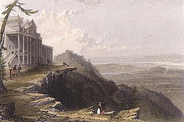 View from The Mountain House (1836), painting by William Henry Bartlett
 -
 Paul Weber, Scene in the Catskills, 1858
 -
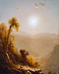 October in the Catskills, 1880 painting by Sanford Robinson Gifford
 -
![The Catskills, 1859 painting by Asher Brown Durand depicting the Catskills using the "sublime landscape" approach[23]](//upload.wikimedia.org/wikipedia/commons/thumb/2/2b/Asher_Brown_Durand_-_The_Catskills_-_Walters_37122.jpg/193px-Asher_Brown_Durand_-_The_Catskills_-_Walters_37122.jpg) The Catskills, 1859 painting by Asher Brown Durand depicting the Catskills using the "sublime landscape" approach[23]
The Catskills, 1859 painting by Asher Brown Durand depicting the Catskills using the "sublime landscape" approach[23] -
 The Redmond Stage, Woodstock music festival, 1969
 -
 Kaaterskill Falls on the Catskill Mountains (1826–27), painting by William Guy Wall, Honolulu Museum of Art


![The Catskills, 1859 painting by Asher Brown Durand depicting the Catskills using the "sublime landscape" approach[23]](/wiki/File:Asher_Brown_Durand_-_The_Catskills_-_Walters_37122.jpg)


See also
References
- ^ "REGIONAL TOPOGRAPHY". Catskills GIS Atlas. Catskill Center. Archived from the original on October 29, 2009. Retrieved October 12, 2009.
- ^ "Physiographic divisions of the conterminous U. S". U.S. Geological Survey. Retrieved December 6, 2007.
- ^ Kudish, Michael (2000). The Catskill Forest: A History. Fleischmanns, NY: Purple Mountain Press. p. 47. ISBN 978-1-930098-02-2.
- ^ "The Elusive Mountain Lion – E-Files – Our History". Sierra Club. Archived from the original on August 7, 2007. Retrieved September 17, 2007.
- ^ "Search results - NYPL Digital Collections".
- ^ "USDA Interactive Plant Hardiness Map". United States Department of Agriculture. Retrieved July 9, 2019.
- ^ a b c d "PRISM Climate Group, Oregon State University". www.prism.oregonstate.edu. Retrieved July 9, 2019.
- ^ "Geology of National Parks, 3D and Photographic Tours". USGS. USGS. Retrieved August 6, 2018.
- ^ Ver Straeten, C. A (2013). "Beneath it all: bedrock geology of the Catskill Mountains and implications of its weathering". Annals of the New York Academy of Sciences. 1298: 1–29. doi:10.1111/nyas.12221. PMID 23895551. S2CID 19940868.
- ^ Stanley Turkel (August 1, 2019). "Hotel History: Catskill Mountain Resort Hotels". Hospitality Net.
- ^ "Whitewater Rivers in and near the Catskill Mountains, New York". Retrieved May 10, 2013.
- ^ DePalma, Anthony (June 15, 2009). "An Unsightly Algae Extends Its Grip to a Crucial New York Stream". The New York Times. Retrieved May 28, 2019.
- ^ "Tour of the Catskills". Anthem Sports. Retrieved December 18, 2013.
- ^ "Windham Mountain Bike World Cup Festival". Archived from the original on March 26, 2016. Retrieved December 18, 2013.
- ^ "The trail system". Round Top Mountain Bike Association. October 20, 2019.
The Round Top trail system evolved from the local riding scene of the 90s.
- ^ "Catskill Interpretive Center". Retrieved October 18, 2017.
- ^ 'Official Guide of the Railways,' January 1950, New York, Ontario and Western section
- ^ Official Guide of the Railways, December 1950, New York, Ontario and Western section, page reproduced at http://www.thejoekorner.com/brochures/nyow-og-timetable/index.html
- ^ American Rails, 'New York, Ontario and Western Railway' https://www.american-rails.com/nyow.html
- ^ "Woodstock Film Commission". Hudsonvalleyfilmcommission.org. Archived from the original on September 22, 2013. Retrieved March 26, 2014.
- ^ Town Talk II, vol.30, number 6, June, 2020
- ^ "Comedians who became stars learned their craft in Catskill Mountain hotels". tribunedigital-sunsentinel. Archived from the original on December 29, 2015. Retrieved January 14, 2016.
- ^ "The Catskills". The Walters Art Museum.
Further reading
- Heilprin, Angelo (1907). "The Catskill Mountains". Bulletin of the American Geographical Society. 39 (4): 193–201. doi:10.2307/198709. ISSN 0190-5929. JSTOR 198709.
- McIntosh, Robert P. (1962). "The forest cover of the Catskill Mountain region, New York, as indicated by land survey records". American Midland Naturalist. 68 (2): 409–23. doi:10.2307/2422746. ISSN 0003-0031. JSTOR 2422746.
- McIntosh, Robert P. (1972). "Forests of the Catskill Mountains, New York". Ecological Monographs. 42 (2): 143–61. doi:10.2307/1942261. JSTOR 1942261.
- McIntosh, R. P.; R. T. Hurley (1964). "The spruce-fir forests of the Catskill Mountains". Ecology. 45 (2): 314–26. doi:10.2307/1933844. ISSN 0012-9658. JSTOR 1933844.
- Rich, John Lyon (1906). "Local glaciation in the Catskill Mountains". The Journal of Geology. 14 (2): 113–21. Bibcode:1906JG.....14..113R. doi:10.1086/621285. ISSN 0022-1376. S2CID 129029014.
- Shepard, Paul (1957). "Paintings of the New England landscape: a scientist looks at their geomorphology". College Art Journal. 17 (1): 30–43. doi:10.2307/773655. ISSN 1543-6322. JSTOR 773655.
- Silverman, Stephen M.; Silver, Raphael D. (2015). The Catskills: Its History and How It Changed America. Knopf Doubleday Publishing Group. ISBN 9781101875889.
- Weathers, K. C.; G. M. Lovett; G. E. Likens; R. Lathrop (2000). "The effect of landscape features on deposition to Hunter Mountain, Catskill Mountains, New York". Ecological Applications. 10 (2): 528–40. doi:10.1890/1051-0761(2000)010[0528:TEOLFO]2.0.CO;2. ISSN 1051-0761.
External links
- . Encyclopædia Britannica. Vol. 5 (11th ed.). 1911.
- Hiking Guide to Catskill High Peaks—Catskill 3500 Club
- List of Catskills peaks organized by hiking difficulty
- Website for the Catskill Mountain Club hiking
- The Catskill Archive – History of the Catskill Mountains
- The Catskill Mountain Foundation
- The Catskill Center
- The Catskill Watershed Corporation
- Catskill Region Photo Gallery
- Catskill Mountainkeeper—Protecting the Six Counties of the Catskills
- Catskill Mountain Businesses listed on Hudson Valley Directory
- Sullivan County Visitors Association

| Counties |  | |
|---|---|---|
| Major cities | ||
| Cities and towns over 100,000 | ||
| Cities and towns over 25,000 |
| |
| Regions | ||
| See also | ||
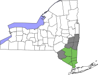
| International | |
|---|---|
| National | |
- Catskills
- Allegheny Plateau
- Landforms of Delaware County, New York
- Landforms of Greene County, New York
- Landforms of Schoharie County, New York
- Landforms of Sullivan County, New York
- Landforms of Ulster County, New York
- Mountain ranges of New York (state)
- Physiographic regions of the United States
- Regions of New York (state)
- Subranges of the Appalachian Mountains
- Tourist attractions in New York (state)
- Upstate New York