
Cairo: Difference between revisions
No edit summary |
|||
| Line 117: | Line 117: | ||
[[File:View from Cairo Tower 31march2007.jpg|thumb|right|Cairo's focal point, the [[Nile]], adjacent to the European-inspired districts near the city's centre|alt=A sharp blue river divides the cityscape, which is primarily greenery and sparse low-rise buildings in the foreground, and dense with several modern high-rises in the background]] |
[[File:View from Cairo Tower 31march2007.jpg|thumb|right|Cairo's focal point, the [[Nile]], adjacent to the European-inspired districts near the city's centre|alt=A sharp blue river divides the cityscape, which is primarily greenery and sparse low-rise buildings in the foreground, and dense with several modern high-rises in the background]] |
||
Cairo is located in northern [[Egypt]], known as [[Lower Egypt]], {{convert|165|km|mi|-1|sp=us}} south of the [[Mediterranean Sea]] and {{convert|120|km|mi|sp=us}} west of the [[Gulf of Suez]] and [[Suez Canal]].<ref>{{cite web|url=http://www.wolframalpha.com/input/?i=cairo+to+suez |work=WolframAlpha |publisher=Wolfram Research |accessdate=10 September 2009 |title=Cairo to Suez}}</ref> The city is along the [[Nile|Nile River]], immediately south of the point where the river leaves its desert-bound valley and branches into the low-lying [[Nile Delta]] region. Although the Cairo metropolis extends away from the Nile in all directions, the city of Cairo resides only on the east bank of the river and two islands within it on a total area of {{convert|214|km2|mi2|sp=us}}.<ref>{{cite web|url=http://www.cairo.gov.eg/C17/C8/Cairo%20Maps/default.aspx|publisher=Cairo Governorate|accessdate=10 September 2009|title=Cairo Maps}} {{Dead link|date=September 2010|bot=H3llBot}}</ref><ref name="citypop">{{cite web |url=http://www.citypopulation.de/Egypt.html |publisher=City Population |last=Brinkhoff |first=Thomas |accessdate=12 September 2009 |title=Egypt: Governorates & Cities}}</ref> |
Cairo is located in northern [[Egypt]], known as [[Lower Egypt]], {{convert|165|km|mi|-1|sp=us}} south of the [[Mediterranean Sea]] and {{convert|120|km|mi|sp=us}} west of the [[Gulf of Suez]] and [[Suez Canal]].<ref>{{cite web|url=http://www.wolframalpha.com/input/?i=cairo+to+suez |work=WolframAlpha |publisher=Wolfram Research |accessdate=10 September 2009 |title=Cairo to Suez}}</ref> The city is along the [[Nile|Nile River]], immediately south of the point where the river leaves its desert-bound valley and branches into the low-lying [[Nile Delta]] region. Although the Cairo metropolis extends away from the Nile in all directions, the city of Cairo resides only on the east bank of the river and two islands within it on a total area of {{convert|214|km2|mi2|sp=us}}.<ref>{{cite web|url=http://www.cairo.gov.eg/C17/C8/Cairo%20Maps/default.aspx|publisher=Cairo Governorate|accessdate=10 September 2009|title=Cairo Maps}} {{Dead link|date=September 2010|bot=H3llBot}}</ref><ref name="citypop">{{cite web |url=http://www.citypopulation.de/Egypt.html |publisher=City Population |last=Brinkhoff |first=Thomas |accessdate=12 September 2009 |title=Egypt: Governorates & Cities}}</ref> |
||
[[File:Cairo Nile River.jpg|thumb|right|The river [[Nile]] flows through Cairo, here contrasting ancient customs of daily life with the modern city of today.]] |
|||
Until the mid-19th century, when the river was tamed by dams, levees, and other controls, the Nile in the vicinity of Cairo was highly susceptible to changes in course and surface level. Over the years, the Nile gradually shifted westward, providing the site between the eastern edge of the river and the [[Mokattam]] highlands on which the city now stands. The land on which Cairo was established in 969 (present-day [[Islamic Cairo]]) was located underwater just over three hundred years earlier, when [[Fustat]] was first built.<ref>{{harvnb|Collins|2002|p=125}}</ref> |
Until the mid-19th century, when the river was tamed by dams, levees, and other controls, the Nile in the vicinity of Cairo was highly susceptible to changes in course and surface level. Over the years, the Nile gradually shifted westward, providing the site between the eastern edge of the river and the [[Mokattam]] highlands on which the city now stands. The land on which Cairo was established in 969 (present-day [[Islamic Cairo]]) was located underwater just over three hundred years earlier, when [[Fustat]] was first built.<ref>{{harvnb|Collins|2002|p=125}}</ref> |
||
Revision as of 03:45, 24 January 2011
Cairo
القاهرة (AL-Qāhira) | |
|---|---|
City | |
| Top left: Cairo Tower; top right: Ibn Tulun Mosque; Middle Left: Muizz Street; Middle Right: Nile Felucca; Bottom: Cairo Citadel Top left: Cairo Tower; top right: Ibn Tulun Mosque; Middle Left: Muizz Street; Middle Right: Nile Felucca; Bottom: Cairo Citadel | |
 Flag Coat of arms of Cairo Coat of arms | |
| Nickname(s): The City of a Thousand Minarets, Capital of the Arab World | |
| Country | |
| Governorate | Cairo Governorate |
| Government | |
| • Governor | Dr. Abdul Azim Wazir |
| Area | |
| • City | 453 km2 (175 sq mi) |
| • Urban | 6,640 km2 (2,560 sq mi) |
| • Metro | 86,369 km2 (33,347 sq mi) |
| Elevation | 23 m (75 ft) |
| Population (2008) | |
| • City | 7,786,640 |
| • Density | 17,190/km2 (44,500/sq mi) |
| • Urban | 17,290,000 |
| • Metro | 19,439,541 |
| • Demonym | Cairene |
| Time zone | UTC+2 (EET) |
| • Summer (DST) | UTC+3 (EEST) |
| Website | www.cairo.gov.eg |
Cairo (Template:Pron-en KYE-roh; Arabic: القاهرة al-Qāhira), literally "The Vanquisher" or "The Conqueror", is the capital of Egypt and the largest city in Africa and the 16th most populous metropolitan area in the world.[1][2]
Cairo is also ranked as one of the most densely populated cities in the world.[3] Nicknamed "The City of a Thousand Minarets" for its preponderance of Islamic architecture, Cairo has long been a centre of the region's political and cultural life. Cairo was founded by the Fatimid dynasty in the 10th Century, but the land composing the present-day city was the site of national capitals whose remnants remain visible in parts of Old Cairo. Cairo is also associated with Ancient Egypt due to its proximity to the ancient cities of Memphis, Giza and Fustat which are nearby to the Great Sphinx and the pyramids of Giza.
The city's original name in Arabic is "Al-Qahira", which became "Cairo" after Europeans corrupted the name. Egyptians today often refer to Cairo as Maṣr (Arabic: مصر), the Arabic pronunciation of the name for Egypt itself, emphasizing the city's continued role in Egyptian influence.[4][5] Cairo has the oldest and largest film and music industries in the Arab World, as well as the world's second-oldest institution of higher learning, al-Azhar University. Many international media, businesses, and organizations have regional headquarters in the city, and the Arab League has had its headquarters in Cairo for most of its existence.
With a population of 7.8 million[6] spread over 453 square kilometers (175 sq mi), Cairo is by far the largest city in Egypt. With an additional ten million inhabitants just outside the city, Cairo resides at the centre of the largest metropolitan area in Africa and the eleventh-largest urban area in the world.[7] Cairo, like many other mega-cities, suffers from high levels of pollution and traffic, but its metro – currently one of only two on the African continent – also ranks among the fifteen busiest in the world,[8] with over 700 million passenger rides annually. The economy of Cairo was ranked first in the Middle East,[9] and 43rd globally by Foreign Policy's 2010 Global Cities Index.[10]
History
Initial settlements

The area around present-day Cairo, especially Memphis, had long been a focal point of Ancient Egypt due to its strategic location just upstream from the Nile Delta. However, the origins of the modern city are generally traced back to a series of settlements in the first millennium. Around the turn of the 4th century,[11] as Memphis was continuing to decline in importance,[12] the Romans established a fortress town along the east bank of the Nile. This fortress, known as Babylon, remains the oldest structure in the city. It is also situated at the nucleus of Egypt's Coptic Christian community, which separated from the Roman and Byzantine church in the late 4th century. Many of Cairo's oldest Coptic churches, including The Hanging Church, are located along the fortress walls in a section of the city known as Coptic Cairo.
After the Muslim conquest of Egypt in 641, Rashidun commander 'Amr ibn al-'As established Fustat just north of Coptic Cairo and Babylon. At Caliph Umar's request, the Egyptian capital was moved from Alexandria to the new city.[13] Fustat also became a regional centre of Islam and home to the Mosque of Amr ibn al-As, the first mosque in Egypt.[14] When the Abbasids usurped the Umayyads in 750, they moved the capital to al-Askar, which they had built just north of Fustat. In 868, under the Tulunids, Egypt's capital was moved further north to their own settlement, al-Qatta'i.[15] However, neither al-Askar nor al-Qatta'i achieved the prominence of Fustat; al-Askar had become indistinguishable from Fustat by the end of the 9th century, and al-Qatta'i was destroyed by the Abbasids when they recaptured Egypt in 905. With the Abbasids' second conquest, Fustat once again became the capital of Egypt.
Foundation and expansion
In 969, led by General Gawhar al-Siqilli, the Fatimid Caliphate conquered Egypt from Tunisia and established a new fortified city northeast of Fustat. It took four years for Jawhar to build the city, initially known as al-Manṣūriyyah,[16] which later took its Modern name, Al-Qahira (Cairo) which was to serve as the new capital of the caliphate. During that time, Jawhar also commissioned the construction of al-Azhar Mosque, which developed into the third-oldest university in the world. Cairo would eventually became a centre of learning, with the library of Cairo containing hundreds of thousands of books.[17] When Caliph al-Mu'izz li Din Allah finally arrived from the old Fatimid capital of Mahdia in Tunisia in 973, the city was given its present name, al-Qahira ("The Victorious"), in reference to the caliph.[16]

For nearly two hundred years after Cairo was established, the administrative centre of Egypt remained in Fustat. However, in 1168, the Fatamids, under the leadership of Vizier Shawar, set fire to Fustat to prevent Cairo's capture by the Crusaders.[18] Egypt's capital was permanently moved to Cairo, which eventually expanded to include the ruins of Fustat and the previous capitals of al-Askar and al-Qatta'i. While the Fustat fire successfully protected the city of Cairo, a continuing power struggle between Shawar, King Amalric I of Jerusalem, and Syrian general Shirkuh led to the downfall of the Fatimid establishment.[19]
In 1169, Saladin was appointed as the new vizier of Egypt and, two years later, he would seize power from the family of the last Fatimid caliph, Al-'Āḍid.[20] As the first Sultan of Egypt, Saladin established the Ayyubid dynasty, based in Cairo , and aligned Egypt with the Abbasids, who were based in Baghdad.[21] During his reign, Saladin also constructed the Citadel, which served as the seat of Egyptian government until the mid-19th century.
In 1250, slave soldiers, known as the Mamluks, seized Egypt and, like many of their predecessors, established Cairo as the capital of their new dynasty. Continuing a practice started by the Ayyubids, much of the land occupied by former Fatimid palaces was sold and replaced by newer buildings.[22] Construction projects initiated by the Mamluks pushed the city outward while also bringing new infrastructure to the centre of the city.[23] Meanwhile, Cairo flourished as a centre of Islamic scholarship and a crossroads on the spice trade route between Europe and Asia. By 1340, Cairo had a population of close to half a million, making it the largest city west of China.[24]
Stagnation and Ottoman rule
Although it avoided Europe's stagnation during the Late Middle Ages, Cairo could not escape the Black Death, which struck the city more than fifty times between 1348 and 1517.[25] During its initial, and most deadly, waves, approximately 200,000 people were killed by the plague,[26] and, by the 15th century, Cairo's population had been reduced to between 150,000 and 300,000.[27] The city's status was further diminished after Vasco da Gama discovered a sea route around the Cape of Good Hope, thereby allowing spice traders to avoid Cairo.[24]
Cairo's political influence diminished significantly after the Ottomans supplanted Mamluk power over Egypt in 1517. Ruling from Istanbul, Sultan Selim I relegated Egypt to a mere province, with Cairo as its capital.[28] For this reason, the history of Cairo during Ottoman times is often described as inconsequential, especially in comparison to other time periods.[24][29][30] However, during the 16th and 17th centuries, Cairo remained an important economic and cultural centre. Although no longer on the spice route, the city facilitated the transportation of Yemeni coffee and Indian textiles, primarily to Anatolia, North Africa, and the Balkans. Cairene merchants were instrumental in bringing goods to the barren Hejaz, especially during the annual hajj to Mecca.[30][31] It was during this same period that al-Azhar University reached the predominance among Islamic schools that it continues to hold today;[32][33] pilgrims on their way to hajj often attested to the superiority of the institution, which had become associated with Egypt's body of Islamic scholars.[34] By the 16th century, Cairo also had high-rise apartment buildings where the two lower floors were for commercial and storage purposes and the multiple stories above them were rented out to tenants.[35]
Under the Ottomans, Cairo expanded south and west from its nucleus around the Citadel.[36] The city was the second-largest in the empire, behind only Istanbul, and, although migration was not the primary source of Cairo's growth, twenty percent of its population at the end of the 18th century consisted of religious minorities and foreigners from around the Mediterranean.[37] Still, when Napoleon arrived in Cairo in 1798, the city's population was less than 300,000, forty percent lower than it was at the height of Mamluk—and Cairene—influence in the mid-14th century.[24][37]
The French occupation was short-lived as British and Ottoman forces, including a sizable Albanian contingent, recaptured the country in 1801.[38] The British vacated Egypt two years later, leaving the Ottomans, the Albanians, and the long-weakened Mamluks jostling for control of the country.[39][40] Continued civil war allowed an Albanian named Muhammad Ali Pasha to ascend to the role of commander and eventually, with the approval of the religious establishment, viceroy of Egypt in 1805.[41]
Modern era
Until his death in 1848, Muhammad Ali Pasha instituted a number of social and economic reforms that earned him the title of founder of modern Egypt.[42][43] However, while Muhammad Ali initiated the construction of public buildings in the city,[44] those reforms had minimal effect on Cairo's landscape.[45] Bigger changes came to Cairo under Isma'il Pasha (r. 1863–1879), who continued the modernization processes started by his grandfather. Drawing inspiration from Paris, Isma'il environs a city of maidans and wide avenues; due to financial constraints, only some of them, in the area now composing Downtown Cairo, came to fruition.[46] Isma'il also sought to modernize the city, which was merging with neighboring settlements, by establishing a public works ministry, bringing gas and lighting to the city, and opening a theater and opera house.[47][48]

The immense debt resulting from Isma'il's projects provided a pretext for increasing European control, which culminated with the British invasion in 1882.[24] The city's economic centre quickly moved west toward the Nile, away from the historic Islamic Cairo section and toward the contemporary, European-style areas built by Isma'il.[49][50] Europeans accounted for five percent of Cairo's population at the end of the 19th century, by which point they held most top governmental positions.[51]

The British occupation was intended to be temporary, but it lasted well into the 20th century. Nationalists staged large-scale demonstrations in Cairo in 1919,[24] five years after Egypt had been declared a British protectorate.[50] Nevertheless, while this led to Egypt's independence in 1922, British troops remained in the country until 1956. During this time, urban Cairo, spurred by new bridges and transport links, continued to in expand to include the upscale neighborhoods of Garden City, Zamalek, and Heliopolis.[52] Between 1882 and 1937, the population of Cairo more than tripled – from 347,000 to 1.3 million[53] – and its area increased from 1,000 hectares (10 km2; 4 sq mi) to 16,300 hectares (163 km2; 63 sq mi).[54]
The British departed Cairo following the Egyptian Revolution of 1952, but the city's rapid growth showed no signs of abating. Seeking to accommodate the increasing population, President Gamal Abdel Nasser redeveloped Midan Tahrir and the Nile Corniche, and improved the city's network of bridges and highways.[55] Meanwhile, additional controls of the Nile fostered development within the island of Gezira and along the city's waterfront. The metropolis began to encroach on the fertile Nile Delta, prompting the government to build desert satellite towns and devise incentives for city-dwellers to move to them.[56]
Despite these efforts, Cairo's population has doubled since the 1960s, reaching close to seven million (with an additional ten million in its urban area). Concurrently, Cairo has established itself as a political and economic hub for North Africa and the Arab World, with many multinational businesses and organizations, including the Arab League, operating out of the city.
In 1992, Cairo was hit by a damaging earthquake, that caused 545 deaths, 6512 injuries and left 50,000 people homeless.[57]
Satellite cities
6th of October City, west of Cairo, and New Cairo, east of Cairo, are major urban developments which have been built to accommodate additional growth and development of the Cairo area.[58] New development includes several high-end residential developments.[59]
Geography

Cairo is located in northern Egypt, known as Lower Egypt, 165 kilometers (100 mi) south of the Mediterranean Sea and 120 kilometers (75 mi) west of the Gulf of Suez and Suez Canal.[60] The city is along the Nile River, immediately south of the point where the river leaves its desert-bound valley and branches into the low-lying Nile Delta region. Although the Cairo metropolis extends away from the Nile in all directions, the city of Cairo resides only on the east bank of the river and two islands within it on a total area of 214 square kilometers (83 sq mi).[61][62]

Until the mid-19th century, when the river was tamed by dams, levees, and other controls, the Nile in the vicinity of Cairo was highly susceptible to changes in course and surface level. Over the years, the Nile gradually shifted westward, providing the site between the eastern edge of the river and the Mokattam highlands on which the city now stands. The land on which Cairo was established in 969 (present-day Islamic Cairo) was located underwater just over three hundred years earlier, when Fustat was first built.[63]
Low periods of the Nile during the 11th century continued to add to the landscape of Cairo; a new island, known as Geziret al-Fil, first appeared in 1174, but eventually became connected to the mainland. Today, the site of Geziret al-Fil is occupied by the Shubra district. The low periods created another island at the turn of the 14th century that now composes Zamalek and Gezira. Land reclamation efforts by the Mamluks and Ottomans further contributed to expansion on the east bank of the river.[64]

Because of the Nile's movement, the newer parts of the city – Garden City, Downtown Cairo, and Zamalek – are located closest to the riverbank. The areas, which are home to most of Cairo's embassies, are surrounded on the north, east, and south by the older parts of the city. Old Cairo, located south of the centre, holds the remnants of Fustat and the heart of Egypt's Coptic Christian community, Coptic Cairo. The Boulaq district, which lies in the northern part of the city, was born out of a major 16th-century port and is now a major industrial centrer. The Citadel is located east of the city centre around Islamic Cairo, which dates back to the Fatimid era and the foundation of Cairo. While western Cairo is dominated by wide boulevards, open spaces, and modern architecture of European influence, the eastern half, having grown haphazardly over the centuries, is dominated by small lanes, crowded tenements, and Islamic architecture.
Northern and extreme eastern parts of Cairo, which include satellite towns, are among the most recent additions to the city, as they developed in the late-20th and early-21st centuries to accommodate the city's rapid growth. The western bank of the Nile is commonly included within the urban area of Cairo, but it composes the city of Giza and the Giza Governorate. Giza has also undergone significant expansion over recent years, and today the city, although still a suburb of Cairo, has a population of 2.7 million.[62] The Cairo Governorate is just north of the Helwan Governorate, which was created in 2008 when some of Cairo's southern districts, including Maadi and New Cairo, were split off and annexed into the new governorate.[65]
Climate

In Cairo, and along the Nile River Valley, the climate is a desert climate (BWh according to the Köppen climate classification system[66]), but often with high humidity due to the river valley's effects. Wind storms can be frequent, bringing Saharan dust into the city during the months of March and April. High temperatures in winter range from 13 °C (55 °F) to 19 °C (66 °F), while night-time lows drop to below 8 °C (46 °F), often to 5 °C (41 °F). In summer, the highs rarely surpass 40 °C (104 °F), and lows drop to about 20 °C (68 °F). Rainfall is sparse, but sudden showers do cause harsh flooding. In New Cairo, a place of higher elevation than down town Cairo, the temperatures often drop below zero during winter causing morning frost. [citation needed]
| Climate data for Cairo (Cairo International Airport) 1991–2020 | |||||||||||||
|---|---|---|---|---|---|---|---|---|---|---|---|---|---|
| Month | Jan | Feb | Mar | Apr | May | Jun | Jul | Aug | Sep | Oct | Nov | Dec | Year |
| Record high °C (°F) | 31.0 (87.8) |
34.2 (93.6) |
37.9 (100.2) |
43.2 (109.8) |
47.8 (118.0) |
46.4 (115.5) |
42.6 (108.7) |
43.4 (110.1) |
43.7 (110.7) |
41.0 (105.8) |
37.4 (99.3) |
30.2 (86.4) |
47.8 (118.0) |
| Mean daily maximum °C (°F) | 18.9 (66.0) |
20.5 (68.9) |
23.8 (74.8) |
28.1 (82.6) |
32.2 (90.0) |
34.6 (94.3) |
35.0 (95.0) |
34.9 (94.8) |
33.4 (92.1) |
30.0 (86.0) |
24.9 (76.8) |
20.5 (68.9) |
28.1 (82.6) |
| Daily mean °C (°F) | 14.4 (57.9) |
15.6 (60.1) |
18.3 (64.9) |
21.8 (71.2) |
25.6 (78.1) |
28.2 (82.8) |
29.1 (84.4) |
29.2 (84.6) |
27.6 (81.7) |
24.6 (76.3) |
20.0 (68.0) |
15.9 (60.6) |
22.5 (72.5) |
| Mean daily minimum °C (°F) | 10.1 (50.2) |
11.0 (51.8) |
13.2 (55.8) |
15.9 (60.6) |
19.3 (66.7) |
22.2 (72.0) |
23.8 (74.8) |
24.3 (75.7) |
22.7 (72.9) |
20.0 (68.0) |
15.6 (60.1) |
11.7 (53.1) |
17.5 (63.5) |
| Record low °C (°F) | 1.2 (34.2) |
3.6 (38.5) |
5.0 (41.0) |
7.6 (45.7) |
12.3 (54.1) |
16.0 (60.8) |
18.2 (64.8) |
19.0 (66.2) |
14.5 (58.1) |
12.3 (54.1) |
5.2 (41.4) |
3.0 (37.4) |
1.2 (34.2) |
| Average precipitation mm (inches) | 4.8 (0.19) |
3.8 (0.15) |
6.3 (0.25) |
1.3 (0.05) |
0.2 (0.01) |
0 (0) |
0 (0) |
0 (0) |
0 (0) |
0.7 (0.03) |
4.3 (0.17) |
3.4 (0.13) |
24.8 (0.98) |
| Average precipitation days (≥ 1.0 mm) | 1.3 | 2.0 | 1.2 | 1.3 | 0.6 | 0.6 | 0.7 | 1.0 | 0.7 | 0.1 | 0.6 | 0.8 | 11.0 |
| Average relative humidity (%) | 59 | 54 | 53 | 47 | 46 | 49 | 58 | 61 | 60 | 60 | 61 | 61 | 56 |
| Average dew point °C (°F) | 5.2 (41.4) |
5.0 (41.0) |
6.1 (43.0) |
7.5 (45.5) |
10.1 (50.2) |
13.9 (57.0) |
17.5 (63.5) |
18.3 (64.9) |
16.7 (62.1) |
14.0 (57.2) |
10.7 (51.3) |
6.7 (44.1) |
11.0 (51.8) |
| Mean monthly sunshine hours | 213 | 234 | 269 | 291 | 324 | 357 | 363 | 351 | 311 | 292 | 248 | 198 | 3,451 |
| Percent possible sunshine | 66 | 75 | 73 | 75 | 77 | 85 | 84 | 86 | 84 | 82 | 78 | 62 | 77 |
| Average ultraviolet index | 4 | 5 | 7 | 9 | 10 | 11.5 | 11.5 | 11 | 9 | 7 | 5 | 3 | 7.8 |
| Source 1: NOAA (humidity, dew point, records 1961–1990)[67][68] | |||||||||||||
| Source 2: Danish Meteorological Institute for sunshine (1931–1960)[69] and Weather2Travel (ultraviolet)[70] | |||||||||||||
Infrastructure

Health
Cairo, as well as neighbouring Giza, has been established as Egypt's main centre for medical treatment, and despite some exceptions, has the most advanced level of medical care in the country. Cairo's hospitals include the jci(JCI) accredited As-Salam International Hospital- Corniche El Nile; Maadi (Egypt's largest private hospital with 350 beds), Ain Shams University Hospital, Dar El Fouad Hospital, as well as Qasr El Ainy General Hospital.
Education
Cairo has long been the hub of education and educational services for Egypt and the region. Today, Cairo is the centre for many government offices governing the Egyptian educational system, has the largest number of educational schools, and higher learning institutes among other cities and governorates of Egypt.
Some of the International Schools found in Cairo include:
Universities in Cairo:

| University | Date of Foundation |
|---|---|
| Al Azhar University | 975 |
| Cairo University | 1908 |
| American University in Cairo | 1919 |
| Ain Shams University | 1950 |
| Arab Academy for Science & Technology and Maritime Transport | 1972 |
| Helwan University | 1975 |
| Sadat Academy for Management Sciences | 1981 |
| Higher Technological Institute | 1989 |
| Modern Academy In Maadi | 1993 |
| Misr International University | 1996 |
| Misr University for Science and Technology | 1996 |
| Modern Sciences and Arts University | 1996 |
| Université Française d'Égypte | 2002 |
| German University in Cairo | 2003 |
| Canadian International College | 2004 |
| British University in Egypt | 2005 |
| Ahram Canadian University | 2005 |
| Nile University | 2006 |
| Future University in Egypt | 2006 |
Transportation


Transportation in Cairo comprises an extensive road network, rail system, subway system, and maritime services. Road transport is facilitated by personal vehicles, taxi cabs, privately owned public buses, and Cairo microbuses. Cairo, specifically Ramses Square, is the centre of almost the entire Egyptian transportation network.[citation needed]
The subway system, officially called "Metro (مترو)", is a fast and efficient way of getting around Cairo. It can get very crowded during rush hour. Two train cars (the fourth and fifth ones) are reserved for women only, although women may ride in any car they want.
An extensive road network connects Cairo with other Egyptian cities and villages. There is a new Ring Road that surrounds the outskirts of the city, with exits that reach outer Cairo districts. There are flyovers and bridges, such as the Sixth of October bridge that, when the traffic is not heavy, allow fast [citation needed] means of transportation from one side of the city to the other.
Cairo traffic is known to be overwhelming and overcrowded.[71] Traffic moves at a relatively fluid pace. Drivers tend to be aggressive, but are more courteous at intersections, taking turns going, with police aiding in traffic control of some congested areas.[citation needed]
On 25 October 2009 a passenger train ran into another one near Giza, just outside Cairo.[72] Local news agencies reported at least 25 people dead.[73] A local resident, Samhi Saleh Abdel Al, told reporters that "the first train stopped after hitting a cow and 10 minutes later the second train arrived at full speed."[74] One of the two trains was travelling from Cairo to Asiot, while the other was said to have been en-route to Fayoum from Al-Jeeza.[75] Around 55 people were injured.[76]
- Cairo International Airport
- Ramses Railway Station
- Cairo Tram
- Cairo Transportation Authority CTA
- Cairo Taxi
- Cairo Metro
- Cairo Yellow Cab
- Cairo Nile Ferry
Sports

Football is the most popular Sport in Egypt, and Cairo has a number of sporting teams that compete in national and regional leagues. The best known teams are Al-Ahly and El Zamalek, whose annual football tournament is perhaps the most watched sports event in Egypt as well as the African and Arabian World. Both teams are known as the "rivals" of Egyptian football, and are the first and the second champions in the African continent and the Arab World. Both teams play their home games at Cairo International Stadium or Naser Stadium, which is Egypt's 2nd largest stadium, Cairo's largest one and one of the largest stadiums in the world.
The Cairo International Stadium was built in 1960 and its multi-purpose sports complex that houses the main football stadium, an indoor stadium, several satellite fields that held several regional, continental and global games, including the African Games, U17 Football World Championship and was one of the stadiums scheduled that hosted the 2006 African Nations Cup which was played in January, 2006 Egypt later won the competition and went on to win the next edition In Ghana (2008) making the Egyptian and Ghanaian national teams the only teams to win the African cup of nations Back to back which resulted in Egypt winning the title for a record number of six times in African Continental Competition's history. This was followed by a third consecutive win in Angola 2010, making Egypt the only country with a record 3-consecutive and 7-total Continental Football Competition winner. This achievement had also placed the Egyptian football team as the #12 best team in the world's FIFA rankings.
Cairo failed at the applicant stage when bidding for the 2008 Summer Olympic Games, which was hosted in Beijing, China. However, Cairo did host the 2007 Pan-Arab Games.
There are several other sports teams in the city that participate in several sports including el Gezira Sporting Club, el Shams Club, el Seid Club, Heliopolis Club and several smaller clubs, but the biggest clubs in Egypt (not in area but in sports) are Al Ahly & Al Zamalek. They have the two biggest football teams in Egypt.
Most of the sports federations of the country are also located in the city suburbs, including the Egyptian Football Association. The headquarters of the Confederation of African Football (CAF) was previously located in Cairo, before relocating to its new headquarters in 6 October City, a small city away from Cairo's crowded districts.
On October 2008, the Egyptian Rugby Federation was officially formed and granted membership into the International Rugby Board.
Egypt is internationally known for the excellence of its squash players who excel in both professional and junior divisions. Gizira Club in Zamalek is where former world #1 Amr Shabana and former world #1 Karim Darwish practice. The Heliopolis Club in Heliopolis is the home of current world #1 Ramy Ashour and his brother, world #24, Hisham Ashour. Other major squash-playing venues are The Shooting Club (Nadi el Seid) in Dokki, The Maadi Club in Maadi and Wadi Degla in Degla.
Culture
Over the ages, and as far back as four thousand years, Egypt stood as the land where civilizations have always met. [citation needed] The Pharaohs together with the Greeks and the Romans have left their imprints here. Muslims from the Arabian Peninsula, led by Amr ibn al-A'as, introduced Islam into Egypt. Khedive Mohammad Ali, with his Albanian family roots, put Egypt on the road to modernity. If anything, the cultural mix in this country is natural, given its heritage. Egypt can be likened to an open museum with monuments of the different historical periods on display everywhere.
Cairo Opera House
President Mubarak inaugurated the new Cairo Opera House of the Egyptian National Cultural Centres on October 10, 1988, seventeen years after the Royal Opera House had been destroyed by fire. The National Cultural Centre was built with the help of JICA, the Japan International Co-operation Agency and stands as a prominent feature for the Japanese-Egyptian co-operation and the friendship between these two nations.
Egypt is proud to be the only state in the region which built two opera houses within a century.
Khedivial Opera House
The Khedivial Opera House or Royal Opera House was the original opera house in Cairo, Egypt. It was dedicated on November 1, 1869 and burned down on October 28, 1971. After the original opera house was destroyed, Cairo was without an opera house for nearly two decades until the opening of the new Cairo Opera House in 1988.
Cairo International Film Festival
Egypt's love of the arts in general can be traced back to the rich heritage bequeathed by the Pharaohs. In modern times, Egypt has enjoyed a strong cinematic tradition since the art of filmmaking was first developed, early in the 20th century. A natural progression from the active theatre scene of the time, cinema rapidly evolved into a vast motion picture industry. This together with the much older music tradition, raised Egypt to become Hollywood Middle East and the cultural capital of the Arab world.
For more than 500 years of recorded history, Egypt has fascinated the West and inspired its creative talents from play writer William Shakespeare, poet and dramatist John Dryden, and novelist and poet Lawrence Durrell to film producer Cecil B. de Mille. Since the silent movies Hollywood has been capitalising on the box-office returns that come from combining Egyptian stories with visual effects.
Egypt has also been a fount of Arabic literature, producing some of the 20th century's greatest Arab writers such as Taha Hussein and Tawfiq al-Hakim to Nobel Laureate, novelist Naguib Mahfouz. Each of them has written for the cinema.
With these credentials, it was clear that Cairo should aim to hold an international film festival. This dream came true on Monday August 16, 1976, when the first Cairo International Film Festival was launched by the Egyptian Association of Film Writers and Critics, headed by Kamal El-Mallakh. The Association ran the festival for seven years until 1983.
This achievement lead to the President of the Festival again contacting the FIAPF with the request that a competition should be included at the 1991 Festival. The request was granted.
In 1998, the Festival took place under the presidency of one of Egypt's leading actors, Hussein Fahmy, who was appointed by the Minister of Culture, Farouk Hosni, after the death of Saad El-Din Wahba.
Four years later, the journalist and writer Cherif El-Shoubashy became president.
For 33 years The International Festival has awarded dozens of international superstars, including John Malkovich, Nicolas Cage, Morgan Freeman, Bud Spencer, Gina Lollobrigida, Ornella Muti, Sophia Loren, Claudia Cardinale, Victoria Abril, Elizabeth Taylor, Shashi Kapoor, Alain Delon, Goldy Hawn, Kurt Russell, Susan Sarandon, Greta Scacchi, Catherine Deneuve, Peter O'Toole, Charlize Theron, Julia Ormond, Mira Sorvino, Stuart Townsend, Alicia Silverstone, Priscilla Presley, Christopher Lee, Irene Papas, Marcello Mastroianni, Salma Hayek, Lucy liu, Samuel Jackson, Tom Berenger and Omar Sharif, as well as directors like Robert Wise, Elia Kazan, Vanessa Redgrave, Oliver Stone, Roland Joffe, Carlos Saura, Ismail Merchant and Michelangelo Antonioni, in an annual celebration and examination of the state of cinema in the world today. The presidents of the Festival since it was founded in 1976 are Saad El-Din Wahba, Hussein Fahmy and Sherif El Shoubashy. This year the festival a milestone of 30 years in an annual celebration and examination of the state of cinema in the world today.
Cairo Geniza
The Cairo Geniza is an accumulation of almost 200,000 Jewish manuscripts that were found in the genizah of the Ben Ezra synagogue (built 882) of Fostat, Egypt (now Old Cairo), the Basatin cemetery east of Old Cairo, and a number of old documents that were bought in Cairo in the later 19th century. These documents were written from about 870 to as late as 1880 AD and have now been archived in various American and European libraries. The Taylor-Schechter collection in the University of Cambridge runs to 140,000 manuscripts; there are a further 40,000 manuscripts at the Jewish Theological Seminary of America.
Economy

Cairo is also in every respect the centre of Egypt, as it has been almost since its founding in 969 AD. The majority of the nation's commerce is generated there, or passes through the city. The great majority of publishing houses and media outlets and nearly all film studios are there, as are half of the nation's hospital beds and universities. This has fueled rapid construction in the city—one building in five is less than 15 years old.
This astonishing growth until recently surged well ahead of city services. Homes, roads, electricity, telephone and sewer services were all suddenly in short supply. Analysts trying to grasp the magnitude of the change coined terms like "hyper-urbanization".
Cairos Automobile assembler & manufacturer
- Arab American Vehicles Company[77]
- Egyptian Light Transport Manufacturing Company (Egyptian NSU pedant)
- Ghabbour Group[78] (Fuso, Hyundai and Volvo)
- MCV Corporate Group[79] (a part of the Daimler AG)
- Mod Car[80]
- Seoudi Group[81] (Modern Motors: Nissan, BMW (formerly); El-Mashreq: Alfa Romeo and Fiat)
- Speranza Chery[82][83] (DME Daewoo Motors Egypt: Chery, Daewoo)
Main sights
- For a complete list, see Visitor attractions in Cairo
The Egyptian Museum


The Museum of Egyptian Antiquities, known commonly as the Egyptian Museum, is home to the most extensive collection of ancient Egyptian antiquities in the world. It has 136,000 items on display, with many more hundreds of thousands in its basement storerooms.
Khan El-Khalili
Khan el-Khalili is an ancient shopping area, nothing less, but some of the shops have also their own little factories or workshops.
The suq (which is the Arabic name for bazaar, or market) dates back to 1382, when Emir Djaharks el-Khalili built a big caravanserai (or khan) right here. A caravanserai was a sort of hotel for traders, and usually the focal point for economic activity for any surrounding area. This caravanserai is still there, you just ask for the narrow street of Sikka Khan el-Khalili and Badestan.
Old Cairo
The part of Cairo that contains Coptic Cairo and Fostat, which contains the Coptic Museum, Babylon Fortress, Hanging Church, the Greek Church of St. George, many other Coptic churches, the Ben Ezra Synagogue and Amr ibn al-'As Mosque.
Cairo Tower
The Cairo Tower is a free-standing concrete TV tower in Cairo. It stands in the Zamalek district on Gezira Island in the Nile River, in the city centre. At 187 meters, it is 43 meters higher than the Great Pyramid of Giza, which stands some 15 km to the southwest.
Qahira Fatimid Mosque
- Al-Azhar Mosque
Established in 972, Al-Azhar mosque was historically the site of the renowned Al-Azhar University, until the university's move in the late 20th century to a new campus in Nasr City.
- Al-Hakim Mosque Jame-al-Anwar, 928
- Aqmar Mosque, 1125
- Juyushi Mosque, 1085
- Lulua Mosque, 1015
-
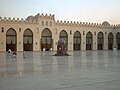
 Al-Azhar Mosque,Marble paved interior courtyard added during the Fatimid period
 -
-

-

-

_2006.jpg)


.jpg)

Islamic sites in the old city
- Imam Husayn Mosque
- Mosque-Mausoleum Zaynab
- Sayyidah Ruqayya Mashhad
- Sayyeda Nafisa Mosque
- Mohammed Ali Basha Mosque
-
 Imam Husayn Mosque,Cairo
 -
 Mosque-Mausoleum Zaynab,Cairo
 -
 Sayyeda Ruqayya Mashhad
 -
 Masjid-Mausoleum Nafisa ,Cairo
 -
 Mohammed Ali Basha Mosque, Cairo


Pollution
Cairo is an expanding city, which has led to many environmental problems. The air pollution in Cairo is a matter of serious concern. Greater Cairo's volatile aromatic hydrocarbon levels are higher than many other similar cities.[84] Air quality measurements in Cairo have also been recording dangerous levels of lead, carbon dioxide, sulphur dioxide, and suspended particulate matter concentrations due to decades of unregulated vehicle emissions, urban industrial operations, and chaff and trash burning. There are over 4,500,000 cars on the streets of Cairo, 60% of which are over 10 years old, and therefore lack modern emission cutting features like catalytic converters. Cairo has a very poor dispersion factor because of lack of rain and its layout of tall buildings and narrow streets, which create a bowl effect. A mysterious black cloud (as Egyptians refer to it) appears over Cairo every fall and causes serious respiratory diseases and eye irritations for the city's citizens. Tourists who are not familiar with such high levels of pollution must take extra care.[85]
Cairo also has many unregistered lead and copper smelters which heavily pollute the city. The results of this has been a permanent haze over the city with particulate matter in the air reaching over three times normal levels. It is estimated that 10,000 to 25,000 people a year in Cairo die due to air pollution-related diseases. Lead has been shown to cause harm to the central nervous system and neurotoxicity particularly in children.[86] In 1995, the first environmental acts were introduced and the situation has seen some improvement with 36 air monitoring stations and emissions tests on cars. 20,000 buses have also been commissioned to the city to improve congestion levels, which are very high.
The city also suffers from a high level of land pollution. Cairo produces 10,000 tons of waste material each day, 4,000 tons of which is not collected or managed. This once again is a huge health hazard and the Egyptian Government is looking for ways to combat this. The Cairo Cleaning and Beautification Agency was founded to collect and recycle the waste; however, they also work with the Zabbaleen (or Zabaleen), a community that has been collecting and recycling Cairo's waste since the turn of the 20th century and live in an area known locally as Manshiyat naser.[87] Both are working together to pick up as much waste as possible within the city limits, though it remains a pressing problem.
The city also suffers from water pollution as the sewer system tends to fail and overflow. On occasion, sewage has escaped onto the streets to create a health hazard. This problem is hoped to be solved by a new sewer system funded by the European Union, which could cope with the demand of the city. The dangerously high levels of mercury in the city's water system has global health officials concerned over related health risks. There is also more concern about environmental issues among Egyptians than before. There is now general awareness and some projects are laid down to help make the public aware of the importance of clean environment.
International relations
Twin towns — Sister cities
North America
 Houston, United States
- New York City, United States (1982)[89]
 Ottawa, Ontario (1989)
Asia
 Ankara, Turkey (2004)
 Beijing, China (1990)
 Seoul, South Korea (1997)
 Tokyo, Japan (1990)
- Xi'an, China (1997)
 Amman, Jordan (1988)
Europe
 Barcelona, Spain (1992)
 Frankfurt, Germany (1979)
- Istanbul, Turkey (1988)
 Minsk, Belarus (1998)
 Paris, France (1985)
- Stuttgart, Germany (1979)
Famous people born in Cairo
- Abu Sa'id al-Afif - 15th century Samaritian
- Boutros Boutros-Ghali, former Secretary-General of the United Nations
- Naguib Mahfouz, novelist, Nobel Prize in Literature in 1988.
- Mohamed ElBaradei, former Director General of the International Atomic Energy Agency 2005 Nobel Peace Prize laureate
- Dalida Italian-Egyptian singer who lived most of her life in France She received 55 golden records and was the first singer to receive a diamond disc .
- Naguib Sawiris, 62nd richest person on earth in a 2007 list of billionaires, reaching US$10.0 billion with his company Orascom Telecom Holding
- Sam Mounier, writer, actor, and director
- Sherif Sonbol (1956), chief photographer of the Cairo Opera House and Al Ahram Weekly, book author, first Egyptian photographer whose work has been subject of an exhibit at New York´s Lincoln Center
- Constantin Xenakis (1931) Greek artist
- Ekmeleddin İhsanoğlu Turkish professor and the secretary general of the Organisation of the Islamic Conference
- Voula Zouboulaki (1931) Greek actress
- Raffi Cavoukian, Canadian children's singer, born 1948
- Mido, Professional football player with AFC Ajax
- Umar al-Tilmisani, The third General Guide (Murshid al-'Am) of the Egyptian Muslim Brothers
- Alaa Abdelnaby- NBA player for the Portland Trail Blazers, Milwaukee Bucks, Boston Celtics, Philadelphia 76ers, and the Sacramento Kings
- Nora Valsami, Greek actress, in 1945
- Maryem Tollar, Egyptian singer who primarily sings Arabic songs.
- Yakup Kadri Karaosmanoğlu, Turkish novelist
- Sonja Zuckerman Socialite and philanthropist known for her charitable contribution to women's shelter and homeless organization, net worth of $900 million.
See also
References
Notes
- ^ http://www.prlog.org/10332580-cairo-alqahira-is-egypts-capital-and-the-largest-city-in-the-middle-east-and-africa.html
{{citation}}: Missing or empty|title=(help) - ^ R.L. Forstall, R.P. Greene, and J.B. Pick, "Which are the largest? Why published populations for major world urban areas vary so greatly", City Futures Conference, (University of Illinois at Chicago, July 2004) – Table 5 (p.34)
- ^ "World's Densest Cities". Forbes. 21 December 2006. Retrieved 6 March 2010.
- ^ Behrens-Abouseif 1992, p. 8
- ^ Golia 2004, p. 152
- ^ Population and Housing Census 2006, Governorate level, Population distribution by sex (xls), Central Agency for Public Mobilisation and Statistics, retrieved 9 July 2009. Adjusted census result, as Helwan governorate was created on 17 April 2008 from a.o. parts of the Cairo governorate.
- ^ Demographia World Urban Areas & Population Projections (PDF), Demographia, 2009, retrieved 9 July 2009
{{citation}}: Unknown parameter|month=ignored (help) - ^ Mustafayev, Nicat (29 June 2009). "World metro systems by annual passenger rides". Retrieved 9 July 2009.
- ^ "The 150 Richest Cities in the World by GDP in 2005". Retrieved 2010-11-11.
- ^ "The 2010 Global Cities Index".
- ^ Hawass & Brock 2003, p. 456
- ^ "Memphis (Egypt)". Encarta. Microsoft. 2009. Archived from the original on 2009-10-31. Retrieved 24 July 2009.
{{cite encyclopedia}}: Unknown parameter|deadurl=ignored (|url-status=suggested) (help) - ^ Butler 2008, p. 341
- ^ Butler 2008, p. 342
- ^ Raymond 2000, pp. 23–9
- ^ a b Glassé & Smith 2003, p. 96
- ^ Meri & Bacharach 2006, p. 451
- ^ Daly & Petry 1998, p. 213
- ^ Daly & Petry 1998, pp. 213–5
- ^ Daly & Petry 1998, p. 215
- ^ Shillington 2005, p. 438
- ^ Raymond 2000, p. 122
- ^ Raymond 2000, pp. 120–8
- ^ a b c d e f Shillington 2005, p. 199
- ^ Shoshan 2002, p. 4
- ^ Bryne 2004, pp. 104–5
- ^ Shoshan 2002, p. 1
- ^ Shillington 2005, p. 447
- ^ Rose, Christopher (1995). "Ottoman Cairo". Cairo: Living Past, Living Future. The University of Texas Center for Middle Eastern Studies. Retrieved 30 July 2009.
{{cite web}}: Unknown parameter|coauthors=ignored (|author=suggested) (help) - ^ a b Winter 1992, p. 225
- ^ İnalcık et al. 1997, pp. 507–9
- ^ Winter 2004, p. 115
- ^ Daly & Petry 1998, pp. 94–5
- ^ Winter 2004, pp. 115–7
- ^ Mortada, Hisham (2003), Traditional Islamic principles of built environment, Routledge, p. viii, ISBN 0700717005
- ^ Winter 1992, p. 226
- ^ a b Winter 1992, pp. 226–7
- ^ Sicker 2001, p. 103
- ^ Sicker 2001, p. 104
- ^ Afaf Lutfi Sayyid-Marsot 1984, p. 39
- ^ Sicker 2001, pp. 104–5
- ^ Afaf Lutfi Sayyid-Marsot 1984, p. 1
- ^ McGregor 2006, p. 53
- ^ Shillington 2005, p. 437
- ^ Raymond 2000, pp. 291, 302
- ^ Raymond 2000, pp. 313–4
- ^ Raymond 2000, pp. 311–3
- ^ Abu-Lughod 1965, pp. 436–44
- ^ Abu-Lughod 1965, pp. 429–31, 455–7
- ^ a b Hourani, Khoury & Wilson 2004, p. 317 Cite error: The named reference "hokhwi317" was defined multiple times with different content (see the help page).
- ^ Abu-Lughod 1965, p. 431
- ^ Raymond 2000, pp. 326–9
- ^ Raymond 2000, p. 319
- ^ Raymond 2000, p. 322
- ^ Raymond 2000, p. 349
- ^ Raymond 2000, pp. 343–5
- ^ "NGDC page on the Cairo earthquake". Retrieved 9 June 2010.
- ^ "To Catch Cairo Overflow, 2 Megacities Rise in Sand" article by Thanassis Cambanis in The New York Times August 24, 2010, accessed August 25, 2010
- ^ Map of Greater Cairo & SODIC Developments, accessed August 25, 2010
- ^ "Cairo to Suez". WolframAlpha. Wolfram Research. Retrieved 10 September 2009.
- ^ "Cairo Maps". Cairo Governorate. Retrieved 10 September 2009. [dead link]
- ^ a b Brinkhoff, Thomas. "Egypt: Governorates & Cities". City Population. Retrieved 12 September 2009.
- ^ Collins 2002, p. 125
- ^ Collins 2002, p. 126
- ^ Leila, Reem (24–30 April 2008). "Redrawing the Map". No. 894. al-Ahram Weekly. Retrieved 12 September 2009.
- ^ "World Map of Köppen-Geiger Climate Classification". Köppen-Geiger. Retrieved 2010-01-22.
- ^ "Cairo Airport Normals 1991–2020". World Meteorological Organization Climatological Standard Normals (1991–2020). National Oceanic and Atmospheric Administration. Archived from the original on 2 October 2023. Retrieved 2 October 2023.
- ^ "Cairo (A)". World Meteorological Organization Climatological Reference Normals (1961–1990). National Oceanic and Atmospheric Administration. Archived from the original on 2 October 2023. Retrieved 2 October 2023.
- ^ Cappelen, John; Jensen, Jens. "Egypten - Cairo" (PDF). Climate Data for Selected Stations (1931–1960) (in Danish). Danish Meteorological Institute. p. 82. Archived from the original (PDF) on April 27, 2013. Retrieved April 14, 2014.
- ^ "Cairo Climate Guide: Monthly Weather, Egypt". Retrieved 29 June 2019.
- ^ "Al-Ahram Weekly | Features | Reaching an impasse". Weekly.ahram.org.eg. 2006-02-01. Retrieved 2009-05-05.
- ^ "Egypt train crash death toll rises". smh.com.au. 2009-10-25. Retrieved 2009-10-25.
- ^ "9&10 News: The nuclear issue...National emergency...Deadly train crash". www.9and10news.com. Retrieved 2009-10-25.
- ^ "[[Al Jazeera]] English - Middle East - Deadly train crash in Egypt". Al Jazeera [1]. Retrieved 2009-10-25.
{{cite web}}: External link in|publisher= - ^ "Maan News Agency: Fourteen killed as trains collide south of Cairo". www.maannews.net. Retrieved 2009-10-25.
- ^ "Two Trains Crash Outside Cairo, Egypt, Killing At Least 25 - Police". Sky News. Retrieved 2009-10-25.
- ^ "Arab American Vehicles Co". Aav.com.eg. Retrieved 2010-06-14.
- ^ http://www.ghabbourauto.com/
- ^ "Welcome to MCV Web Site". Mcv-eg.com. Retrieved 2010-06-14.
- ^ TradeHolding.com B2B Network. "Panda, Buy from Mod Car. Egypt - Ash Sharqiyah - Middle East Business B2B Directory - Saudi Arabia, UAE, Bahrain Companies, Middle East Businesses, Products & Trade Leads, Arab Business". Gulfbusiness.tradeholding.com. Retrieved 2010-06-14.
{{cite web}}: CS1 maint: numeric names: authors list (link) - ^ "Seoudi Group 1001 opportunities for investment in Egypt and Arab World". Seoudi.com. Retrieved 2010-06-14.
- ^ "اسبرانزا ايجيبت". Speranza Egypt. Retrieved 2010-06-14.
- ^ "Welcome to Daewoo Motor Website". Aboulfotouh.com. Retrieved 2010-06-14.
- ^ Khoder, M.I. (2007), "Ambient levels of volatile organic compounds in the atmosphere of Greater Cairo", Atmospheric Environment, 41 (3), Air Pollution Research Department, National Research Centre, Dokki, Giza: 554–566, doi:10.1016/j.atmosenv.2006.08.051, ISSN: 1352-2310, retrieved 2007-01-01.
{{citation}}: Unknown parameter|month=ignored (help) - ^ Khoder, M, "Black cloud reappears over Cairo", Middle East online, 41: 554, doi:10.1016/j.atmosenv.2006.08.051.
{{citation}}: Cite has empty unknown parameter:|coauthors=(help) - ^ Lidsky, T. I.; Schneider, JS (2003), "Lead neurotoxicity in children: basic mechanisms and clinical correlates", Brain, 126 (1): 5–19, doi:10.1093/brain/awg014, PMID 12477693, retrieved 2008-04-19.
{{citation}}: Unknown parameter|month=ignored (help) - ^ Epstein, Jack (2006-06-03). "From Cairo's trash, a model of recycling / Old door-to-door method boasts 85% reuse rate". Sfgate.com. Retrieved 2009-05-05.
- ^ "Sister city agreements". Cairo Governorate. Retrieved 23 September 2010.
- ^ "New York City Global Partners". The City of New York. 2010. Retrieved 27 January 2010.
Bibliography
- Abu-Lughod, Janet (1965), "Tale of Two Cities: The Origins of Modern Cairo", Comparative Studies in Society and History, vol. 7, Cambridge, UK: Cambridge University Press, ISSN 0010-4175
{{citation}}: Unknown parameter|month=ignored (help) - Afaf Lutfi Sayyid-Marsot (1984), Egypt in the Reign of Muhammad Ali (illustrated, reprint ed.), Cambridge, UK: Cambridge University Press, ISBN 0521289688
- Beattie, Andrew (2005), Cairo: A Cultural History (illustrated ed.), New York: Oxford University Press, ISBN 0195178939
- Butler, Alfred J. (2008), The Arab Conquest of Egypt - And the Last Thirty Years of the Roman Dominion, Portland, Ore: Butler Press, ISBN 1443727830
- Behrens-Abouseif, Doris (1992), Islamic Architecture in Cairo (2nd ed.), Brill, ISBN 978-90-04-09626-4
- Byrne, Joseph Patrick (2004), The Black Death (illustrated, annotated ed.), Westport, Conn.: Greenwood Publishing Group, ISBN 0313324921
- Collins, Robert O. (2002), The Nile (illustrated ed.), New Haven, Conn.: Yale University Press, ISBN 0300097646
- Daly, M. W.; Petry, Carl F. (1998), The Cambridge History of Egypt: Islamic Egypt, 640-1517, Cambridge, UK: Cambridge University Press, ISBN 0521471370
- Glassé, Cyril; Smith, Huston (2003), The New Encyclopedia of Islam (2nd revised ed.), Singapore: Tien Wah Press, ISBN 0759101906
- Golia, Maria (2004), Cairo: city of sand, Reaktion Books, ISBN 9781861891877
- Hawass, Zahi A.; Brock, Lyla Pinch (2003), Egyptology at the Dawn of the Twenty-First Century: Archaeology (2nd ed.), Cairo: American University in Cairo, ISBN 9774246748
- Hourani, Albert Habib; Khoury, Philip Shukry; Wilson, Mary Christina (2004), The Modern Middle East: A Reader (2nd ed.), London: I.B. Tauris, ISBN 1860649637
- İnalcık, Halil; Faroqhi, Suraiya; Quataert, Donald; McGowan, Bruce; Pamuk, Sevket (1997), An Economic and Social History of the Ottoman Empire (illustrated, reprinted ed.), Cambridge, UK: Cambridge University Press, ISBN 0521574552
- McGregor, Andrew James (2006), A Military History of Modern Egypt: From the Ottoman Conquest to the Ramadan War, Westport, Conn.: Greenwood Publishing Group, ISBN 0275986012
- Meri, Josef W.; Bacharach, Jere L. (2006), Medieval Islamic Civilization: An Encyclopedia, New York: Taylor & Francis, ISBN 0415966922
- Raymond, André (2000), Cairo, Cambridge, Mass.: Harvard University Press, ISBN 0674003160
- Sanders, Paula (2008), Creating Medieval Cairo: Empire, Religion, and Architectural Preservation in Nineteenth-Century Egypt, Cairo: American University in Cairo, ISBN 9774160959
- Shillington, Kevin (2005), Encyclopedia of African History, New York: Taylor & Francis, ISBN 1579584535
- Shoshan, Boaz (2002), David Morgan (ed.), Popular Culture in Medieval Cairo, Cambridge, UK: Cambridge University Press, ISBN 0521894298
- Sicker, Martin (2001), The Islamic World in Decline: From the Treaty of Karlowitz to the Disintegration of the Ottoman Empire (illustrated ed.), Westport, Conn.: Greenwood Publishing Group, ISBN 027596891X
- Winter, Michael (1992), Egyptian Society Under Ottoman Rule, 1517-1798, London: Routledge, ISBN 041502403X
- Winter, Michael (2004), Egyptian Society Under Ottoman Rule, 1517-1798, London: Routledge, ISBN 0203169239
Further reading
- Artemis Cooper, Cairo in the War, 1939-1945, Hamish Hamilton, 1989 / Penguin Book, 1995. ISBN 0-14-024781-5 (Pbk)
- André Raymond, Cairo, trans. Willard Wood. Harvard University Press, 2000.
- Max Rodenbeck, Cairo– the City Victorious, Picador, 1998. ISBN 0-330-33709-2 (Hbk) ISBN 0-330-33710-6 (Pbk)
- Wahba, Magdi (1990). Cairo Memories" in Studies in Arab History: The Antonius Lectures, 1978–87. Edited by Derek Hopwood. London: Macmillan Press.
- "Article: Rescuing Cairo's Lost Heritage - Islamica Magazine, Issue 15, 2006". Archived from the original on 2007-04-02. Retrieved 2006-12-06.
- Peter Theroux, Cairo - Clamorous heart of Egypt National Geographic Magazine April 1993
- Cynthia Myntti, Paris Along the Nile: Architecture in Cairo from the Belle Epoque, American University in Cairo Press, 2003.
- Cairo's belle époque architects 1900 - 1950, by Samir Raafat.
- Antonine Selim Nahas, one of city's major belle époque (1900–1950) architects.
- Nagib Mahfooz novels, all tell great stories about Cairo's deep conflicts.
External links
 Definitions from Wiktionary
 Media from Commons
 News from Wikinews
 Quotations from Wikiquote
 Texts from Wikisource
 Textbooks from Wikibooks
 Resources from Wikiversity
- Template:Wikitravel
- New Projects in Cairo From Worldarab
- Cairo City Government
- Demographia - Cairo: Central City & Suburban Population & Density
- Coptic Churches of Cairo
- Mosques in Cairo
- Travel in Egypt
- Interactive map of Cairo
Photos and videos
- Maqrizi's Cairo
- Cairo in 100 pictures page in French.
- Cairo 360-degree full-screen images
- Impressions of Cairo's Streetlife
- Cairo Travel Photos Pictures of Cairo published under Creative Commons License
- Call to Cairo Time-lapse film of Cairo cityscapes
- 200+ high-quality photos of Cairo
- Photos of Cairo's nights
- Photos of hammams in Cairo
- Cairo, Egypt - video by Global Post
Lat. and Long. 30°3′29″N 31°13′44″E / 30.05806°N 31.22889°E
| |||||||||||||||||||||||||||||||||||||||||||||||||||||||||||||||||||||||||||||||||||||||||||||||||||||||


.jpg)