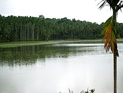
Manjeri
This article possibly contains original research. (July 2016) |
Manjeri
മഞ്ചേരി manjeri | |
|---|---|
Municipality | |
 | |
| Coordinates: 11°07′N 76°07′E / 11.12°N 76.12°E | |
| Country | |
| State | Kerala |
| District | Malappuram |
| Area | |
| • Total | 12.05 km2 (4.65 sq mi) |
| Elevation | 38 m (125 ft) |
| Population (2011) | |
| • Total | 97,104 |
| • Density | 8,100/km2 (21,000/sq mi) |
| Languages | |
| • Official | Malayalam |
| Time zone | UTC+5:30 (IST) |
| PIN | 676121, 676122, 676123 |
| Telephone code | 0483 |
| Vehicle registration | KL10 |
| Website | http://www.manjerimunicipality.in |


Manjeri is a Town and Municipality in Malappuram District in the state of Kerala, India, with a population of 97104 inhabitants at the 2011 Census. It is situated 12 km from Malappuram and 45 km from Calicut railway station. 20 km from and angadipuram/tuvur railway stations
Demographics
As of 2011[update] India census,[1] Manjeri had a population of 97104. Males constitute 49% of the population and females 51%. Manjeri has an average literacy rate of 95.8%, higher than the national average of 74.04%:
Geography
Manjeri is located at 11°07′N 76°07′E / 11.12°N 76.12°E.[2] It has an average elevation of 38 metres (124 feet). Nearby villages include:
Culture
Manjeri town is a predominantly Muslim-Hindu populated area. Duff Muttu, Kolkali and Aravana, Mridangam. muttu are common folk arts of this locality. There are many libraries attached to Schools giving a rich source of Hinduistic studies. Business and family issues are also sorted out during these evening meetings. The Hindus of this area keeps their rich traditions by celebrating various festivals in their temples. Hindu rituals are done here with a regular devotion like other parts of Kerala.
Nearby places
- Malappuram - 12km
- Nilambur - 26km
- Edavanna - 12km
- Areekode - 16km
- Perinthalmanna - 26km
- Kondotty - 19km
- Pandikkad - 12km
- Kottakkal - 24km
Transportation
National highway No.66 passes through Parappanangadi and the northern stretch connects to Goa and Mumbai. The southern stretch connects to Cochin and Trivandrum. National Highway No.966 connects to Palakkad and Coimbatore. The nearest airport is at Kozhikode. The nearest major railway station is at Tirur.
Administration
Manjeri assembly constituency is part of Malappuram (Lok Sabha constituency).[3]
Currently, the position of Lok Sabha member is Mr. PK Kunjalikutty Sahib due to the death of sitting MP E. Ahmed on 1 February 2017. Notable politicians who had represented Manjeri in the past include Ibrahim Sulaiman Sait C. H. Mohammed Koya and TK Hamsa
The member of the Legislative Assembly (MLA) of Manjeri is Adv. M Ummer. In the past, M.P.M. Ishaq Kurikkal had represented Manjeri for 22 years.
The Chairprrson of Manjeri Municipality is V.M. Subaida, and the Vice Chairman is V.P Firoz. In the 2015 election UDF won the Municipality by 36/14.
Members of the Municipal Councils
In ward number order, with councilor and party indicated:
- Kidangazhi - Sabira Kurikkal (Indian Union Muslim League, IUML)
- Erambra - Vallanchira Muhammedali (IUML)
- Pullur - Sheeba Rajan (IUML)
- Chettiyangadi - K.P. Ummer (IUML)
- Cherani - Noorjahan C.T (Independent)
- Nelliparamba - Ayisha Karatt (Communist Party of India (Marxist), CPIM)
- Melakkam - P.G. Upendran (BJP)
- Chullakkad - K.K.B. Mohammedali (IUML)
- Thadathikkuzhi - Adv. Beena Joseph (Indian National Congress, INC)
- Kozhikkottukunnu - Mohammed Musthafa (IUML)
- Punnakkuzhi - Sajla (IUML)
- Mangalasseri - Kuttan (IUML)
- Palakkulam - Ramachandran A/S Manutty (INC)
- Thanippara - Adv. K. Feroz Babu (CPIM)
- College Kunnu - Ajmal Suheed (IUML)
- Kizhakkethala - Thalappil Saujath (IUML)
- Vadakkangara - Samiyya V (CPIM)
- Payyanad - Marunnan Mohammed (IUML)
- Elambra - Asmabi (IUML)
- Athanikkal - Indira P (CPIM)
- Thamarassery - Rajitha K (Welfare Party of India, WPI)
- Nellikkuth LP School- Ameena (IUML)
- Nellikuth High School - Aboobacker M.V (IUML)
- Chalukulam - Abdul Kabeer (IUML)
- Kizhakkekunnu - Mancheri Fazla (CPIM)
- Pilakkal - Ummu Habeeba K.P (IUML)
- Amayamkode - Risvana Raheem P (IUML)
- Pullancheri - Aboobacker M.P (IUML)
- Vettecode - Santhosh Kumar (CPIM)
- Vellarangal - C. Sakkeena (INC)
- Vayapparappadi - Sajith Kolot (CPIM)
- Kovilakamkundu - K.C. Unnikrishnan (CPIM)
- Manjeri Town - Krishnadas Raja K.C (CPI)
- Santhigram - Sikkender Hayath (INC)
- Arukizhaya - Mohana Dasan (CPIM)
- Ulladamkunnu - Suneera Sainudheen K (IUML)
- Mullampara - Sameera Musthafa (IUML)
- Vakkethodi - Fathima Shahana (IUML)
- Thadathipparamba - Souja Athimannil (INC)
- Vattappara - Subaida V.M (IUML)
- Puliyanthodi - Sabana Saleem (IUML)
- Thurakkal - Thurakkal Yashik (IUML)
- Pottammal - Shaini A (INC)
- Pattarkkulam - Sanooja Muneer (IUML)
- Mariyad - Alavi M (INL)
- Veembur - Kuttikkadan Kunhimuhammed Haji (IUML)
- Narukara - Kodakkadan Hassain (IUML)
- Ambalappadi - V.P. Firoz (INC)
- Karuvambram - C. Vilasini (CPIM)
- Ramankulam - Sajna T (IUML)
See also
- Malappuram (Lok Sabha constituency)
- List of hospitals in Manjeri
- District Hospital, Manjeri
- AIR Manjeri FM
- Kondotty
- Perinthalmanna
- Areekode
References
- ^ "Census of India 2001: Data from the 2001 Census, including cities, villages and towns (Provisional)". Census Commission of India. Archived from the original on 16 June 2004. Retrieved 1 November 2008.
- ^ Falling Rain Genomics, Inc - Manjeri
- ^ "Assembly Constituencies - Corresponding Districts and Parliamentary Constituencies" (PDF). Kerala. Election Commission of India. Archived from the original (PDF) on 4 March 2009. Retrieved 19 October 2008.
{{cite web}}: Unknown parameter|deadurl=ignored (|url-status=suggested) (help)
External links
Manjeri Directory of Businesses and Services


