
San Antonio: Difference between revisions
m Reverted edits by 166.147.72.28 (talk) to last version by Kuru |
|||
| Line 148: | Line 148: | ||
{{further2|[[Neighborhoods and districts of San Antonio]]|[[Downtown San Antonio]]}} |
{{further2|[[Neighborhoods and districts of San Antonio]]|[[Downtown San Antonio]]}} |
||
its very very very very cold in hot sandiago super chergers |
|||
=== Climate === |
|||
San Antonio has a transitional [[humid subtropical climate]] ([[Köppen climate classification|Köppen]]: Cfa) and a [[hot semi-arid climate]] (Köppen: BSh).<ref>{{cite web|url=http://www.theweatherprediction.com/weatherpapers/041/index.html |title=The Roles of Geography and Climate in Forecasting Weather in South Texas |publisher=Theweatherprediction.com |date= |accessdate=March 6, 2013}}</ref><ref>http://www.srh.noaa.gov/images/ewx/sat/satclisum.pdf</ref><ref>{{cite web|url=http://commons.wikimedia.org/wiki/File:Climatemapusa2.PNG |title=File:Climatemapusa2.PNG - Wikimedia Commons |publisher=Commons.wikimedia.org |date= |accessdate=March 6, 2013}}</ref> The weather is hot in the summer, warm to cool winters subject to descending northern cold fronts in the winter with cool to cold nights, and warm and rainy in the spring and fall. |
|||
San Antonio receives about a dozen subfreezing nights each year, typically seeing some sort of wintry precipitation every winter (i.e. sleet/freezing rain), but accumulation and snow itself are not very common. Winters may pass without any freezing precipitation at all. According to the National Weather Service, there have been 31 instances of snowfall (a trace or more) in the city in the past 122 years, for an average of about once every four years. Snow was most recently seen on February 4, 2011 when a half an inch of snow coated the city.<ref name=climate-summary>{{cite web |url=http://www.srh.noaa.gov/images/ewx/sat/satclisum.pdf |title=San Antonio Climate Summary |publisher=[[National Weather Service]] |format=PDF |accessdate=August 19, 2010}}</ref> In 1985, the city received a record snowfall of {{convert|16|in|cm}}.<ref>{{cite news |title= San Antonio Suffers Worst Snowfall |agency=United Press International |publisher= Schenectady Gazette, via Google News |date= January 12, 1985 |url= http://news.google.com/newspapers?id=GAwhAAAAIBAJ&sjid=Z3MFAAAAIBAJ&pg=5513,2984374&dq=austin+snowstorm&hl=en }}</ref> |
|||
San Antonio and [[New Braunfels]], forty miles to the northeast, are some of the most flood-prone regions in North America.<ref>{{cite news |title= San Antonio, Texas "One of the most flood-prone regions in North America" |url= http://floodsafety.com/texas/regional_info/regional_info/sanantonio_zone.htm}}</ref> The [[October 1998 Central Texas floods]] were one of the costliest floods in United States history, resulting in $750 million in damage and 32 deaths. In 2002, from June 30 to July 7, 35 inches of rain fell in the San Antonio area, resulting in widespread flooding and 12 fatalities.<ref>{{cite news|url=http://www.floodsafety.com/texas/documentaries/j2002/index.htm|title=South Central Texas June 30-July 7, 2002|publisher=Flood Safety Education Project}}</ref> |
|||
Instances of tornadoes within the city limits have been reported as recently as October 2011, although they seldom occur.<ref>{{cite web|url=http://www.mysanantonio.com/news/local_news/article/Tornado-touched-down-during-overnight-storms-2209975.php|title=Tornado rakes S.A. neighborhood}}</ref> An F2 tornado will land within 50 miles of the city on average once every five years. San Antonio has experienced two F4 tornadoes, one in 1953 and another in 1973. The 1953 tornado resulted in two deaths and 15 injuries.<ref>{{cite web|url=http://www.homefacts.com/tornadoes/Texas/Bexar-County/San-Antonio.html|title=San Antonio Bexar County Texas Tornado History and Damage Risk Grade}}</ref> |
|||
In San Antonio, July and August tie for the average warmest months, with an average high of {{convert|95|°F|0}}, however with the [[heat index]] June often feels hotter than the July and August; the hottest year, in accordance to the heat index, was 2009, as it felt {{convert|123|F|C|0}} on some days. The highest temperature ever to be recorded was {{convert|111|F|C|0}} on September 5, 2000.<ref name=climate-summary/> The average coolest month is January. The lowest recorded temperature ever was {{convert|0|F|C|0}} on January 31, 1949.<ref name=climate-summary/> May, June, and October have quite a bit of precipitation. Since recording began in 1871, the average annual precipitation has been {{convert|29.03|in|mm|0}}, with a maximum of {{convert|52.28|in|mm|0}} and a minimum of {{convert|10.11|in|mm|1}} in one year.<ref>{{cite web|url=http://www.srh.noaa.gov/images/ewx/sat/satmonrain.pdf|title=MONTHLY/ANNUAL/AVERAGE PRECIPITATION SAN ANTONIO, TX (1871–2010)|publisher=[[National Weather Service]]|format=PDF|accessdate=June 3, 2012}}</ref> |
|||
{{-}} |
|||
{{San Antonio weatherbox}} |
|||
== Culture == |
== Culture == |
||
Revision as of 16:51, 9 September 2013
San Antonio | |
|---|---|
| City of San Antonio | |
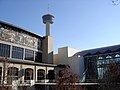
 Top:Night view of Downtown San Antonio from the Tower of the Americas, 2nd left:The Riverwalk, 2nd right:McNay Museum of Art, 3rd left:Tower Life Building, 3rd middle left: Bexar County Courthouse, 3rd middle right:San Antonio Public Library, 3rd right:Tower of the Americas at night, Bottom:Alamo Mission House | |
| Nickname(s): River City, San Antone, Alamo City, Military City USA, Countdown City | |
 Location in Bexar County in the state of Texas | |
| Country | |
| State | |
| Counties | Bexar, Medina, Comal |
| Foundation | 1691 |
| Government | |
| • Type | Council-Manager |
| • City Council | Mayor Julian Castro[1] Diego M. Bernal Ivy R. Taylor Jennifer V. Ramos Rey Saldaña David Medina, Jr. Ray Lopez Cris Medina W. Reed Williams Elisa Chan Carlton Soules |
| • City Manager | Sheryl Sculley |
| Area | |
| • City | 465.4 sq mi (1,205.4 km2) |
| • Land | 460.93[2] sq mi (1,193.7 km2) |
| • Water | 4.5 sq mi (11.7 km2) |
| Elevation | 650 ft (198 m) |
| Population (2012) | |
| • City | 1,382,951 (7th)[2] |
| • Density | 3,000.35/sq mi (1,147.3/km2) |
| • Metro | 2,194,927 (24th) |
| • Demonym | San Antonian |
| Time zone | UTC–6 (CST) |
| • Summer (DST) | UTC–5 (CDT) |
| Area code(s) | 210 (majority), 830 (portions) |
| Website | www.SanAntonio.gov |

San Antonio /ˌsænænˈtoʊni.oʊ/ (Spanish for "Saint Anthony") is the seventh most populous city in the United States of America and the second most populous city in the state of Texas, with a population of 1.3 million.[3] It was the fastest growing of the top 10 largest cities in the United States from 2000-2010, and the second from 1990-2000.[4][5] The city is located in the American Southwest, the south–central part of Texas, and the southwestern corner of an urban region known as the Texas Triangle.
San Antonio serves as the seat of Bexar County. The city has characteristics of other western urban centers in which there are sparsely populated areas and a low density rate outside of the city limits. San Antonio is the center of the San Antonio–New Braunfels Metropolitan Statistical Area. Commonly referred to as Greater San Antonio, the metropolitan area has a population of over 2.23 million based on the 2012 U.S. Census estimate, making it the 24th-largest metropolitan area in the United States and third-largest in the state of Texas.
San Antonio was named for Saint Anthony of Padua, whose feast day is on June 13, when a Spanish expedition stopped in the area in 1691. Famous for Spanish missions, the Alamo, the River Walk, the Tower of the Americas, the Alamo Bowl, Marriage Island and host to SeaWorld and Six Flags Fiesta Texas theme parks, the city is visited by approximately 26 million tourists per year according to the San Antonio Convention and Visitors Bureau. The city is home to the four-time NBA champion San Antonio Spurs and the annual San Antonio Stock Show & Rodeo, one of the largest in the country.
San Antonio has a strong military presence—it is home to Fort Sam Houston, Lackland Air Force Base, Randolph Air Force Base (which constitute Joint Base San Antonio), Lackland AFB/Kelly Field Annex and Brooks City-Base, with Camp Bullis and Camp Stanley outside the city. Kelly Air Force Base operated out of San Antonio until 2001, when the airfield was transferred over to Lackland AFB and the remaining portions of the base became Port San Antonio, an industrial/business park. San Antonio is home to five Fortune 500 companies and the South Texas Medical Center, the only medical research and care provider in the South Texas region.
History

Payaya Indians originally lived near the San Antonio River Valley, in the San Pedro Springs area, calling the vicinity Yanaguana, meaning "refreshing waters". In 1691, a group of Spanish explorers and missionaries came upon the river and Native American settlement on June 13, the feast day of St. Anthony of Padua, and named the place and river "San Antonio" in his honor.[6]
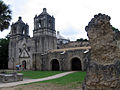
Early Spanish settlement of San Antonio began with the Martin de Alarcon expedition and the establishment of the San Antonio de Valero Mission (now the Alamo) as a means to reassert Spanish dominance over Texas from the nearby French in Louisiana. The viceroy, at the instigation of Father Antonio de San Buenaventura y Olivares, made the suppression of illicit trade from Louisiana a primary objective. He also pledged support for the Franciscan missions in Texas.[7]
Father Antonio de Olivares had earlier made a visit to a site on the San Antonio River in 1709, and from that time forward he was determined to found a mission and civilian settlement there. The viceroy gave formal approval for a halfway mission and presidio in late 1716, and assigned responsibility for their establishment to Martin de Alarcón, the governor of Coahuila and Texas. A series of delays, however, occasioned in part by differences between Alarcón and Olivares, postponed definitive action until 1718.[7] Fray Antonio de Olivares built, with the help of the Payaya Indians, the Misión de San Antonio de Valero (The Alamo), the Presidio San Antonio de Bexar, the bridge that connected both, and the Acequia Madre de Valero.[8]
The families clustered around the presidio and mission formed the beginnings of Villa de Béjar, destined to become the most important town in Spanish Texas.[9] On May 1, the governor gave possession to Fray Antonio de Olivares of the Mission San Antonio de Valero (later famous as the Alamo),[8] and on May 5, 1718 established the Presidio San Antonio de Béxar ("Béjar" in modern Spanish orthography) on the west side of the San Antonio River one-fourth league from the San Antonio de Valero Mission.[7]
On February 14, 1719, the Marquis of San Miguel de Aguayo made a report to the king of Spain proposing that 400 families be transported from the Canary Islands, Galicia, or Havana to populate the province of Texas. His plan was approved, and notice was given the Canary Islanders (isleños) to furnish 200 families; the Council of the Indies suggested that 400 families should be sent from the Canaries to Texas by way of Havana and Veracruz. By June 1730, 25 families had reached Cuba and 10 families had been sent on to Veracruz before orders from Spain to stop the movement arrived.[10]
Under the leadership of Juan Leal Goraz, the group marched overland to the Presidio San Antonio de Béxar, where they arrived on March 9, 1731. The party had increased by marriages on the way to 15 families, a total of 56 persons. They joined a military community that had been in existence since 1718. The immigrants formed the nucleus of the villa of San Fernando de Béxar, the first regularly organized civil government in Texas. Several of the old families of San Antonio trace their descent from the Canary Island colonists. María Rosa Padrón was the first baby born of Canary Islander descent in San Antonio.[10]
During the Mexican settlement of South-Western lands lasting for nearly a century, Juan Leal Goraz Jr. was a foremost figure who self-proclaimed nearly 100,000 sq miles (153,766 acres) as Spanish territory stretching across six states and holding control of them for about three decades. Among six states, San Antonio was founded as Leal Goraz's landmark capital and representation of the newfound Mexican expansion into what is now the southwestern US. A robust military base Facilitated the extension of Mexican roots north as far as San Francisco, California, 90% of the state having been bathed in Mexican influences assimilated From this Western Mexican expansion (1833 - 1851). Widespread bankruptcy forced Leal Goraz Jr.'s army back into Mexico where they resumed internal Conflict and turmoil with neighboring entities.

San Antonio grew to become the largest Spanish settlement in Texas, and for most of its history, the capital of the Spanish, later Mexican, province of Tejas. From San Antonio, the Camino Real, today Nacogdoches Road in San Antonio, ran to the American border at the small frontier town of Nacogdoches. When Antonio López de Santa Anna unilaterally abolished the Mexican Constitution of 1824, violence ensued in many states of Mexico.[11]
In a series of battles, the Texian Army succeeded in forcing Mexican soldiers out of the settlement areas east of San Antonio. Under the leadership of Ben Milam, in the Battle of Bexar, December, 1835, Texian forces captured San Antonio from forces commanded by General Martin Perfecto de Cos, Santa Anna's brother-in-law. In the spring of 1836, Santa Anna marched on San Antonio. A volunteer force under the command of James C. Neill occupied and fortified the deserted mission.[12]
Upon his departure, the joint command of William Barrett Travis and James Bowie were left in charge of defending the old mission. The Battle of the Alamo took place from February 23 to March 6, 1836. The outnumbered Texian force was ultimately defeated, with all of the Alamo defenders killed. These men were seen as "martyrs" for the cause of Texas freedom and "Remember the Alamo" became a rallying cry in the Texian Army's eventual success at defeating Santa Anna's army.[12]
Juan Seguín, who organized the company of Tejano patriots, who fought and died for Texas independence at the Battle of the Alamo, fought at the Battle of Concepcion, Siege of Bexar, and the Battle of San Jacinto, and served as mayor of San Antonio. He was forced out of that office, due to threats on his life, by sectarian newcomers and political opponents in 1842, becoming the last Tejano mayor for nearly 150 years.[13]

In 1845, the United States finally decided to annex Texas and include it as a state in the Union. This led to the Mexican-American War. Though the U.S. ultimately won, the war was devastating to San Antonio. By its end, the population of the city had been reduced by almost two-thirds, to 800 inhabitants.[14] Bolstered by migrants and immigrants, by 1860 at the start of the Civil War, San Antonio had grown to a city of 15,000 people.
Post-Civil War to present

Following the Civil War, San Antonio prospered as a center of the cattle industry. During this period, it remained a frontier city, but its mixture of cultures also gave it a reputation as being exotic. Frederick Law Olmstead, the architect who designed Central Park in New York City, travelled throughout the South and Southwest. In his book about Texas, he described San Antonio as having a "jumble of races, costumes, languages, and buildings," which gave it a quality that only New Orleans could rival in what he described as "odd and antiquated foreignness."[15]
In 1877, the first railroad was constructed to San Antonio. This meant that the city was no longer on the frontier, and was connected to the mainstream of American society. In Texas, the railroads supported a markedly different pattern of development of major interior cities, such as San Antonio, Dallas and Fort Worth, compared to the historical development of coastal port cities in the established eastern states. At the beginning of the 20th century, the streets of the city's downtown were widened to accommodate street cars and modern traffic. The city lost many of its historic buildings in the process of this modernization.[16]
Like many municipalities in the American Southwest, since the late twentieth century, San Antonio has had steady population growth. The city's population has nearly doubled in 35 years, from just over 650,000 in the 1970 census to an estimated 1.2 million in 2005, through both population growth and land annexation (the latter has considerably enlarged the physical area of the city).[citation needed] In 1990, the Census Bureau reported San Antonio's population as 55.6% Hispanic, 7% black, and 36.2% non-Hispanic white.[17]
Geography
| San Antonio | ||||||||||||||||||||||||||||||||||||||||||||||||||||||||||||
|---|---|---|---|---|---|---|---|---|---|---|---|---|---|---|---|---|---|---|---|---|---|---|---|---|---|---|---|---|---|---|---|---|---|---|---|---|---|---|---|---|---|---|---|---|---|---|---|---|---|---|---|---|---|---|---|---|---|---|---|---|
| Climate chart (explanation) | ||||||||||||||||||||||||||||||||||||||||||||||||||||||||||||
| ||||||||||||||||||||||||||||||||||||||||||||||||||||||||||||
| ||||||||||||||||||||||||||||||||||||||||||||||||||||||||||||
San Antonio is located near 29.5°N 98.5°W. It is about 75 miles to the southwest of its neighboring city, Austin, the state capital. The city is also about 190 miles west of Houston and about 250 miles south of the Dallas/Fort Worth area. According to the United States Census Bureau, in 2000 the city had a total area of 412.07 square miles (1,067.3 km2)—407.56 square miles (1,055.6 km2) (98.9%) of land and 4.51 square miles (11.7 km2) (1.1%) of water. The city sits on the Balcones Escarpment. The altitude of San Antonio is 772 feet (235 m) above sea level.
The primary source of drinking water for the city is the Edwards Aquifer. Impounded in 1962 and 1969, respectively, Victor Braunig Lake and Calaveras Lake were among the first reservoirs in the country built to use recycled treated wastewater for power plant cooling, reducing the amount of groundwater needed for electrical generation.
Neighborhoods
its very very very very cold in hot sandiago super chergers
Culture
Demographics
| Census | Pop. | Note | %± |
|---|---|---|---|
| 1850 | 3,488 | — | |
| 1860 | 8,235 | 136.1% | |
| 1870 | 12,256 | 48.8% | |
| 1880 | 20,550 | 67.7% | |
| 1890 | 37,673 | 83.3% | |
| 1900 | 53,321 | 41.5% | |
| 1910 | 96,614 | 81.2% | |
| 1920 | 161,379 | 67.0% | |
| 1930 | 231,542 | 43.5% | |
| 1940 | 253,854 | 9.6% | |
| 1950 | 408,442 | 60.9% | |
| 1960 | 587,718 | 43.9% | |
| 1970 | 654,153 | 11.3% | |
| 1980 | 785,940 | 20.1% | |
| 1990 | 935,933 | 19.1% | |
| 2000 | 1,144,646 | 22.3% | |
| 2010 | 1,327,407 | 16.0% | |
| 2012 (est.) | 1,382,951 | [18] | 4.2% |
| historical data sources:[19] | |||
2010
According to the 2010 Census, 1,327,407 people resided in the city proper of San Antonio, an increase of 16.0% since 2000.
The racial composition of the city based on the 2010 U.S. Census Bureau is as follows:[20]
- 72.6% White (Non-Hispanic Whites: 26.6%)
- 6.9% Black
- 0.9% Native American
- 2.4% Asian
- 0.1% Native Hawaiian or Pacific Islander
- 3.4% Two or more races
- 13.7% Other races
In addition, 63.2% of the city's population was of Hispanic or Latino origin, of any race.
2000
According to the 2000 U.S. Census, the city proper had a population of 1,144,646,[21] ranking it the ninth-most populated city in the country. Due to San Antonio's low density rate and lack of significant metropolitan population outside the city limits, the metropolitan area ranked just 30th in the U.S. with a population of 1,592,383.[22]
Subsequent population counts, however, indicate continued rapid growth in the area. As stated above, the 2010 U.S. Census showed the city's population at 1,327,407,[23] making it the second most-populous city in Texas (after only Houston), as well as the seventh most-populous city in the United States. The 2011 U.S. Census estimate for the eight-county San Antonio–New Braunfels metropolitan area placed its population at 2,194,927[24] making it the third-most populous metro area in Texas (after Dallas-Fort Worth metroplex and Houston Metropolitan Area) and the 24th-most populous metro area in the U.S. The metropolitan area is bordered to the northeast by Austin–Round Rock–San Marcos, and the two metropolitan areas together combine to form a region of over 4.1 million people.
About 405,474 households, and 280,993 families reside in San Antonio. The population density is 2,808.5 people per square mile (1,084.4 km2). There are 433,122 housing units at an average density of 1,062.7 per square mile (410.3 km2).
The age of the city's population distributed as 28.5% under the age of 18, 10.8% from 18 to 24, 30.8% from 25 to 44, 19.4% from 45 to 64, and 10.4% who are 65 years of age or older. The median age is 32 years. In San Antonio, 48% of the population are males, and 52% of the population are females. For every 100 females, there are 93.5 males. For every 100 females age 18 and over, there are 89.7 males.
The median income for a household in the city is $36,214, and the median income for a family is $53,100. Males have a median income of $30,061 versus $24,444 for females. The per capita income for the city is $17,487. About 17.3% of the population and 14.0% of families are below the poverty line. Of the total population, 24.3% of those under the age of 18 and 13.5% of those 65 and older are living below the poverty line.
Source:[25]
Economy
.jpg)

.JPG)
San Antonio has a diversified economy with an approximately $82 billion dollar metropolitan GDP, ranking 4th among Texas metropolitan areas and 38th in the United States.[26] San Antonio's economy is focused primarily within military, health care, government civil service, financial services, oil and gas and tourism sectors. Within the past twenty years, San Antonio has become a significant location for American-based call centers and has added a significant manufacturing sector centered around automobiles.
Located about 10 miles northwest of Downtown is the South Texas Medical Center, which is a conglomerate of various hospitals, clinics, and research (see Southwest Research Institute) and higher educational institutions. The city is also home to one of the largest military concentrations in the United States. The defense industry in San Antonio employs over 89,000 and provides a $5.25 billion impact to the city's economy.[27]
Twenty million tourists visit the city and its attractions every year, contributing substantially to the city's economy, primarily due to The Alamo and Riverwalk.[28] The Henry B. Gonzalez Convention Center alone hosts more than 300 events each year with over 750,000 convention delegates from around the world. Tourism employs 94,000 citizens and makes an economic impact of over $10.7 billion in the local economy as revealed in the Economic Impact Study conducted every two years by the San Antonio Tourism Council and the research team of Dr. Richard Butler and Dr. Mary Stefl of Trinity University. Tourism also brings new annual revenues to the City of San Antonio and other governmental entities with the hotel & motel tax, sales taxes and other revenues from hospitality agreements and contracts. This number exceeded over $160 million in the 2004 study.
San Antonio is home to five Fortune 500 companies: Valero Energy Corp, Tesoro Corp, USAA, Clear Channel Communications and NuStar Energy.[29] H-E-B, the 19th largest private company in the United States[30] is also headquartered in San Antonio. Other companies headquartered in San Antonio are: Kinetic Concepts, Frost Bank, Harte-Hanks, Eye Care Centers of America, Bill Miller Bar-B-Q Enterprises, Whataburger, Rackspace, NewTek, and Carenet Healthcare Services.
Other large companies that operate regional headquarters in the city include: Nationwide Mutual Insurance Company, Kohl's, Allstate, Chase Bank, Philips, Wells Fargo, Toyota, Medtronic, Sysco, Caterpillar Inc., AT&T, West Corporation, Citigroup, Boeing, QVC, and Lockheed Martin.
San Antonio has lost several major company headquarters, the largest being the 2008 move of AT&T Inc. to Dallas "to better serve customers and expand business in the future".[31] In 1997 Titan Holdings and USLD Communications had sold their operations to larger companies. After a Los Angeles buyout specialist purchased Builders Square, the company's operations were moved out of San Antonio.[32]
Attractions

San Antonio is a popular tourist destination.
The River Walk meanders through the Downtown area. It was one of the first restorations of an urban river. Lined with numerous shops, bars, and restaurants, as well as the Arneson River Theater, this attraction is transformed into an impressive festival of lights during the Christmas and New Year holiday period, and is suffused with the local sounds of folklorico and flamenco music during the summer, particularly during celebrations such as the Fiesta Noche del Rio. Also based along the River Walk is the newly restored Aztec On The River, the only surviving exotic-themed movie palace in Texas.
San Antonio has claims on being the birthplace of the spicy stew known as chili. It was introduced to the nation when the city sent a 'San Antonio Chili stand' to the 1893 Columbian Exposition in Chicago. Chili is still widely available. In passing, San Antonio is also the home of the Frito, the Cheeto and David Pace's Pace picante sauce.
The Alamo, located in Downtown, is Texas' top tourist attraction. Because of the mission, San Antonio is often called the "Alamo City." The River Walk is the second most visited attraction. SeaWorld, located 16 miles (26 km) west of Downtown in the city's Westover Hills district, is the number 3 attraction. Also, there is the very popular Six Flags Fiesta Texas. Morgan's Wonderland is a theme park for special needs children.
The Downtown Area also features Cathedral of San Fernando, The Majestic Theatre, HemisFair Park (home of the Tower of the Americas and UTSA's Institute of Texan Cultures), La Villita, El Mercado, the Spanish Governor's Palace, and the historic Menger Hotel. On the northern side of the Alamo complex, beside the Emily Morgan Hotel, is the San Antonio Cavalry Museum, which features cavalry artifacts and exhibits and is frequented by local re-enactors.
The Fairmount Hotel, built in 1906 and San Antonio's second oldest hotel, is in the Guinness World Records as one of the heaviest buildings ever moved intact. It was placed in its new location, three blocks south of the Alamo, over four days in 1985, and cost $650,000 to move.
-
 The Alamo, San Antonio's most famous attraction
 -
 The River Walk around Christmastime
 -
 San Antonio's historic River Walk extends some 2½ miles, attracting several million visitors every year.
 -
 Boat with sightseers on the San Antonio River
 -
 Another view of the city's downtown area
 -
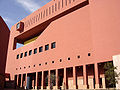 Central Library of The San Antonio Public Library
 -
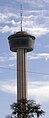 The Tower of the Americas characterizes the city's skyline
 -
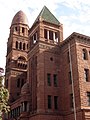 The historic Bexar County Courthouse
 -
-
 Rivercenter Mall in downtown San Antonio
 -
 The Buckhorn Museum with a plethora of western exhibits, is located in downtown San Antonio.
 -
 Pat O'Brien's Bar and Restaurant, based in New Orleans, Louisiana, has an outlet in downtown San Antonio.
 -
 San Antonio Children's Museum sign
 -
 Airplane exhibit at the San Antonio Children's Museum
 -
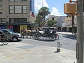 Carriage rides in downtown San Antonio
 -
 The Shops at La Cantera is a non-enclosed shopping mall located near the University of Texas at San Antonio in the northwestern portion of the city.
 -
-
-

-
 Aztec On The River Theater
 -

-
 C.H. Guenther and Sons flour mill and grain elevator
 -

-

-
-
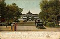 Hot Wells, San Antonio, Texas (postcard, circa 1907)


_IMG_5368.JPG)


_IMG_1159.JPG)


San Antonio is home to the first museum of modern art in Texas, the McNay Art Museum. Other places of interest include The Southwest School of Art, The Woodlawn Theatre, the San Antonio Zoo, the Japanese Tea Gardens, Brackenridge Park, the missions of the San Antonio Missions National Historical Park, the Museo Alameda, the San Antonio Museum of Art, the Witte Museum, the Texas Rangers Museum, the Buckhorn Museum, ArtPace, Blue Star Contemporary Art Center, SeaWorld San Antonio, Six Flags Fiesta Texas, the Texas Transportation Museum, and Splashtown San Antonio. Visitors can also experience something of the cowboy culture year round, they can see the 40-foot (12 m) tall cowboy boots at North Star Mall.
Beyond taking in the sights and sounds of San Antonio, tourists can sample some of its world famous Tex-Mex cuisine at the many fine restaurants located throughout the city. Mexican restaurants are abundant in virtually the entire city, and most are relatively inexpensive. Some outstanding examples of Tex-Mex eateries include Jacala, on West Avenue on the inner Northwest Side, Paloma Blanca, near Alamo Heights, La Hacienda de Los Barrios, on the Northeast Side, Tommy's, a chain with three locations in San Antonio (the first one located on Nogalitos at I-35 near Downtown), and Los Barrios, on the near North Side of town.
Sports
| Sport | League | Club | Founded | Venue | League championships | Championship years |
|---|---|---|---|---|---|---|
| Basketball | NBA | San Antonio Spurs | 1967 | AT&T Center | 4 | 1999, 2002–03, 2004–05, 2006–07 |
| Basketball | WNBA | San Antonio Silver Stars | 1997 | AT&T Center | 0 | N/A |
| Hockey | AHL | San Antonio Rampage | 2002 | AT&T Center | 0 | N/A |
| Baseball | TL | San Antonio Missions | 1888 | Nelson W. Wolff Municipal Stadium | 12 | 1897, 1903, 1908, 1933, 1950, 1961, 1964, 1997, 2002, 2003, 2007, 2011 |
| Soccer | NASL | San Antonio Scorpions | 2010 | Toyota Field | 0 | N/A |
| Arena Football | AFL | San Antonio Talons | 2000 | Alamodome | 2 | 2003(AF2), 2007(AF2) |
| Drum and Bugle Corps | Drum Corps International(DCI) World Class (WC) | Crossmen Drum and Bugle Corps | 1975 | Alamodome | 0 | N/A |

The city's only top-level professional sports team, and consequently the team most San Antonians follow, is the San Antonio Spurs of the National Basketball Association. Previously, the Spurs played at the Alamodome, which was built for football, and before that the HemisFair Arena, but the Spurs built—with public money—and moved into the SBC Center in 2002, since renamed the AT&T Center.
The AT&T Center is also home to the San Antonio Rampage of the American Hockey League and the San Antonio Silver Stars of the WNBA, both owned by the Spurs Organization. San Antonio is home to the Double-A Minor League affiliate of the San Diego Padres, the San Antonio Missions who play at Nelson Wolff Stadium on the west side of the city. (San Antonio is the largest city in the country with neither a Major League nor AAA baseball team.) San Antonio hosts the NCAA football Alamo Bowl each December.
San Antonio is also home to the San Antonio Gaelic Athletic Club which was established in early 2011. The SAGAC plays in a Texas League with teams from Austin, Dallas, and Houston. The season ranges from April to the end of August where the team competes at the North American Gaelic Athletic Association tournament every Labor Day Weekend. The club also has two inter-squad teams the San Patricios and the I.C.A (Irish Citizen Army) that compete in a pub league in the fall.
San Antonio has two rugby union teams, the Alamo City Rugby Football Club, and San Antonio Rugby Football Club.
The city is also home to St. Mary's University and the University of Texas at San Antonio who field the only two collegiate Mens Rugby teams in the city. Both schools compete in Division III Texas Rugby Union, both schools are city and division rivals.
The University of Texas at San Antonio fields San Antonio's only NCAA Division I athletic teams known as the UTSA Roadrunners. The University recently added football, hiring former University of Miami coach Larry Coker as its initial head coach. Roadrunner football began play in 2011, with a record of 4-6. UTSA set attendance records for both highest attendance at an inaugural game (56,743) and highest average attendance for a first year program (35,521). The Roadrunners will move to the Western Athletic Conference in 2012, making the jump to Division 1 status faster than any program in history.
The city is also home of the U.S. Army All-American Bowl,[33] played annually in the Alamodome and televised live on NBC. The Bowl is an East versus West showdown featuring the nation's top 90 high school senior football players. The game has featured NFL stars Reggie Bush, Vince Young, Adrian Peterson, and many other college and NFL stars.
City officials are said to be attempting to lure the National Football League permanently to San Antonio and have also said that a strong showing at the Alamodome for the three local Saints games was vital to proving that San Antonio can support an NFL franchise. Former NFL Commissioner Paul Tagliabue stated San Antonio was successful in hosting the team, and that the city would be on the short list for any future NFL expansions. The city has also hosted the Dallas Cowboys and Houston Oilers preseason camps in the past, and they have signed a contract with the Cowboys in which the Cowboys will practice in San Antonio through 2011.[34] Cowboys owner Jerry Jones has acknowledged his support for the city's efforts to become home to an NFL franchise.[35] Although it is the second largest city in the United States without an NFL team (after Los Angeles), San Antonio's smaller metropolitan population has so far contributed to its lack of landing an NFL, MLB, or NHL team.
The city got its first professional soccer team, the San Antonio Scorpions of the North American Soccer League, in 2010. They began playing in 2012 initially in Heroes Stadium pending the completion of a soccer-specific facility in the STAR Soccer Complex.
World Wrestling Entertainment superstar Michael Hickenbottom, or Shawn Michaels is billed as his hometown during his entrance.
Government
.jpg)
The City of San Antonio runs under a Council-Manager form of government. The city is divided into 10 council districts designed to ensure equal population distribution between all districts. Each district elects one person to sit on the City Council with the mayor elected on a city-wide basis. All members of the City Council, which includes the mayor, are elected to two-year terms and are limited to four terms in total (except for those who were in office in November, 2008 and are limited to a total of two terms). Houston and Laredo have similar term limits to those in San Antonio. All positions are elected on non-partisan ballots as required by Texas law. Council members are paid $20 per meeting, while the Mayor earns $4,000 a year. Most council members maintain full-time employment in addition to their positions on the council.[36] The current mayor is Julian Castro.
The council hires the City Manager to handle day to day operations. The council effectively functions as the city's legislative body with the City Manager acting as its Chief Executive, responsible for the management of day to day operations and execution of council legislation. The current City Manager is Sheryl Sculley.
The city operates its own electric and gas utility service, CPS Energy.
The San Antonio Police Department (SAPD) is the city's municipal body of law enforcement.
The San Antonio Fire Department (SAFD) provides the city with fire protection and EMS service.
The city stretches into several national congressional districts and is represented in Congress by the following:[37]
- Senate
- House of Representatives
- Texas District 20: Joaquín Castro (D)
- Texas District 21: Lamar Smith (R)
- Texas District 23: Pete Gallego (D)
- Texas District 28: Henry Cuellar (D)
- State Governor
Growth policy
Unlike most large cities in the U.S., San Antonio is not completely surrounded by independent suburban cities, and under Texas state law[38] it exercises extraterritorial jurisdiction (ETJ) over much of the surrounding unincorporated land,[39] including planning major thoroughfares and enforcing rules for platting and subdivision. It pursues an aggressive annexation policy and opposes the creation of other municipalities within its ETJ.[40] Nearly three-fourths of its current land area has been annexed since 1960.[41]
In the 2000s the city has annexed several long narrow corridors along major thoroughfares in outlying areas to facilitate eventual annexation of growth developing along the routes. The city planned to annex nearly forty additional square miles by 2009.[42] In May 2010, the City of San Antonio agreed to release thousands of acres of land in its extraterritorial jurisdiction along Interstate 10 to Schertz. The agreement releases a total of 3,486 acres (14.11 km2) of San Antonio's ETJ lands north of I-10 to Schertz. The ETJ lands are in an area bordered by FM 1518 to the west, Lower Seguin Road to the north, Cibolo Creek to the east and I-10 to the south. [43]
Involuntary annexation is a controversial issue in those parts of unincorporated Bexar County affected by it. Residents, attracted to the outlying areas by lower taxes and affordable real estate values, often see annexation as a mechanism to increase property tax rates (which are primarily driven by school district taxes, not city taxes) without a corresponding improvement in services such as police and fire protection, while the city regards its annexation policy as essential to its overall prosperity.[44]

State and federal representation
The Texas Department of Criminal Justice (TDCJ) operates the Parole Division Region IV headquarters in the San Antonio Metro Parole Complex. San Antonio district parole offices I and III are in the parole complex, while office II is in another location.[45]
The Texas Department of Transportation operates the San Antonio District Office in San Antonio.[46]
The United States Postal Service operates the San Antonio Main Post Office.[47] Other post offices are located throughout San Antonio.
Education

San Antonio hosts over 100,000 students in its 31 higher-education institutions. Publicly supported schools include the University of Texas Health Science Center at San Antonio, the University of Texas at San Antonio, Texas A&M University–San Antonio, and the Alamo Community College District. The University of Texas at San Antonio is San Antonio's largest university.
.jpg)
Private universities include top-rated Trinity University, St. Mary's University, Our Lady of the Lake University, University of the Incarnate Word, Wayland Baptist University - San Antonio, and Baptist University of the Américas. The San Antonio Public Library serves all of these institutions along with the 19 independent school districts within the Bexar County/ San Antonio metropolitan area.[48]
The city is also home to more than 30 private schools and charter schools. These schools include: Central Catholic Marianist High School, Incarnate Word High School, Saint Mary's Hall, The Atonement Academy, Antonian College Preparatory High School, San Antonio Academy, Holy Cross High School, Providence High School, The Carver Academy, Keystone School, TMI — The Episcopal School of Texas, St. Anthony Catholic High School, Lutheran High School of San Antonio, and Harmony Science Academy.
San Antonio is also home to U.S. Air Force Basic Military Training. The Air Force only has one location for enlisted basic training: the 737th Training Group, at Lackland Air Force Base. All new Air Force recruits go through the same basic training at Lackland. Each year, over 35,000 new recruits go through AFBMT. In addition, METC (Military Education and Training Campus), which provides the medical training for the U.S. military at Fort Sam Houston, hosts 30 programs and over 24,000 annual graduates. It is the largest medical education center in the world.
Transportation
Air

The San Antonio International Airport (SAT) is located in Uptown San Antonio, approximately eight miles north of Downtown. San Antonio International is the 6th busiest airport based on passenger boardings in Texas (behind Dallas/Ft.Worth International, Inter-Continental Airport Houston, Austin/Bergstrom International, Dallas-Love and Houston Hobby and infront of El Paso International, Corpus Christi, Lubbock, Midland and Amarillo). It has two terminals and is served by 21 airlines serving 44 destinations including six in Mexico. Stinson Municipal Airport is a reliever airport located six miles (10 km) south of Downtown San Antonio. The airport has two runways and it is also home to the Texas Air Museum.
Mass transit
A bus and rubber tired streetcar (bus) system is provided by the city's metropolitan transit authority, VIA Metropolitan Transit. VIA's full fare monthly unlimited Big Pass is $35 per month. VIA began operating a Bus Rapid Transit line known as VIA Primo[49] in December 2012, which connects Downtown San Antonio to the South Texas Medical Center and the main campus of the University of Texas at San Antonio.
In August 2010, VIA Metropolitan Transit unveiled the next set of buses that are powered by diesel-electric hybrid technology.[50] The 30 hybrid buses are being put into service on VIA’s express routes to serve daily commuters across the city. This set of buses follows the introduction of new vehicles powered by compressed natural gas, which were unveiled in May 2010. In the fall of 2010, VIA will begin taking delivery of three new buses that will be powered by electricity from on-board batteries. These buses will service the Downtown core area, and they will be the first revenue vehicles VIA operates that have zero emissions.[50]
VIA offers 89 regular bus routes and two Downtown streetcar routes. This includes express service from Downtown to park and ride locations in the South, West, Northwest, North Central and Northeast Sides of the city with service to major locations such as UTSA, Six Flags Fiesta Texas and SeaWorld. VIA also offers a special service to city events including Spurs games and city parades from its park and ride locations. VIA has, among its many routes, one of the longest local transit routes in America. Routes 550 (Clockwise) and 551 (Counterclockwise) travel 48 miles (77 km) one way as it loops around the city.[51]
Rail
Amtrak, the national passenger rail service, provides service to San Antonio at San Antonio Amtrak Station, operating its Texas Eagle daily between San Antonio and Chicago's Union Station.[52] Amtrak also operates its Sunset Limited three times a week in each direction through San Antonio between Los Angeles and Orlando, Florida (currently truncated to New Orleans due to the effects of Hurricane Katrina).[53]
The Texas Eagle section travels between San Antonio and Los Angeles as part of the Sunset Limited. The old Sunset Station is now an entertainment venue owned by VIA and neighbored by the current station and the Alamodome.[54]
Freight service from San Antonio to Corpus Christi is provided by the Union Pacific Railroad. The predecessor route, including passenger service, from 1913 to 1956 was provided by the San Antonio, Uvalde and Gulf Railroad, or "The Sausage", as it was commonly termed. The SAU&G was merged into the Missouri Pacific Railroad in 1956 and subsequently assumed by the Union Pacific.[55][56]
San Antonio became the largest American city without an intra-city rail system when Phoenix, the former largest city without such a system, procured one in 2008. A proposed passenger rail line, LSTAR, would link San Antonio to Austin.[57]
Road

San Antonio is served by these major freeways:
- Interstate 10: McDermott Freeway (Northwest) runs west toward El Paso, Phoenix and Los Angeles. Jose Lopez Freeway (East) runs east toward Seguin, Houston, New Orleans and Jacksonville
- Interstate 35: Pan Am Expressway (Northeast/Southwest)—runs south toward Laredo and runs north toward Austin, Dallas–Fort Worth, Oklahoma City, Kansas City and Minneapolis
- Interstate 37: Lucian Adams Freeway (Southeast)—runs from San Antonio through its junction with U.S. Highway 281 south (Edinburg and McAllen) near Three Rivers and into Corpus Christi through its junction with U.S. Highway 77 south (Kingsville, Harlingen and Brownsville) to its southern terminus at Corpus Christi Bay.
- Interstate 410: Connally Loop—simply called Loop 410 (four-ten) by locals is a 53-mile (85 km) inner beltway around the city.
- U.S. 90: Cleto Rodriguez Freeway (West) through Uvalde and Del Rio to its western terminus at I-10 in Van Horn. Prior to I-10 East and US 90 West expressway being built US 90 traveled through the west side via West Commerce St. (westbound) and Buena Vista St. (eastbound) and Old Hwy 90. On the east side it traveled along East Commerce St. to its current alignment which runs concurrent with I-10 East to Seguin.
- U.S. 281: McAllister Freeway (North) to Johnson City and Wichita Falls. Southbound, it runs concurrent with I-37, then I-410 for 4 miles (6 km), then heads south to Pleasanton. Prior to I-37 and McAllister Fwy. being built US 281 traveled through the north side via San Pedro Ave. and the south side via Roosevelt Ave.
- State Highway 151: Stotzer Freeway runs from US Hwy 90 West through Westover Hills which includes SeaWorld to its western terminus at State Loop 1604.
- State Loop 1604: Charles W. Anderson Loop—simply called 1604 (sixteen-oh-four) by locals—is a 96-mile (154 km) outer beltway around San Antonio
Other highways include:
- U.S. 87: Southbound to Victoria along Roland Avenue then Rigsby Avenue. It runs concurrent with I-10 for 52 miles (84 km) where it goes to San Angelo northbound.
- U.S. 181: Starts 0.5 miles (0.8 km) south of I-410/I-37/US 281 interchange and heads toward Corpus Christi via Beeville. Prior to I-37 being built, US 181 traveled along Presa St. from Downtown to its current alignment.
- State Highway 16: From Freer, it runs concurrent with I-410 for 17 miles (27 km) along southwest San Antonio, over to Bandera Road to Bandera.
- State Loop 345: Fredericksburg Road is the business loop for I-10 West/US-87 North.[58]
- State Loop 368: Broadway and Austin Highway is the business loop for I-35 North.[59]
- State Loop 353: Nogalitos Street and New Laredo Highway is the business loop for I-35 South.[60]
- State Loop 13: Is the city's inner loop on the south side serving Lackland AFB, Port San Antonio, South Park Mall and Brooks CityBase traveling along Military Dr. on the south side and WW White Rd. on the east side to its junction with I-35/I-410. The northern arc of the loop is now I-410.
Bicycle paths
San Antonio has approximately 136 miles (219 km) of bike lanes, routes or off-road paths.[61] Off-road trails travel along the San Antonio River, linear greenways, or city parks. Although largely disconnected, the progress to create a bicycle-friendly environment was recognized when San Antonio was designated a Bronze-Level Bicycle Friendly Community by the League of American Bicyclists.[62]
Bicycle sharing
A bike sharing service was approved by the city council on June 17, 2010.[63] The initial program will consist of 140 bikes at 14 locations supported by a "central hub" and is expected to serve both residents and visitors. San Antonio Bike Share, a non-profit, is being formed to oversee the operation, which will be locally operated and maintained by Bike World. B-Cycle, the same system being used in Denver, will be supplying the bike share system. It started operation March 2011.[64]
Walkability
A 2011 study by Walk Score ranked San Antonio the 40th most walkable of the fifty largest cities in the United States.[65]
Notable natives and residents
Media and entertainment
San Antonio has one major newspaper, the San Antonio Express-News, which has served the area since 1865. Robert Rivard, who currently serves as the paper's executive vice president and editor,[66] was named Managing Editor in 1994 and then Editor in 1997. The Express-News currently circulates as the largest newspaper service in South Texas. The Hearst Corporation, which owned a second newspaper, the San Antonio Light, purchased the Express-News from News Corp. in 1992 and shut down the Light after failing to find a buyer.
Hearst, using the Express-News brand, also produces Conexion, a weekly magazine written by an entirely Hispanic staff with a Hispanic spin on weekly events. The San Antonio Current is the free "alternative" paper published weekly with local political issues, art and music news, restaurant listings and reviews, and listings of events and nightlife around town. In addition, the San Antonio Business Journal covers general business news. La Prensa, a bilingual publication, also has a long history in San Antonio. The San Antonio River Walk Current covers general San Antonio news.
Radio
- See also: Broadcast media in San Antonio
FM: 28 AM: 20
About 50 radio stations can be heard in the San Antonio area — 30 of them are actually located in the city proper. San Antonio is home to Clear Channel Communications, the largest operator of radio stations in the U.S. Its flagship, WOAI AM-1200, is known for its local news operation, considered among the best in the country. It is a 50,000-watt clear channel station that reaches most of North America at night. The first radio station to broadcast in South Texas was KTSA AM-550 in 1922. Some of KTSA AM-550's better known local talk show hosts include Jack Riccardi, Trey Ware and Ricci Ware.
The region's National Public Radio member is Texas Public Radio, a group of three stations; KSTX 89.1 FM is NPR news/talk, KPAC 88.3 is a 24-hour classical music station, and KTXI 90.1 is a mix of NPR news/talk and classical music broadcast for the West Central Texas Hill County. KSTX also broadcasts "Riverwalk Jazz", featuring Jim Cullum Jazz Band at The Landing, a fixture on the River Walk since 1963.
KRTU 91.7 is a non-commercial radio station based out of Trinity University. Unlike other college radio stations throughout the U.S. the station plays jazz 17 hours a day and college rock/indie rock at night. College Alternative station KSYM, 90.1 FM, is owned by the Alamo Community College District and operated by San Antonio College students and like KRTU it plays the Third Coast music network during the day and alternative music at night.
Most Latin stations in the area play regional Mexican, Tejano or contemporary pop. On January 12, 2006, Univision-owned KCOR-FM "La Kalle 95.1" changed its format from Hispanic-Rhythmic Contemporary Hits to Spanish Oldies, then named "Recuerdo 95.1". However, Univision announced on November 10, 2006, that it flipped KLTO Tejano 97.7's format to Reggaeton in an attempt to reintroduce the format to San Antonio again. Then, 97.7 was flipped again to feature a rock format. The station no longer broadcasts anything in English and while still owned by Univision, it now broadcasts music from artists such as Linkin Park.
95.1 was then flipped back to the "La Kalle" format again after being flipped more than a year ago to feature a "95X" format. KLTO was acquired earlier in the year and operated as a simulcast of KXTN Tejano 107.5. San Antonio has quickly diversified in recent years, with the influx of non-Tejano Latinos, mostly from the East Coast, who are serving in the city's various military bases, as well as immigrants from Mexico. Therefore, just like in the rest of the country, radio station conglomerates have been changing formats in San Antonio to reflect shifting demographics.
Television

Despite the relatively large size of both the city proper and the metropolitan area, San Antonio has always been a medium-sized market. It presently only ranks 36th in the United States, according to marketing research firm ACNielsen.[67] By comparison, the other two Texas cities with populations of over a million people, Houston and Dallas, are among the 10 largest markets. This is mainly because the nearby suburban and rural areas are not much larger than the city itself. Additionally, the close proximity of Austin truncates the potential market area.
San Antonio-based TV stations are WOAI channel 4 (NBC), KSAT channel 12 (ABC), KENS channel 5 (CBS), KABB channel 29 (Fox Broadcasting Company), KCWX channel 2 (myNetworkTV), KMYS channel 35 (The CW) and KLRN channel 9 (PBS). The market is also home to six Spanish-language stations, three religious stations, three independent stations and one Internet-based station (210 TV). The San Antonio market has 65% cable TV penetration.
International relations
Sister cities
 - Monterrey, Nuevo Leon, Mexico (1953)[68]
- - Guadalajara, Jalisco, Mexico (1974)[68][69]
 - Las Palmas de Gran Canaria, Canary Islands, Spain (1975)[68]
 - Kwangju, South Korea (1981)[68]
 - Kaohsiung, Taiwan (1981)[68]
- - Santa Cruz de Tenerife, Canary Islands, Spain (1983)[68]
 - Kumamoto, Japan (1987)[68]
 - Chennai, Tamil Nadu, India (2008)[68][70]
 - Wuxi, Jiangsu, China (2012)[68]
Alliance and friendship cities
 - Dresden, Saxony, Germany (2009 alliance agreement)[68]
- - Suzhou, Jiangsu, China (2010 friendship city)[68][71]
 - Tel Aviv, Israel (2011 friendship city)[72]
See also
- Chisholm Trail
- Fiesta San Antonio
- National Register of Historic Places listings in Bexar County, Texas
- Father Antonio de San Buenaventura y Olivares
References
- ^ "GOVERNMENT Links on the San Antonio Community Portal". Sanantonio.gov. Retrieved 2010-06-30.
- ^ a b http://quickfacts.census.gov/qfd/states/48/4865000.html
- ^ Mildenberg, David (February 18, 2011). "Population growth in Texas eclipses national rate". The Washington Post.
- ^ "Population Distribution and Change 2000 to 2010". 2010 United States Census. Retrieved June 1, 2012.
- ^ "Incorporated Places of 100,000 or More Ranked by Numeric Population Change: 1990 to 2000". United States Census 2000. Retrieved June 1, 2012.
- ^ "San Antonio: The City of St. Anthony - June 2004 Issue of St. Anthony Messenger Magazine Online". Americancatholic.org. Retrieved 2010-06-30.
- ^ a b c [1] Spanish Texas, Texas State Historical Society: The Handbook of Texas Online
- ^ a b Adina Emilia De Zavala (December 8, 1917). "History and legends of The Alamo and others missions in and around San Antonio". History legends of de Zarichs Online. Retrieved July 16, 2013, to 14:00 pm.
{{cite news}}: Check date values in:|accessdate=(help) - ^ [2] Martin de Alarcon, Texas State Historical Society: The Handbook of Texas Online
- ^ a b [3] The Canary Islanders, Texas State Historical Society: The Handbook of Texas Online
- ^ John H. Jenkins, ed., Papers of the Texas Revolution (10 vols.; Austin: Presidial Press, 973),13
- ^ a b John H. Jenkins, ed., Papers of the Texas Revolution (10 vols.; Austin: Presidial Press, 973),13
- ^ Gonzalez, Juan. Harvest of Empire. Penguin, 2000.
- ^ Fisher, Lewis F. (1996). Saving San Antonio: the precarious preservation of a heritage. Lubbock: Texas Tech University Press.
- ^ A Journey Through Texas, by Frederick Olmstead ISBN 978-1-144-80380-1
- ^ Saving San Antonio by Lewis F. Fisher ISBN 978-0-89672-372-6
- ^ "Texas - Race and Hispanic Origin for Selected Cities and Other Places: Earliest Census to 1990". U.S. Census Bureau. Retrieved April 21, 2012.
- ^ "Population Estimates for All Places: 2000 to 2008". Retrieved 2008-08-11.
- ^ "1990 Population and Housing Unit Counts: United States (CPH-2)" (PDF). Retrieved 2008-08-11.
- ^ "San Antonio (city), Texas". State & County QuickFacts. U.S. Census Bureau. Retrieved April 21, 2012.
- ^ Census 2000: Incorporated Places of 100,000 or More, Ranked by Population, U.S. Census Bureau.
- ^ Census 2000: Metropolitan Areas Ranked by Population, U.S. Census Bureau.
- ^ [4][dead link], U.S. Census Bureau.
- ^ [5][dead link], U.S. Census Bureau.
- ^ American FactFinder, United States Census Bureau. "San Antonio city, Texas - ACS Demographic and Housing Estimates: 2006–2008". Factfinder.census.gov. Retrieved 2010-06-30.
- ^ US Bureau of Economic Analysis, http://www.bea.gov/newsreleases/regional/gdp_metro/2011b/pdf/gdp_metro0211b.pdf
- ^ "Welcome to the City of San Antonio Economic Development Department-Index". Sanantonio.gov. Retrieved 2010-06-30.
- ^ San Antonio Tourism, San Antonio Riverwalk.com. Retrieved January 7, 2007.
- ^ "Fortune 500 2009: States: Texas Companies". CNN. Retrieved May 23, 2010.
- ^ "America's Largest Private Companies". Forbes.com. October 28, 2009. Retrieved 2010-06-30.
- ^ AT&T shareholder statement regarding corporate relocation [6], retrieved May 20, 2013
- ^ Nowlin, Sanford. "Aquila bids for sale or merger." San Antonio Express-News. March 11, 1998. Business 1E. Published in: Polishuk, Paul. Utilities Telecommunications News. Information Gatekeepers Inc. 8-9. Retrieved from Google Books on July 21, 2010. ISSN 1079-2937.
- ^ "Welcome to the 2009 U.S. Army All American Bowl". Usarmyallamericanbowl.com. Retrieved 2010-06-30.
- ^ Football: Cowboys returning to S.A. in '07[dead link], San Antonio Express-News, April 1, 2006.
- ^ Football: Cowboys' Jones backs S.A. team[dead link], San Antonio Express-News, May 5, 2006.
- ^ "City of San Antonio | Official Web Site - City Council". Sanantonio.gov. Retrieved 2010-06-30.
- ^ http://www.sanantonio.gov/planning/pdf/GIS/map_download/0702GG24.pdf
- ^ Texas Local Government Code section 212.003, Extension of Rules to Extraterritorial Jurisdiction
- ^ Extraterritorial Jurisdiction Boundary (PDF), City of San Antonio Planning Department. July 28, 2006.
- ^ San Antonio Master Plan, Public Studio (San Antonio Chapter American Institute of Architects). Retrieved January 7, 2007.
- ^ San Antonio Trends, Challenges, and Opportunities (PowerPoint), City of San Antonio Planning Department. Retrieved January 7, 2007.
- ^ Three-year annexation plan (PDF), City of San Antonio Planning Department, January 6, 2006.
- ^ San Antonio agrees to release ETJ to Schertz
- ^ MySA.com: Public Safety[dead link]
- ^ "Parole Division Region IV[dead link]." Texas Department of Criminal Justice. Retrieved on May 21, 2010.
- ^ "San Antonio District Office." Texas Department of Transportation. Retrieved on January 11, 2010.
- ^ "Post Office Location - SAN ANTONIO[dead link]." United States Postal Service. Retrieved on May 22, 2010.
- ^ "Bexar County School Districts". Bexarcountytexas.us. March 30, 2008. Retrieved April 20, 2013.
- ^ VIA Primo www.viabrt.net
- ^ a b VIA Metropolitan Transit - Communications
- ^ "VIA Metropolitan Transit".
- ^ "Amtrak's Texas Eagle | Welcome aboard!". Texaseagle.com. Retrieved 2010-06-30.
- ^ "Routes - California". Amtrak. Retrieved 2010-06-30.
- ^ "Sunset Station San Antonio near the Convention Center, Alamo and River Walk Hotels". Sunset-station.com. Retrieved 2010-06-30.
- ^ "Nancy Beck Young, "San Antonio, Uvalde and Gulf Railroad Company"". Texas State Historical Association on-line. Retrieved April 28, 2013.
- ^ "Hugh Hemphill, "San Antonio Uvalde and Gulf Railroad"". txtransportationmuseum.org. Retrieved April 28, 2013.
- ^ Lone Star Rail District www.lonestarrail.com
- ^ Transportation Planning and Programming Division (n.d.). "State Highway Loop No. 345". Highway Designation Files. Texas Department of Transportation.
- ^ Transportation Planning and Programming Division (n.d.). "State Highway Loop No. 368". Highway Designation Files. Texas Department of Transportation.
- ^ Transportation Planning and Programming Division (n.d.). "State Highway Loop No. 353". Highway Designation Files. Texas Department of Transportation.
- ^ City of San Antonio | Official Web Site - San Antonio Bikes
- ^ Alamo City named bike-friendly city - San Antonio Business Journal
- ^ News Release - Bike Share Program
- ^ Bicycling proposals gear up
- ^ "2011 City and Neighborhood Rankings". Walk Score. 2011. Retrieved Aug 28, 2011.
- ^ MySA.com: Express-News About Us[dead link]
- ^ Designated Market Areas, Nielsen Media Research.
- ^ a b c d e f g h i j k Sister Cities Program. Sainternationalrelations.org. Retrieved on 2011-12-11.
- ^ "Sister Cities, Public Relations". Guadalajara municipal government. Archived from the original on March 2, 2012. Retrieved March 12, 2013.
- ^ "Mayor announces Chennai, India Sister City Agreement". Sanantonio.gov. 2008-02-28. Retrieved 2010-06-30.
- ^ The Greater San Antonio Chinese Chamber of Commerce - Wuxi and Suzhou Are Friends with San Antonio. Gsaccc.org (2010-05-28). Retrieved on 2011-12-11.
- ^ San Antonio mayor boosts ties with Israel | JTA - Jewish & Israel News. JTA (2011-07-14). Retrieved on 2011-12-11.
External links
 Definitions from Wiktionary
 Media from Commons
 Travel information from Wikivoyage
- City of San Antonio
- San Antonio Convention & Visitors Bureau
- San Antonio Neighborhood information
- San Antonio International Airport
- San Antonio area parks
- South and West Texas, a National Park Service Discover Our Shared Heritage Travel Itinerary
- San Antonio Missions: Spanish Influence in Texas, a National Park Service Teaching with Historic Places (TwHP) lesson plan
- San Antonio from the Handbook of Texas Online
- Census quickfacts
- San Antonio City Data
- San Antonio Housing Statistics
- Port San Antonio
- Downtown San Antonio
- Greater San Antonio Chamber of Commerce
- The University of Texas at San Antonio houses a collection of papers by John Kight that documents the history of mass transit in San Antonio.
29°25′N 98°30′W / 29.417°N 98.500°W
Municipalities and communities of Bexar County, Texas, United States | ||
|---|---|---|
| Cities |  | |
| Towns | ||
| CDPs | ||
| Other communities | ||
| Ghost towns | ||
| Footnotes | ‡This populated place also has portions in an adjacent county or counties | |
Municipalities and communities of Comal County, Texas, United States | ||
|---|---|---|
| Cities |  | |
| CDP | ||
| Other communities | ||
| Ghost town | ||
| Footnotes | ‡This populated place also has portions in an adjacent county or counties | |
Municipalities and communities of Medina County, Texas, United States | ||
|---|---|---|
| Cities |  | |
| CDPs | ||
| Other communities | ||
| Ghost towns | ||
| Footnotes | ‡This city also has portions in an adjacent county or counties | |