
Qannir
Template:Infobox former Arab villages in Palestine Qannir (Arabic: قنْير) was a Palestinian village, located 35 kilometers south of Haifa. With 750 inhabitants in 1945, it was depopulated in the lead up to the 1948 Arab-Israeli war.
History
Qannir appears on sheet 45 Jacotin's map drawn-up during Napoleon's invasion in 1799.[1] In 1859, the English consul Rogers estimated the population to be 250, who cultivated 24 feddans of land. By 1880s, The Survey of Western Palestine described the place as a village of mud of moderate size, with one well to the south, and another to the west.[2] By a later account, the village consisted of stone houses built side by side.[3]
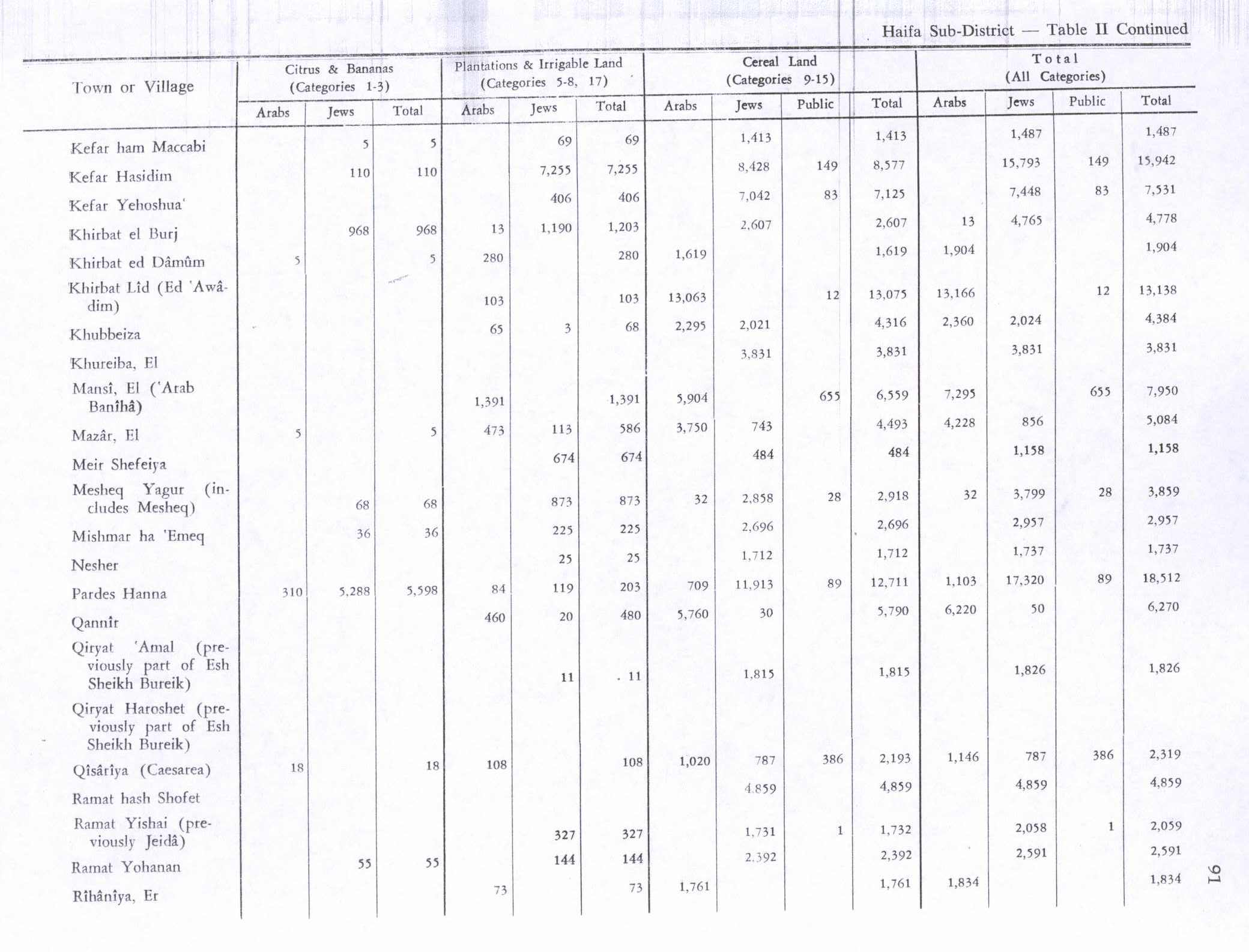
By 1944/45 the village had a total of 5,760 dunums of land allocated to cereals; while 460 dunums were irrigated or used for orchards.[3][4]
1948, and after
Between 22 -24 April 1948, the women and children of Qannir started to evacuate the village, apparently on [Arab] "orders from on high".[5][6]
According to a dispatch sent by Fawzi al-Qawuqji to the [Arab] High Command, an enemy attack from Ein Hashofeit started on 0400 on 8th May towards Quannir and Kafr Quari. The attackers were supported by armored cars. According to al-Qawuqji the attack was "resisted and repelled", with a result of one killed and four wounded on the Palestinian side.[7]
However, according to Haganah sources, the forces of the Alexandroni Brigade "raided the village on 9 May 1948, killed four Arabs and blew up 55 houses".[8] According to Morris, the remaining villagers probably left at this time.[9] The Jewish Israeli locality of Regavim, established in 1949, is located on the village's former lands.[3]
Khalidi described the place in 1992:
Stone rubble is strewn about the site, which is covered with thorns, fig trees, and cactus. Part of the adjacent land is used by Israelis as pasture and the other part is cultivated.[3]
See also
References
- ^ Palestine Exploration Quarterly Jan-Apr 1944. Jacotin's Map of Palestine. D.H.Kellner. p. 161.
- ^ Conder and Kitchener, 1881, SWP II, p.42. Cited in Khalidi, 1992, p. 181.
- ^ a b c d Khalidi, 1992, p.181
- ^ Hadawi, 1970, p.91
- ^ Morris, 2004, p. 175, note 67: "Summary of Intelligence for Alexandroni Brigade (11.5.48), No. 8´IDFA (=Israel Defense Forces and Defence Ministry Archive) 2506\49\\80.
- ^ Morris, 2004, p. 244 note 623: Tiroshi (Eitan)´to HIS-AD, 29 Apr. 1948, HA 105\257; and HIS-AD (=Haganah Intelligence Service -Arab Department) Information 29.4.48. IDFA 922\75\\1205.
- ^ al-Qawuqji, 1972, "Memoirs, 1948, Part II" , Dispatch 9/5 1948, Quoted in Khalidi, 1992, p. 181
- ^ Morris, 2004, p. 244, note 624: Tiroshi (Eitan)´to HIS-AD, 3 May 1948, IDFA 6400\49\\66; and Logbook, entry for 9th May 1948, IDFA 665\51\\1.
- ^ Morris, 2004, p. 244
Bibliography
- Conder, Claude Reignier and H.H. Kitchener (1881): The Survey of Western Palestine: memoirs of the topography, orography, hydrography, and archaeology. London:Committee of the Palestine Exploration Fund. vol 2
- Hadawi, Sami (1970), Village Statistics of 1945: A Classification of Land and Area ownership in Palestine, Palestine Liberation Organization Research Center
- Khalidi, Walid (1992), All That Remains: The Palestinian Villages Occupied and Depopulated by Israel in 1948, Washington D.C.: Institute for Palestine Studies, ISBN 0-88728-224-5
- Morris, Benny (2004), The Birth of the Palestinian Refugee Problem Revisited, Cambridge University Press, ISBN 978-0-521-00967-6
- al-Qawuqji, Fauzi (1972): Memoirs of al-Qawuqji, Fauzi in Journal of Palestine Studies
- "Memoirs, 1948, Part I" in 1, no. 4 (Sum. 72): 27-58., dpf-file, downloadable
- "Memoirs, 1948, Part II" in 2, no. 1 (Aut. 72): 3-33., dpf-file, downloadable
