Tabuk, Kalinga
Tabuk Taboc | |
|---|---|
 Cathedral of the Episcopal Church in the Philippines, Tabuk City | |
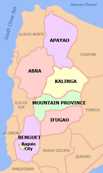
 Location in the province of Kalinga | |
| Coordinates: 17°24′25″N 121°26′33″E / 17.4069°N 121.4425°E | |
| Country | Philippines |
| Region | Cordillera Administrative Region |
| Province | Kalinga |
| District | Lone District |
| Established | June 16, 1950 |
| Cityhood | June 23, 2007 |
| Barangays | 42 |
| Government | |
| • Mayor | Ferdinand B. Tubban |
| Area | |
• Total | 700.25 km2 (270.37 sq mi) |
| Population (2020 census)[3] | |
• Total | 121,033 |
| • Density | 170/km2 (450/sq mi) |
| Time zone | UTC+8 (PHT) |
| ZIP code | 3800 |
| IDD : area code | +63 (0)74 |
| Income class | 5th class |
| Website | www |
Tabuk (Template:Lang-ilo) is a 5th class city and the capital of the province of Kalinga in the Philippines. According to the 2020 census, it has a population of 121,033 people.[3]
It borders with the town of Pinukpuk in the north and the town of Rizal in the north-east. On its westernmost section it shares border with the towns of Pasil and Lubuagan. On the south-west it borders with the town of Tanudan. Tabuk City is a border city of Kalinga with the provinces of Isabela and Mountain Province. In the east, it is bordered by the town of Quezon, Isabela, which is about 20 kilometers from the city center and the town of Paracelis, Mountain Province, to the south.
History
The former municipal district of Tabuk was transformed into a regular municipality by Republic Act No. 533, approved June 16, 1950.[4]
Cityhood
Barangays
Tabuk is politically subdivided into 42 barangays. [2]
Demographics
| Year | Pop. | ±% p.a. |
|---|---|---|
| 1918 | 4,079 | — |
| 1939 | 3,343 | −0.94% |
| 1948 | 7,376 | +9.19% |
| 1960 | 21,261 | +9.22% |
| 1970 | 28,016 | +2.79% |
| 1975 | 33,918 | +3.91% |
| 1980 | 42,768 | +4.74% |
| 1990 | 57,200 | +2.95% |
| 1995 | 63,507 | +1.98% |
| 2000 | 78,633 | +4.69% |
| 2007 | 87,912 | +1.55% |
| 2010 | 103,912 | +6.27% |
| 2015 | 110,642 | +1.20% |
| Source: Philippine Statistics Authority[5][6][7][8] | ||
In the 2020 census, the population of Tabuk was 121,033 people,[3] with a density of 170 inhabitants per square kilometre or 440 inhabitants per square mile.
References
- ^ "Official City/Municipal 2013 Election Results". Intramuros, Manila, Philippines: Commission on Elections (COMELEC). 11 September 2013. Retrieved 2 January 2014.
- ^ a b "Province: Kalinga". PSGC Interactive. Quezon City, Philippines: Philippine Statistics Authority. Retrieved 12 November 2016.
- ^ a b c Census of Population (2020). "Cordillera Administrative Region (CAR)". Total Population by Province, City, Municipality and Barangay. Philippine Statistics Authority. Retrieved 8 July 2021.
- ^ "R.A. No. 533: An Act to Convert the Municipal District of Tabuk, Sub-province of Kalinga, Mountain Province, into a Regular Municipality to be Known as the Municipality of Tabuk". PhilippineLaw.info. Retrieved 4 January 2015.
- ^ Census of Population (2015). "Cordillera Administrative Region (CAR)". Total Population by Province, City, Municipality and Barangay. Philippine Statistics Authority. Retrieved 20 June 2016.
- ^ Census of Population and Housing (2010). "Cordillera Administrative Region (CAR)" (PDF). Total Population by Province, City, Municipality and Barangay. National Statistics Office. Retrieved 29 June 2016.
- ^ Censuses of Population (1903–2007). "Cordillera Administrative Region (CAR)". Table 1. Population Enumerated in Various Censuses by Province/Highly Urbanized City: 1903 to 2007. National Statistics Office.
- ^ "Province of Kalinga". Municipality Population Data. Local Water Utilities Administration Research Division. Retrieved 17 December 2016.


