
New York metropolitan area
New York Metropolitan Area
New York-Newark-Bridgeport New York-New Jersey-Connecticut-Pennsylvania Combined Statistical Area (CSA) | |
|---|---|
 | |
| Country | United States of America |
| States | |
| Largest city | New York City |
| Other Cities | Newark Jersey City Yonkers Paterson Bridgeport Elizabeth Stamford New Haven Waterbury Clifton Norwalk Danbury New Rochelle Passaic |
| Area | |
| • Total | 11,842 sq mi (30,670 km2) |
| Elevation | 509−0 ft (509 m) |
| Population (2010) | |
| • Total | 22,085,649 |
| • Density | 1,900/sq mi (720/km2) |
| Ranked 1st in the US | |
| Time zone | UTC-5 (EST) |
| • Summer (DST) | UTC-4 (EDT) |
| Area code(s) | 212, 646 917, 718, 347, 917, 860, 929, 516, 631, 914, 845, 570, 203, 201, 551, 862, 973, 908, 609, 732, |


The New York metropolitan area includes the largest city in the United States (New York City); counties comprising Long Island and the lower Hudson Valley in New York State; the five largest cities in New Jersey (Newark, Jersey City, Elizabeth, Paterson, and Trenton) and their vicinities; six of the seven largest cities in Connecticut (Bridgeport, New Haven, Stamford, Waterbury, Norwalk, and Danbury), as well as their vicinities.
As per the 2010 Census, the New York City metropolitan area continues to be the most populous in the United States, by both the Metropolitan Statistical Area (MSA) definition (18.9 million)[1] and the Combined Statistical Area (CSA) definition (22.1 million);[2] it is also one of the most populous in the world.[3][4][5] The MSA covers 6,720 sq mi (17,405 km2), while the CSA area is 11,842 sq mi (30,671 km2), encompassing an ethnically and geographically diverse region. As a center of many industries including finance, international trade, media and entertainment, tourism, biotechnology, and manufacturing, it is one of the most important economic regions in the world.
Definitions
Metropolitan Statistical Area

New York-White Plains-Wayne, NY-NJ Metropolitan Division
Nassau-Suffolk, NY Metropolitan Division
Newark-Union, NJ-PA Metropolitan Division
Edison-New Brunswick, NJ Metropolitan Division
Rest of the New York-Newark-Bridgeport, NY-NJ-CT-PA Combined Statistical Area
The U.S. Office of Management and Budget has two definitions of the area: the Metropolitan Statistical Area (MSA) and the Combined Statistical Area (CSA). The MSA definition is called the New York-Northern New Jersey-Long Island, New York-New Jersey-Pennsylvania Metropolitan Statistical Area, and includes a population of 18,897,109 as of the 2010 census[6] (roughly 1 in 16 Americans). The MSA is further subdivided into four metropolitan divisions. The 23-county metropolitan area includes ten counties in New York State (coinciding with the five boroughs of New York City, the two counties of Long Island, and three counties in the lower Hudson Valley); 12 counties in Northern and Central New Jersey; and one county in northeastern Pennsylvania. The largest urbanized area in the United States is at the heart of the metropolitan area, the New York–Newark, NY–NJ–CT Urbanized Area (estimated to have a population of 18,319,939 as of 2008 and an area of 6,720 square miles).
The counties and county groupings constituting the New York metropolitan area are listed below with 2009 U.S. Census Bureau estimates of their populations.
New York-Northern New Jersey-Long Island, NY-NJ-PA Metropolitan Statistical Area (19,069,796)
- New York-White Plains-Wayne, NY-NJ Metropolitan Division (11,732,233)
- Kings County (Brooklyn), NY
- Queens County, NY
- New York County (Manhattan), NY
- Bronx County, NY
- Richmond County (Staten Island), NY
- Westchester County, NY
- Bergen County, NJ
- Hudson County, NJ
- Passaic County, NJ
- Rockland County, NY
- Putnam County, NY
- Nassau-Suffolk, NY Metropolitan Division (2,875,904)
- Edison-New Brunswick, NJ Metropolitan Division (2,335,390)
- Newark-Union, NJ-PA Metropolitan Division (2,126,269)
Combined Statistical Area

The Combined Statistical Area definition consists of the original MSA plus a wider region consisting of five adjacent metropolitan areas. The area is known as the New York-Newark-Bridgeport, New York-New Jersey-Connecticut-Pennsylvania Combined Statistical Area, with an estimated population of 22,085,649[7] as of 2009. About one out of every fifteen Americans resides in this region, which includes seven additional counties in New York, New Jersey, and Connecticut, and is often referred to as the Tri-State Area and less commonly the Tri-State Region (but leaving out Pennsylvania). However, the New York City television designated market area (DMA) includes Pike County, Pennsylvania,[8] which is also included in the CSA.
In addition to the New York-Northern New Jersey-Long Island, NY-NJ-PA Metropolitan Statistical Area, the following Metropolitan Statistical Areas are also included in the New York-Newark-Bridgeport, NY-NJ-CT-PA Combined Statistical Area (total pop. 22,232,494):
- Bridgeport-Stamford-Norwalk, CT Metropolitan Statistical Area (916,829)
- New Haven-Milford, CT Metropolitan Statistical Area (862,477)
- Poughkeepsie-Newburgh-Middletown, NY Metropolitan Statistical Area (677,094)
- Trenton-Ewing, NJ Metropolitan Statistical Area (366,222)
- Torrington, CT Micropolitan Statistical Area (189,927)
- Kingston, NY Metropolitan Statistical Area (182,693)
- Ulster County (182,693)
Geography


The area is frequently divided into the following regions:[11][12]
- New York City (Center of the region)
- Long Island (Nassau & Suffolk Counties, NY – separated by water from the rest of the region except New York City; not including Queens County or Kings County (Brooklyn), which coincide with two of New York City's Five Boroughs)
- North Jersey (Northern portion of New Jersey)
- Central Jersey (Middle portion of New Jersey)
- Hudson Valley (Lower Hudson Valley suburbs of Westchester, Putnam and Rockland Counties; and Mid-Hudson exurbs of Dutchess, Orange and Ulster Counties)
- Western Connecticut (Only Fairfield, New Haven and Litchfield Counties are part of the region and separated by the state line)
All five areas can be (and often are) further divided. For instance, Long Island can be divided into the South and North Shores (usually when speaking about Nassau County), Western Suffolk, and the East End. The Hudson Valley and Connecticut are sometimes grouped together and referred to as the Northern Suburbs, largely because of the shared usage of Metro-North Railroad.[13]
Subregions
New York City
Long Island
Long Island is home to two of New York City's boroughs: Brooklyn and Queens, as well as the more suburban Nassau and Suffolk counties, all within New York State.
It has a population of 7,568,304 as of the United States Census 2010 and is the most populated island in the United States and the 17th most populous island in the world. For transportation, it is served by the Long Island Expressway and the Long Island Railroad. It is also home to John F. Kennedy International Airport and LaGuardia Airport, two of the three major airport hubs in the area.
Northern New Jersey
Northern New Jersey is typically defined as the following counties:
- Bergen County
- Essex County
- Hudson County
- Hunterdon County (anything north of Readington Township)
- Morris County
- Passaic County
- Somerset County (anything north of Watchung)
- Sussex County
- Union County (anything north of Westfield)
- Warren County
The New Jersey State Department of Tourism splits North Jersey into the urban Gateway Region and the more rural Skylands Region.
Northern New Jersey is home to four of the largest cities of New Jersey: Newark, Jersey City, Paterson, and Elizabeth.
The region is geographically diverse with wetlands, mountains, and valleys scattered throughout the area. It has a large network of expressways and public transportation rail services which are mostly operated by New Jersey Transit. It is also home to the second largest airport in the area, Newark Liberty International Airport.
Central Jersey
Central Jersey is the middle portion of the state of New Jersey. It is home to both New York City and Philadelphia commuters. Due to this fact, it is loosely associated with the Delaware Valley and is considered to be part of both regions. Important towns such as Trenton (State capital of New Jersey) and Princeton (home to Princeton University) are located in this subregion, as is a significant portion of the Jersey Shore.
- Middlesex County
- Mercer County
- Monmouth County
- Ocean County (some consider this county a part of South Jersey)
- Union County (anything south of Westfield)
- Somerset County (anything south of Watchung)
- Hunterdon County (anything south of Readington Township)


Lower Hudson Valley
The lower Hudson Valley is centered around the Hudson River north of New York City and lies within New York State. It is mostly suburban and contains fewer job centers than the rest of the region. It is one the fastest growing areas in the metropolitan area, because of high housing costs in New York City and the inner suburbs. Historically, the valley was home to many factories, but a significant number have closed. Cleanup efforts to improve the Hudson River water quality after years of pollution are currently planned and will be supervised by the United States Environmental Protection Agency (EPA).[15]


Connecticut
Fairfield, New Haven, and Litchfield Counties are located in the western portion of Connecticut with large business and industrial parks scattered throughout the area although mostly contained within Fairfield County. The three counties (and Connecticut in general) have had a long-standing reputation for affluence. Geographically, the areas are flat along the coast with low hills eventually giving way to large mountain ranges such as The Berkshires further inland. Most of the largest cities in the state are located within New Haven and Fairfield Counties.
Urban areas of the region

The combined statistical area is a multicore metropolitan region containing several urban areas.


| Population rank |
Urbanized area | State(s) | 2000 population |
|---|---|---|---|
| 1 | New York—Newark | NY—NJ—CT | 17,799,861 |
| 42 | Bridgeport—Stamford | CT—NY | 888,890 |
| 70 | New Haven | CT | 531,314 |
| 90 | Poughkeepsie—Newburgh | NY | 351,982 |
| 122 | Trenton | NJ | 268,472 |
| 163 | Waterbury | CT | 189,026 |
| 190 | Danbury | CT—NY | 154,455 |
| 350 | Hightstown | NJ | 69,977 |
| 435 | Kingston | NY | 53,458 |
| 452 | Middletown | NY | 50,071 |
Principal cities
The following is a list of "principal cities" and their respective population estimates from the 2010 U.S. Census Bureau publication. Principal cities are generally those where there is a greater number of jobs than employed residents.[17][18][19][20]
- New York-Northern New Jersey-Long Island MSA
- New York City: 8,175,133
- Newark, New Jersey: 277,140
- Edison, New Jersey: 99,967
- Woodbridge Township, New Jersey: 99,265
- New Rochelle, New York: 77,062
- Mount Vernon, New York: 67,292
- White Plains, New York: 56,853
- Union, New Jersey: 56,642
- Wayne, New Jersey: 54,717
- Jersey City, New Jersey: 247,597
- Yonkers, New York: 195,976
- Paterson, New Jersey: 146,199
- Trenton-Ewing MSA
- Trenton, New Jersey: 84,913
- Ewing, New Jersey: 35,790
- Bridgeport-Stamford-Norwalk MSA
- Bridgeport, Connecticut: 144,229
- Stamford, Connecticut: 122,643
- Norwalk, Connecticut: 85,603
- Danbury, Connecticut: 80,893
- Stratford, Connecticut: 51,384
- New Haven-Milford MSA
- New Haven, Connecticut: 129,779
- Milford, Connecticut: 51,271
- Poughkeepsie-Newburgh-Middletown MSA
- Poughkeepsie, New York: 32,736
- Newburgh, New York: 28,866
- Middletown, New York: 28,086
- Kingston MSA
- Kingston, New York: 23,893
- Torrington Micropolitan Area
- Torrington, Connecticut: 36,383
Climate
Under the Köppen climate classification, New York City; western Long Island; the eastern shore of Westchester County, New York; the southwestern coastline of Connecticut; and a sliver of the Jersey Shore experience a humid subtropical climate (Cfa).[21][22] Using the 0 °C (32 °F) threshold, New York City is the northernmost metropolis on the North American continent with the humid subtropical categorization.
The remainder of the New York metropolitan area is classified as experiencing a humid continental climate.[23][24] However, the area covered by this humid continental categorization is itself split into two realms, Dfa (hot summer subtype) versus Dfb (warm summer subtype); the Dfb region generally lies further north and inland,[25] at a higher elevation, and receives greater snowfall[26] than the Dfa region.
Winters are cold and damp, and prevailing wind patterns that blow offshore minimize the moderating effects of the Atlantic Ocean; yet the Atlantic and the partial shielding of the Appalachians keep the New York area warmer in the winter than inland North American metropolitan areas located at similar or lesser latitudes including Pittsburgh, Cincinnati, and Indianapolis. The average temperature in January, the area's coldest month, is 39.1 °F (3.9 °C). However, temperatures in winter can for a few days be as low as 10 °F (−12 °C) and as high as 50 °F (10 °C).[27] Spring and autumn are unpredictable and can range from chilly to warm, although they are usually mild with low humidity. Summers in New York City are typically hot and humid with a July average of 84.9 °F (29.4 °C). Nighttime conditions are often exacerbated by the urban heat island phenomenon, and temperatures exceed 90 °F (32.2 °C) on average of 17 days each summer and can exceed 100 °F (38 °C).[28]
New York City receives 49.7 inches (1,260 mm) of precipitation annually, which is fairly spread throughout the year. Average winter snowfall for 1981 to 2010 has been 26.7 inches (68 cm), but this usually varies considerably from year to year.[29] Hurricanes and tropical storms are rare in the New York area, but are not unheard of and always have the potential to strike the area.[30] Extreme temperatures in New York City have ranged from −15 °F (−26 °C), recorded in February 1934, up to 106 °F (41 °C) in July 1936.[31]
The New York metropolitan area averages 234 days with at least some sunshine annually, and averages 58% of possible sunshine annually, accumulating 2,400 to 2,800 hours of sunshine per annum.[32]
| Month | Jan | Feb | Mar | Apr | May | Jun | Jul | Aug | Sep | Oct | Nov | Dec | Year |
|---|---|---|---|---|---|---|---|---|---|---|---|---|---|
| Record high °F (°C) | 72 (22) |
78 (26) |
86 (30) |
96 (36) |
99 (37) |
101 (38) |
106 (41) |
104 (40) |
102 (39) |
94 (34) |
84 (29) |
75 (24) |
106 (41) |
| Mean maximum °F (°C) | 60.4 (15.8) |
60.7 (15.9) |
70.3 (21.3) |
82.9 (28.3) |
88.5 (31.4) |
92.1 (33.4) |
95.7 (35.4) |
93.4 (34.1) |
89.0 (31.7) |
79.7 (26.5) |
70.7 (21.5) |
62.9 (17.2) |
97.0 (36.1) |
| Mean daily maximum °F (°C) | 39.5 (4.2) |
42.2 (5.7) |
49.9 (9.9) |
61.8 (16.6) |
71.4 (21.9) |
79.7 (26.5) |
84.9 (29.4) |
83.3 (28.5) |
76.2 (24.6) |
64.5 (18.1) |
54.0 (12.2) |
44.3 (6.8) |
62.6 (17.0) |
| Daily mean °F (°C) | 33.7 (0.9) |
35.9 (2.2) |
42.8 (6.0) |
53.7 (12.1) |
63.2 (17.3) |
72.0 (22.2) |
77.5 (25.3) |
76.1 (24.5) |
69.2 (20.7) |
57.9 (14.4) |
48.0 (8.9) |
39.1 (3.9) |
55.8 (13.2) |
| Mean daily minimum °F (°C) | 27.9 (−2.3) |
29.5 (−1.4) |
35.8 (2.1) |
45.5 (7.5) |
55.0 (12.8) |
64.4 (18.0) |
70.1 (21.2) |
68.9 (20.5) |
62.3 (16.8) |
51.4 (10.8) |
42.0 (5.6) |
33.8 (1.0) |
48.9 (9.4) |
| Mean minimum °F (°C) | 9.8 (−12.3) |
12.7 (−10.7) |
19.7 (−6.8) |
32.8 (0.4) |
43.9 (6.6) |
52.7 (11.5) |
61.8 (16.6) |
60.3 (15.7) |
50.2 (10.1) |
38.4 (3.6) |
27.7 (−2.4) |
18.0 (−7.8) |
7.7 (−13.5) |
| Record low °F (°C) | −6 (−21) |
−15 (−26) |
3 (−16) |
12 (−11) |
32 (0) |
44 (7) |
52 (11) |
50 (10) |
39 (4) |
28 (−2) |
5 (−15) |
−13 (−25) |
−15 (−26) |
| Average precipitation inches (mm) | 3.64 (92) |
3.19 (81) |
4.29 (109) |
4.09 (104) |
3.96 (101) |
4.54 (115) |
4.60 (117) |
4.56 (116) |
4.31 (109) |
4.38 (111) |
3.58 (91) |
4.38 (111) |
49.52 (1,258) |
| Average snowfall inches (cm) | 8.8 (22) |
10.1 (26) |
5.0 (13) |
0.4 (1.0) |
0.0 (0.0) |
0.0 (0.0) |
0.0 (0.0) |
0.0 (0.0) |
0.0 (0.0) |
0.1 (0.25) |
0.5 (1.3) |
4.9 (12) |
29.8 (76) |
| Average extreme snow depth inches (cm) | 5.8 (15) |
7.9 (20) |
4.4 (11) |
0.4 (1.0) |
0.0 (0.0) |
0.0 (0.0) |
0.0 (0.0) |
0.0 (0.0) |
0.0 (0.0) |
0.0 (0.0) |
0.4 (1.0) |
3.7 (9.4) |
12.3 (31) |
| Average precipitation days (≥ 0.01 in) | 10.8 | 10.0 | 11.1 | 11.4 | 11.5 | 11.2 | 10.5 | 10.0 | 8.8 | 9.5 | 9.2 | 11.4 | 125.4 |
| Average snowy days (≥ 0.1 in) | 3.7 | 3.2 | 2.0 | 0.2 | 0.0 | 0.0 | 0.0 | 0.0 | 0.0 | 0.0 | 0.2 | 2.1 | 11.4 |
| Average relative humidity (%) | 61.5 | 60.2 | 58.5 | 55.3 | 62.7 | 65.2 | 64.2 | 66.0 | 67.8 | 65.6 | 64.6 | 64.1 | 63.0 |
| Average dew point °F (°C) | 18.0 (−7.8) |
19.0 (−7.2) |
25.9 (−3.4) |
34.0 (1.1) |
47.3 (8.5) |
57.4 (14.1) |
61.9 (16.6) |
62.1 (16.7) |
55.6 (13.1) |
44.1 (6.7) |
34.0 (1.1) |
24.6 (−4.1) |
40.3 (4.6) |
| Mean monthly sunshine hours | 162.7 | 163.1 | 212.5 | 225.6 | 256.6 | 257.3 | 268.2 | 268.2 | 219.3 | 211.2 | 151.0 | 139.0 | 2,534.7 |
| Percent possible sunshine | 54 | 55 | 57 | 57 | 57 | 57 | 59 | 63 | 59 | 61 | 51 | 48 | 57 |
| Average ultraviolet index | 2 | 3 | 4 | 6 | 7 | 8 | 8 | 8 | 6 | 4 | 2 | 1 | 5 |
| Source 1: NOAA (relative humidity and sun 1961–1990; dew point 1965–1984)[34][35][36] | |||||||||||||
| Source 2: Weather Atlas[37]. | |||||||||||||
| Month | Jan | Feb | Mar | Apr | May | Jun | Jul | Aug | Sep | Oct | Nov | Dec | Year |
|---|---|---|---|---|---|---|---|---|---|---|---|---|---|
| Average sea temperature °F (°C) |
41.7 (5.4) |
39.7 (4.3) |
40.2 (4.5) |
45.1 (7.3) |
52.5 (11.4) |
64.5 (18.1) |
72.1 (22.3) |
74.1 (23.4) |
70.1 (21.2) |
63.0 (17.2) |
54.3 (12.4) |
47.2 (8.4) |
55.4 (13.0) |
Demographics


2010 Census
As of the 2010 Census, the metropolitan area had a population of 22,085,649. The population density was 1,865 per square mile. The racial markup was that 61.6% or 13,595,960 were White, 16.9% or 3,727,105 were African Americans, 0.5% or 102,349 were American Indian and Alaskan Native, Asians were 9.1% or 2,008,906 overall, Pacific Islanders were less than 1% with a population of 9,971, 8.8% or 1,944,165 listed themselves as "some other race", while 3.2% (697,193) were of two or more races. Hispanics were 21.7% of any race or 4,790,542.[citation needed]
The median age was 37.9. 25.5% were under 18, 9.5% were 18 to 24 years, 28% were 25 to 44 years of age, 26.6% were 45 to 64 years old, and 13.2% were over the age of 65. Males composed 48.3% of the population while females were 51.7% of the population.[citation needed]
97.7% of the population were in households, 2.3% were in group quarters, and 1% were institutionalized. There were 8,103,731 of which 30.2% or 2,449,343 had children. 46.1% or 3,736,165 were composted of opposite sex and married couples. Male households with no wife composed 4.9% or 400,534. 15.0% or 1,212,436 were female households, with no husbands. 34% or 2,754,596 were non-family households. The household density were 684 per square mile. 91.9% of housing units were occupied with a 3.8% vacancy rate. The average household size was 2.65 per household. The average income for non-family households was $90,335, and the average income for families was $104,715. 13.3% or 2,888,493 of the population were below the poverty line.[citation needed]
26.7% or 5,911,993 of the population were born outside the United States. Out of this, 17.4% or 1,028,506 were born in Europe, 27.0% or 1,595,523 were born in Asia, 3.8% or 224,109 were born in Africa, 0.2% or 11,957 were born in Oceania, 50.6% or 2,992,639 were born in Latin America.[citation needed]
Population estimates
As of July 1, 2011, the United States Census Bureau estimated the population of the metropolitan area at 22,214,083, an increase of 128,434 (0.6%) from the previous year.[39]
The New York City metropolitan area is ethnically diverse. It is home to the largest Jewish community outside Israel.[40] The metropolitan area is also home to 20% of the nation's Indian Americans and 15% of all Korean Americans[41][42] and the largest Asian Indian population in the Western Hemisphere; the largest Italian American and African American populations and the second-largest Hispanic community in the United States; and including 6 Chinatowns in New York City,[43] as well as one each in Edison, New Jersey and Nassau County, Long Island,[44] comprised as of 2010 a population of 682,265 overseas Chinese,[45] the largest outside of Asia. The New York region continues to be by far the leading metropolitan gateway for legal immigrants admitted into the United States.[46]
The metropolitan area is home to a self-identifying gay and bisexual community estimated at 568,903 individuals, the largest in the United States.[47] Same-sex marriages in New York were legalized on June 24, 2011 and were authorized to take place beginning 30 days thereafter.[48]
Economy

The regional economy is a center in international banking and commerce. It is the largest in the United States and one of the most important in the world. New York is considered a global city. Finance, international trade, media, real estate, manufacturing, tourism, biotechnology, and education are the leading industries in the area. Other industries include entertainment and news media. In 2010, the gross metropolitan product was $1.28 trillion dollars,[50] second only to Tokyo, and is larger than all but 14 countries.[51]
Along with its wealth, the area has a cost of living that is among the highest in the United States.[52] Changes in house prices for the area are publicly tracked on a regular basis using the Case–Shiller index; the statistic is published by Standard & Poor's and is also a component of S&P's 10-city composite index of the value of the residential real estate market.
Education
The metropolitan area has numerous higher education institutions. Prestigious colleges such as Columbia University and New York University in Manhattan, Princeton University in Princeton, New Jersey, and Yale University in New Haven, Connecticut are located in the region. The New York City Department of Education is the largest school district in the United States serving over 1.2 million students.[53] Public high schools such as High Technology High School in Monmouth County, New Jersey, Newcomers High School in Long Island City, Queens, and Stuyvesant High School are some of the most prestigious in the country.[54]
Attainment
According to the 2010 American Community Survey, of the 14,973,063 persons in this area over 25 years of age, 14.8% (2,216,578) had a graduate or professional degree, 21.1% (3,166,037) had a bachelor's degree, 6.4% (962,007) had an associate degree, 16.0% (2,393,990) had some college education but no degree, 26.8% (4,009,901) had a high school diploma or equivalent, 14.8% (2,224,557) had less than a high school education.[55] In 2010, CNN Money ranked the area as one of the top 10 smartest regions in the United States.[56]
Transportation
The depth and intricacy of the transportation network in the New York City region parallel the size and complexity of the metropolis itself.
Rail
About one in every three users of mass transit in the United States and two-thirds of the nation's rail riders live in the New York City metropolitan area.[57][58]
New York City Subway

The New York City Subway is the largest rapid transit system in the world when measured by stations in operation, with 472, and by length of routes. It is the third largest when measured by annual ridership (1.5 billion passenger trips in 2006).[59] New York's subway is also notable because nearly the entire system remains open 24 hours a day, in contrast to the overnight shutdown common to systems in most cities, including Hong Kong,[60][61] London, Paris, Seoul,[62][63] and Tokyo.
Commuter rail
The metropolitan area is also fundamentally defined by the areas from which people commute into New York City. The city is served by three primary commuter rail systems plus Amtrak.


Metro-North Railroad (MNRR), the busiest commuter railroad in the United States (as of 2012),[64] is operated by the Metropolitan Transportation Authority (MTA) (an agency of New York state that focuses on New York City-area transit), in conjunction with the Connecticut Department of Transportation and New Jersey Transit. Its major terminal is Grand Central Terminal. Trains on the Port Jervis Line and Pascack Valley Line terminate at Hoboken Terminal in Hoboken, New Jersey; commuters may transfer at either Secaucus Junction for New Jersey Transit trains to New York Pennsylvania Station or at Hoboken Terminal for PATH trains into Manhattan.
The Long Island Rail Road (LIRR), the second busiest commuter railroad in the United States,[64] is also operated by the MTA. It has two major terminals at Pennsylvania Station in Midtown Manhattan and Atlantic Terminal in Downtown Brooklyn, with a minor terminal at the Long Island City station and a major transfer point at the Jamaica station in Queens.
New Jersey Transit (NJT), the third busiest commuter railroad in the United States by passenger miles and also third in trips (when direct operated and purchased transportation services are both included—fourth if only direct operated are included),[64] is operated by the New Jersey Transit Corporation, an agency of the state of New Jersey, in conjunction with Metro-North Railroad and Amtrak. A map of the system can be found here. It has major terminals at Pennsylvania Station in Manhattan, Hoboken Terminal, and Newark Pennsylvania Station, with a major transfer point at Secaucus Junction in Hudson County, New Jersey. New Jersey Transit also operates the Hudson–Bergen Light Rail through Hudson County, the Newark City Subway, and the River Line that runs along tracks shared with Conrail Shared Assets Operations from Trenton to Camden in southern New Jersey. NJ Transit also has commuter buses operating in and out of Manhattan.
Amtrak's Northeast Corridor offers service to Philadelphia, New Haven, and other points between and including Boston and Washington, D.C.
Major stations in the metropolitan area are:
| Station | Railroad(s) | State | County | Type |
|---|---|---|---|---|
| Pennsylvania Station (New York City) | Amtrak, LIRR, NJT | NY | New York | Terminal and Transfer |
| Grand Central Terminal | MNRR | NY | New York | Terminal |
| Pennsylvania Station (Newark) | Amtrak, NJT, PATH | NJ | Essex | Terminal and Transfer |
| Hoboken Terminal | NJT, MNRR, PATH | NJ | Hudson | Terminal |
| Atlantic Terminal | LIRR | NY | Kings | Terminal |
| Hunterspoint Avenue | LIRR | NY | Queens | Terminal |
| Jamaica Station | LIRR | NY | Queens | Terminal and Transfer |
| Secaucus Junction | NJT, MNRR | NJ | Hudson | Transfer |
| New Haven Union Station | Amtrak, MNRR, Shore Line East | CT | New Haven | Terminal and Transfer |
| Trenton Station | Amtrak, NJT, SEPTA | NJ | Mercer | Terminal and Transfer |
The following table shows all train lines operated by these commuter railroads in the New York metropolitan area. New Jersey Transit operates an additional train line in the Philadelphia metropolitan area. (Shown counterclockwise from the Atlantic Ocean):
Additionally, the Port Authority of New York and New Jersey, an agency of the states of New York and New Jersey, operates the PATH system. This heavy rail transportation service serves the counties of New York, Hudson, and Essex. A map can be found here.
Major highways
This article is missing information about section. (November 2011) |
The following highways serve the region:

Interstates
_4.JPG)
 Interstate 78
 Interstate 80
 Interstate 84
 Interstate 87
 Interstate 95
 Interstate 195
 Interstate 278—serves as southern beltway around New York City
 Interstate 280
 Interstate 287—serves as northern beltway around New York City
 Interstate 295 (New York)
 Interstate 478
 Interstate 495 also known as Long Island Expressway or LIE
 Interstate 678
 Interstate 684
 Interstate 895
U.S. Routes
State Routes
 New Jersey Route 3
 New Jersey Route 4
 New York State Route 9A
 New Jersey Route 17
 New Jersey Route 21
 New Jersey Route 24
 New York State Route 25
 New York State Route 27
 New Jersey Route 139
 New Jersey Route 208
 New Jersey/New York Route 440
 New Jersey Route 495
Other limited-access roads

Some of these roads have a numerical designation assigned to it:
 Belt Parkway
 Bronx River Parkway
 Franklin D. Roosevelt Drive (also referred to as the FDR Drive)
 Garden State Parkway
 Grand Central Parkway
 Harlem River Drive
 Henry Hudson Parkway
 Hutchinson River Parkway
 Merritt Parkway
 New Jersey Turnpike (part of I-95)
 New York State Thruway (part of I-87)
 Northern State Parkway
 Palisades Interstate Parkway
 Saw Mill River Parkway
 Sprain Brook Parkway
 Taconic State Parkway
Named bridges and tunnels


- Bayonne Bridge (part of NY 440 and NJ 440), scheduled to undergo a $1 billion project to raise the roadway by 64 feet to 215 feet to allow taller container ships to pass underneath to access seaports in New York City and northern New Jersey.[68]
- Bronx–Whitestone Bridge (part of I-678)
- Brooklyn–Battery Tunnel (part of I-478)
- Brooklyn Bridge, iconic of New York City and designated a National Historic Landmark by the U.S. National Park Service on January 29, 1964.[69]
- Driscoll Bridge (part of the Garden State Parkway), with a total of 15 travel lanes and 6 shoulder lanes, the widest motor vehicle bridge in the world by number of lanes[70] and one of the world's busiest.
- Ed Koch Queensboro Bridge (part of NY 25)
- George Washington Bridge (part of I-95 and US 1-9/46), the world's busiest motor vehicle bridge[71] and one of the world's widest, with 14 lanes.[72]
- Goethals Bridge (part of I-278)
- Holland Tunnel (part of I-78)
- Lincoln Tunnel (part of Route 495)
- Manhattan Bridge, connecting Brooklyn to Manhattan's Chinatown, carries 4 tracks of the B, D, N, and Q trains of the New York City Subway, in addition to other traffic.
- Outerbridge Crossing (part of NY 440 and NJ 440)
- Queens–Midtown Tunnel (part of I-495)
- Robert F. Kennedy Bridge (part of I-278), also known as the Triborough Bridge.
- Tappan Zee Bridge (part of I-87, I-287, and the New York State Thruway), planned to undergo a $5 billion replacement.[73]
- Throgs Neck Bridge (part of I-295)
- Verrazano-Narrows Bridge (part of I-278), the longest suspension bridge in the Americas and one of the longest in the world.[74][75]
- Williamsburg Bridge, carries 2 tracks of the J, M, and Z trains of the New York City Subway, in addition to other traffic.
Commuter bus
New Jersey Transit, Academy Bus, Coach USA, Spanish Transportation, and several other companies operate commuter coaches into the Port Authority Bus Terminal in Manhattan, and many other bus services in New Jersey. Bus services also operate in other nearby counties in the states of New York and Connecticut, but most terminate at a subway terminal or other rail station.
Major airports

The New York metropolitan area handles the busiest urban airspace in the United States - carrying over 100 million passengers annually,[76] and is served by three major airports.
| Airport | IATA code | ICAO code | County | State |
|---|---|---|---|---|
| John F. Kennedy International Airport | JFK | KJFK | Queens | New York |
| Newark Liberty International Airport | EWR | KEWR | Essex/Union | New Jersey |
| LaGuardia Airport | LGA | KLGA | Queens | New York |
The following smaller airports are also in the metro area and provide daily commercial service:
| Airport | IATA code | ICAO code | County | State |
|---|---|---|---|---|
| Long Island MacArthur Airport | ISP | KISP | Suffolk | New York |
| Stewart International Airport | SWF | KSWF | Orange | New York |
| Tweed New Haven Regional Airport | HVN | KHVN | New Haven | Connecticut |
| Westchester County Airport | HPN | KHPN | Westchester | New York |
Commuter usage
According to the 2010 American Community Survey, 54.3% (5,476,169) of commuters used a car or other private vehicle alone, 7.0% (708,788) used a carpool, 27.0% (2,721,372) used public transportation, 5.5% (558,434) walked to work, 2.0% (200,448) used some other means of transportation such as a bicycle to get to work.[77]
History
This section may require cleanup to meet Wikipedia's quality standards. The specific problem is: grammer, style, citations. (May 2012) |


During the Wisconsinan glaciation, the region was at the edge of a large ice sheet that was over 1000 feet in depth. The ice sheet scraped away large amounts of soil, leaving bedrock. Later on, the ice sheet would help split apart what are now Long Island and Staten Island.

The region was inhabited by Native American tribes such as the Lenape[81] and others. The tribes used the abundant waterways in the area for many purposes such as fishing and trade routes. Later, when Henry Hudson visited the area, he built a settlement called New Amsterdam on Lower Manhattan Island. In 1664, the English conquered Dutch land holdings that included New Amsterdam. The English renamed it New Amsterdam New York, for the Duke of York. As the fur trade expanded north, New York became a trade hub. The trading bought in a diverse set of ethnic groups including Africans, Jews, and the Portuguese. The island of Manhattan had an extraordinary natural harbor formed by New York Bay (actually the drowned lower river valley of the Hudson River, enclosed by glacial moraines), the East River (actually a tidal strait), and the Hudson River, all of which are confluent at the southern tip, from which all later development spread.
During the American Revolution, New York was an important region for battle. Many battles such as the Battle of Long Island and the Battle of New York were fought here. However, New York City remained in the hands of the British until the war ended in 1783. After the war, New York was made capital of the United States. After a rather short term the capitol moved to Philadelphia. In 1792, the Buttonwood Agreement, made by a group of merchants, created what is now the New York Stock Exchange. Today, many people in the Tri-State Area work in this important stock exchange. Large-scale immigration into New York was a result of a large demand for manpower. A cosmopolitan attitude in the city created tolerance for various cultures and ethnic groups. German, Irish, and Italian immigrants were among the largest ethnic groups. Today, many of their descendents continue to live in the region. Cultural buildings such as the Metropolitan Museum of Art, the Metropolitan Opera, the American Museum of Natural History were built. New York newspapers were read around the country as media moguls James Gordon Bennett, Sr., Joseph Pulitzer and William Randolph Hearst battled for readership. In 1884, over 70% of exports passed through ports in New York or in one of the surrounding towns. The five boroughs of New York City — The Bronx, Brooklyn, Manhattan, Queens, and Staten Island — were consolidated into a single city in 1898.[82][83]
The now-unified New York City encouraged both more physical connections between the boroughs and the growth of bedroom communities. The New York City Subway began operating in 1905 as different private systems that were later taken over by the city. Railroad stations such as Grand Central Terminal and Pennsylvania Station helped fuel suburban growth. During the era of the Prohibition, when alcohol was banned nationwide, organized crime grew to supply the high demand for bootleg alcohol. The iconic Broadway Theater District developed with the showing of the musical, Show Boat.
The Great Depression suspended the region's fortunes as a period of widespread unemployment and poverty began. City planner Robert Moses began his automobile-centered career of building bridges, parkways, and later expressways. During World War II, the city economy was hurt by blockades of German U-Boats, which limited of shipping with Europe.
After its population peaked in 1950, much of the city's population began leaving for the suburbs. The effects were a result of white flight. Industry and commerce also declined in this era, with businesses leaving for the suburbs and other cities. Crime affected the city severely. Urban renewal projects alleviated the decay in Midtown Manhattan to a certain extent, but later failed. Blackouts such as the Northeast Blackout of 1965 and the New York City Blackout of 1977 caused massive rioting. A rare highlight was the completion of the former World Trade Center, which once stood as the tallest buildings in the world.
In the 1980s, the city economy was booming. Wall Street was fueling an economic surge in the real estate market. Despite this, crime was still an issue. Beginning in the 1990s, however, crime dropped substantially.

A major event in the regions history was the September 11th attacks in 2001, killing nearly 3,000 people as two planes crashed into the former World Trade Center, causing them to collapse. Businesses led an exodus from Lower Manhattan because of this. In 2003, another blackout occurred, the 2003 North America blackout, but the city suffered no looting. A building boom in New York City continues to this day although this has been slowed down by the Great Recession.
Statistical history
The U.S. Census Bureau first designated metropolitan areas in 1950 as standard metropolitan areas (SMAs). The "New York-Northeastern NJ SMA" was defined to include 17 counties: 9 in New York (the five boroughs of New York City, Nassau, Suffolk, Westchester, and Rockland) and 8 in New Jersey (Bergen, Hudson, Passaic, Essex, Union, Morris, Somerset, and Middlesex). In 1960, the metropolitan area standards were modified and renamed standard metropolitan statistical areas (SMSAs). The new standards resulted in the splitting of the former SMA into several pieces: the nine New York counties became the "New York SMSA"; three of the New Jersey counties (Essex, Union, and Morris) became the "Newark SMSA"; two other New Jersey counties (Bergen and Passaic) became the "Paterson-Passaic-Clifton SMSA"; Hudson County was designated the "Jersey City SMSA"; and Middlesex and Somerset counties lost their metropolitan status. In 1973, a new set of metropolitan area standards resulted in further changes: Nassau and Suffolk counties were split off as their own SMSA ("Nassau-Suffolk SMSA"); Bergen County (originally part of the Paterson-Clifton-Passaic SMSA) was transferred to the New York SMSA; the New York SMSA also received Putnam County (previously non-metropolitan); Somerset County was added to the Newark SMSA; and two new SMSAs, the "New Brunswick-Perth Amboy-Sayreville SMSA" (Middlesex County) and "Long Branch-Asbury Park SMSA" (Monmouth County), were established. In 1983, the concept of a consolidated metropolitan statistical area (CMSA) was first implemented. A CMSA consisted of several primary metropolitan statistical areas (PMSAs), which were individual employment centers within a wider labor market area. The "New York-Northern New Jersey-Long Island CMSA" consisted of 12 PMSAs. Seven PMSAs were based on the original 1950 New York SMA that were split up: New York, Bergen-Passaic, Jersey City, Middlesex-Somerset-Hunterdon (Hunterdon added for the first time), Monmouth-Ocean (Ocean added for the first time), Nassau-Suffolk, and Newark (Sussex added for the first time). One additional PMSA was the Orange County PMSA (previously the Newburgh-Middletown SMSA). The other four PMSAs were former SMSAs in Connecticut: Bridgeport, Stamford, Norwalk, and Danbury. In 1993, four PMSAs were added to the New York-Northern New Jersey-Long Island CMSA: Trenton PMSA (Mercer County), Dutchess County PMSA, Waterbury PMSA, and New Haven PMSA. Several new counties were also added to the CMSA: Sussex, Warren, and Pike. The CMSA model was originally utilized for tabulating data from the 2000 census. In 2003, a new set of standards was established using the core-based statistical area (CBSA) model was adopted and remains in use as of 2010. The CBSA model resulted in the splitting up of the old CMSA into several metropolitan statistical areas: New York-Northern New Jersey-Long Island, Poughkeepsie-Newburgh-Middletown, Trenton-Ewing, Bridgeport-Stamford-Norwalk (includes Danbury), and New Haven-Milford (includes Waterbury).
Popular culture and entertainment
Sports teams
New York City is home to the headquarters of the National Football League,[84] Major League Baseball,[85] the National Basketball Association,[86] and the National Hockey League.[87] Four of the ten most expensive stadiums ever built worldwide (MetLife Stadium, the new Yankee Stadium, Madison Square Garden, and Citi Field) are located in the New York metropolitan area.[88]

Listing of the professional sports teams in the New York metropolitan area:
- National Basketball Association (NBA)
- Women's National Basketball Association (WNBA)
- Major League Baseball (MLB)
- New York Mets
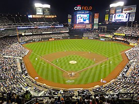
Citi Field in Flushing, Queens is the home of the New York Mets. - New York Yankees

Yankee Stadium in the South Bronx is the home of the New York Yankees.
- New York Mets
- Minor League Baseball (MiLB)
- Atlantic League of Professional Baseball (ALPB)
- Canadian American Association of Professional Baseball (CanAm League)
- National Football League (NFL)
- National Hockey League (NHL)
- American Hockey League (AHL)
- East Coast Hockey League (ECHL)
- Major League Soccer (MLS)
- Arena Football (AFL)
- Major League Lacrosse (outdoor) (MLL)
- World Team Tennis (WTT)


Media
The New York City metropolitan area is home to the headquarters of several well-known media companies, subsidiaries, and publications, including Thomson Reuters, The New York Times Company, News Corporation, The Wall Street Journal, Fox News, ABC, CBS, and NBC. Local television channels include WCBS-TV 2 (CBS), WNBC 4 (NBC), WNYW 5 (FOX), WABC-TV 7 (ABC), WWOR-TV 9 (MyNetworkTV), WPIX 11 (CW), WNET 13 (PBS), WNYE-TV 25 (NYC Media) and WPXN-TV 31 (Ion). NY1 is a 24/7 local news provider available only to cable subscribers. Radio stations serving the area include: WNYC, WFMU, WABC-AM, and WFAN. Many television and radio stations use the top of the Empire State Building to broadcast their terrestrial television signals, while some media entities broadcast from studios in Times Square.
Theme parks
In New Jersey

| Main Park | Other Parks | Location | Year Opened |
|---|---|---|---|
| Six Flags Great Adventure | Six Flags Wild Safari, Six Flags Hurricane Harbor | Jackson | 1974 |
| Mountain Creek Waterpark | None | Vernon | 1998 |
In New York State
Playland, Rye, Westchester County
Area codes

The area is served by 24 area codes:
- 212: Serves Manhattan and is overlaid with 646 and 917.
- 718: Serves all other boroughs of New York City and is overlaid with 347, 917, 929
- 917: Serves all of New York City
- 516: Serves Nassau County
- 631: Serves Suffolk County
- 914: Serves Westchester County
- 845: Serves the Hudson Valley counties of Southern New York State.
- 570: Serves Northeastern Pennsylvania
- 203: Serves Southwestern Connecticut and is overlaid with 475
- 860: Serves the rest of Connecticut not served by 203 or 475
- 201: Serves most of Bergen County, as well as parts of Essex, Hudson and Passaic in Northern New Jersey. and is overlaid with 551.
- 973: Serves portions of Bergen, Essex, Hudson, Morris, Passaic, Sussex and northern portions of Union County in Northern New Jersey, also southern portions of Union County in Central New Jersey and is overlaid with 862.
- 908: Serves communities in Union County, Somerset County, northern parts of Middlesex County, Hunterdon County, Warren County, and Morris County as well as some cell phones in Monmouth County in New Jersey.
- 732: Serves Middlesex County, Somerset County, and southern portions of Union County in Central Jersey and northern portions of Union County in North Jersey, and Monmouth and northern Ocean counties on the Jersey Shore and overlaid with 848
- 609: Serves Mercer County and parts of Middlesex and Monmouth Counties.
See also
- Cities and metropolitan areas of the United States
- Regional Plan Association
- Transportation in New York City
- Mass transit in New York City
References
- ^ "Table GCT-PL2 - Population and Housing Occupancy Status: 2010 - United States -- Metropolitan Statistical Area; and for Puerto Rico". U.S. Census Bureau. Retrieved August 31, 2012.
- ^ "Table GCT-PL2 - Population and Housing Occupancy Status: 2010 - United States -- Combined Statistical Area; and for Puerto Rico". U.S. Census Bureau. Retrieved March 28, 2012.
- ^ "World's Largest Urban Areas [Ranked by Urban Area Population]". Rhett Butler. 2003–2006. Retrieved November 25, 2011.
- ^ "Largest Cities of the World – (by metro population)". Woolwine-Moen Group d/b/a Graphic Maps. Retrieved November 25, 2011.
- ^ "Largest urban areas in the world: 2008 All Urban Areas 2,000,000 & Over" (PDF). Wendell Cox Consultancy. Retrieved November 25, 2011.
- ^ "Population Change for the Ten Most Populous and Fastest Growing Metropolitan Statiscal Areas: 2000 to 2010" (PDF). U.S. Census Bureau. March 2011. p. 6. Retrieved April 12, 2011.
- ^ "Annual Estimates of the Population of Combined Statistical Areas: April 1, 2000 to July 1, 2009" (CSV). 2009 Population Estimates. United States Census Bureau, Population Division. Retrieved March 23, 2010.
- ^ http://transition.fcc.gov/dtv/markets/maps_current/New_York_NY.pdf New York City Designated Market Area map PDF
- ^ "Elevations and Distances in the United States". U.S Geological Survey. April 29, 2005. Retrieved August 31, 2012.
- ^ Mark J. Magyar (November 8, 2011). "Paterson Great Falls National Park: More Than Scenery". Copyright © 2010-2011, njSPOTLIGHT. All rights reserved. Retrieved September 2, 2012.
- ^ Geography Explained (see Change in Labor Market Areas) http://www.labor.ny.gov/stats/lsgeog.shtm
- ^ http://www2.census.gov/geo/maps/puma/puma2k/ct_puma5.pdf
- ^ "Metro-North Railroad". Metropolitan Transportation Authority of the State of New York. Retrieved September 27, 2011.
- ^ "National Historic Landmarks Program - Lake Mohonk Mountain House". National Park Service. Retrieved September 3, 2012.
- ^ "Frequently Asked Questions". Hudson River PCBs. New York, NY: U.S. Environmental Protection Agency. Retrieved September 29, 2011.
- ^ "National Historic Landmarks Program - New Haven Green Historic District" (PDF). National Park Service. Retrieved September 3, 2012.
- ^ Office of Management and Budget – Standards for Defining Metropolitan and Micropolitan Statistical Areas, Sec. 5
- ^ United States Census Bureau (web) (3). "USA: New York". City Population. Thomas Brinkhoff. Retrieved 9 June 2012.
{{cite web}}: Check date values in:|date=and|year=/|date=mismatch (help); Unknown parameter|month=ignored (help) - ^ United States Census Bureau (web) (3). "USA: New Jersey". City Population. Thomas Brinkhoff. Retrieved 9 June 2012.
{{cite web}}: Check date values in:|date=and|year=/|date=mismatch (help); Unknown parameter|month=ignored (help) - ^ United States Census Bureau (web) (3). "USA: Connecticut". City Population. Thomas Brinkhoff. Retrieved 9 June 2012.
{{cite web}}: Check date values in:|date=and|year=/|date=mismatch (help); Unknown parameter|month=ignored (help) - ^ Peel, M. C.; Finlayson, B. L.; McMahon, T. A. "World Map of Köppen-Geiger climate classification". The University of Melbourne. Retrieved September 3, 2012.
{{cite web}}: CS1 maint: multiple names: authors list (link) - ^ "New York Polonia Polish Portal in New York". Copyright © 2010-2012 NewYorkPolonia.com. Retrieved September 3, 2012.
- ^ Peel, M. C.; Finlayson, B. L.; McMahon, T. A. "World Map of Köppen-Geiger climate classification". The University of Melbourne. Retrieved September 3, 2012.
{{cite web}}: CS1 maint: multiple names: authors list (link) - ^ "united states annual snowfall map". ©1998-2012 HowStuffWorks, Inc. Retrieved September 3, 2012.
- ^ "The Climate of New York". New York State Climate Office. Retrieved September 3, 2012.
- ^ "Weatherbase New York, New York". © Copyright 2012 Canty and Associates LLC. Retrieved September 3, 2012.
- ^ "Weatherbase New York, New York". © Copyright 2012 Canty and Associates LLC. Retrieved September 3, 2012.
- ^ Sam Dolnick (August 28, 2011). "Damage From Irene Largely Spares New York – Recovery Is Slower in New York Suburbs". © 2011 The New York Times Company. Retrieved September 3, 2012.
- ^ "Monthly Weather Averages and Records for New York, NY". © 1995 - 2012, The Weather Channel, LLC weather.com® Licensed by TRUSTe. Retrieved September 3, 2012.
- ^ "united states annual sunshine map". HowStuffWorks, Inc. Retrieved September 3, 2012.
- ^ Belvedere Castle at NYC Parks
- ^ "NowData – NOAA Online Weather Data". National Oceanic and Atmospheric Administration. Retrieved May 4, 2021.
- ^ "Summary of Monthly Normals 1991–2020". National Oceanic and Atmospheric Administration. Archived from the original on May 4, 2021. Retrieved May 4, 2021.
- ^ "New York Central Park, NY Climate Normals 1961−1990". National Oceanic and Atmospheric Administration. Retrieved July 18, 2020.
- ^ a b "New York, New York, USA - Monthly weather forecast and Climate data". Weather Atlas. Retrieved July 4, 2019.
- ^ Asian Americans: Contemporary Trends and Issues Second Edition, Edited by Pyong Gap Min. Pine Forge Press - An Imprint of Sage Publications, Inc. 2006. Retrieved August 31, 2012.
- ^ "Population Estimates: Metropolitan and Micropolitan Statistical Areas". United States Census Bureau. Retrieved August 8, 2012.
- ^ "World Jewish Population". SimpleToRemember.com – Judaism Online. Retrieved September 2, 2012.
- ^ "Profile of General Population and Housing Characteristics: 2010 Demographic Profile Data Geography: New York-Newark-Bridgeport, NY-NJ-CT-PA CSA". Retrieved September 2, 2012.
- ^ "Profile of General Population and Housing Characteristics: 2010 Demographic Profile Data Geography: United States". U.S. Census Bureau. Retrieved September 2, 2012.
- ^ Kirk Semple (June 23, 2011). "Asian New Yorkers Seek Power to Match Numbers". The New York Times Company. Retrieved September 2, 2012.
- ^ Lawrence A. McGlinn, Department of Geography SUNY-New Paltz. "BEYOND CHINATOWN: DUAL IMMIGRATION AND THE CHINESE POPULATION OF METROPOLITAN NEW YORK CITY, 2000, Page 6" (PDF). Middle States Geographer, 2002, 35: 110-119, Journal of the Middle States Division of the Association of American Geographers. Retrieved June 27, 2012.
- ^ "Profile of General Population and Housing Characteristics: 2010 Demographic Profile Data Geography: New York-Newark-Bridgeport, NY-NJ-CT-PA CSA". Retrieved September 2, 2012.
- ^ "Yearbook of Immigration Statistics: 2011 - Supplemental Table 2". U.S. Department of Homeland Security. Retrieved September 2, 2012.
- ^ Gary J. Gates, PhD. "Same-sex Couples and the Gay, Lesbian, Bisexual Population: New Estimates from the American Community Survey" (PDF). The Williams Institute on Sexual Orientation. Retrieved September 2, 2012.
- ^ Nicholas Confessore and Michael Barbaro (June 24, 2011). "New York Allows Same-Sex Marriage, Becoming Largest State to Pass Law". The New York Times Company. Retrieved September 2, 2012.
- ^ "Market highlights for first half-year 2010" (PDF). World Federation of Exchanges. Retrieved April 11, 2012.
- ^ "GDP by State". Greyhill Advisors. Retrieved September 23, 2011.
- ^ Zumbrun, Joshua. "In Pictures: World's Most Economically Powerful Cities". Forbes.
- ^ Huddleston, Cameron. "Top 5 Cities with the highest cost of living". Kiplinger's. Retrieved September 2, 2012.
- ^ "Selected statistics on enrollment, teachers, dropouts, and graduates in public school districts enrolling more than 15,000 students, by state: 1990, 2000, and 2006" (PDF). Digest of Education Statistics 2008. U.S. Department of Education. Institute of Education Sciences, National Center for Education Statistics. March 18, 2009. pp. 129–139. Retrieved April 26, 2009.
- ^ "Gold Medal List". US News. pp. 1–2. Retrieved October 28, 2011.
{{cite web}}: Text "US News Best High Schools" ignored (help) - ^ "SELECTED SOCIAL CHARACTERISTICS IN THE UNITED STATES 2010 American Community Survey 1-Year Estimates". U.S Census Bureau. Retrieved November 16, 2011.
- ^ Christie, Les (October 1, 2010). "America's brainiest places to live". CNN Money. Retrieved November 16, 2011.
- ^ "The MTA Network: Public Transportation for the New York Region". Metropolitan Transportation Authority. Retrieved September 7, 2012.
- ^ Pisarski, Alan (October 16, 2006). "Commuting in America III: Commuting Facts" (PDF). Transportation Research Board. Retrieved September 7, 2012.
- ^ "The MTA Network: Public Transportation for the New York Region". Metropolitan Transportation Authority. Retrieved September 4, 2012.
- ^ "Service Hours". Copyright © 2011 MTR. Retrieved September 6, 2012.
- ^ "Tsuen Wan Line". Copyright © 1998-2012 TravelChinaGuide.com, All rights reserved. Retrieved September 6, 2012.
- ^ "Train Time Table - Search station". Seoul Metropolitan Rapid Transit Corporation. Retrieved September 6, 2012.
- ^ "Subway map". Seoul Metropolitan Rapid Transit Corporation. Retrieved September 6, 2012.
- ^ a b c Metro-North ridership tops LIRR for 1st time - Poughkeepsie Journal
- ^ "Port Authority of New York and New Jersey - George Washington Bridge". Retrieved August 31, 2012.
- ^ "Longest Suspension Bridges in the World". © 2000–2012 Pearson Education, publishing as Infoplease. Retrieved September 7, 2012.
- ^ "Verrazano-Narrows Bridge". © by Eastern Roads. Retrieved September 7, 2012.
- ^ "Port Authority: Bayonne Bridge Project 6 Months Ahead Of Schedule". ©2012 CBS Local Media, a division of CBS Radio Inc. All rights reserved. July 18, 2012. Retrieved September 7, 2012.
- ^ "Brooklyn Bridge - National Historic Landmarks Program". U.S. National Park Service. Retrieved September 7, 2012.
- ^ "Garden State Parkway opens world's widest bridge - 15 lanes". TOLLROADSnews, Peter Samuel. April 11, 2006. Retrieved September 7, 2012.
- ^ "Port Authority of New York and New Jersey - George Washington Bridge". Retrieved September 7, 2012.
- ^ "Garden State Parkway opens world's widest bridge - 15 lanes". TOLLROADSnews, Peter Samuel. April 11, 2006. Retrieved September 7, 2012.
- ^ Ted Mann (August 20, 2012). "Tappan Zee Span Gets New Push". The Wall Street Journal Copyright ©2012 Dow Jones & Company, Inc. All Rights Reserved. Retrieved September 7, 2012.
- ^ "Longest Suspension Bridges in the World". © 2000–2012 Pearson Education, publishing as Infoplease. Retrieved September 7, 2012.
- ^ "Verrazano-Narrows Bridge". © by Eastern Roads. Retrieved September 7, 2012.
- ^ Susan Fleming. "FAA Airspace Redesign: An Analysis of the New York/New Jersey/Philadelphia Project, United States Government Accountability Office Report to the Congressional Requesters". Copyright Diane Publishing Company. All Rights Reserved. Retrieved September 7, 2012.
- ^ http://factfinder2.census.gov/faces/tableservices/jsf/pages/productview.xhtml?pid=ACS_10_1YR_DP03&prodType=table%7Ctitle=SELECTED ECONOMIC CHARACTERISTICS 2010 American Community Survey 1-Year Estimates|publisher=US Census Bureau
- ^ "Statue of Liberty". World Heritage. UNESCO. Retrieved August 31, 2012.
- ^ "Queens - The NYC Experience". Copyright 2012 The City of New York. February 16, 2011. Retrieved September 7, 2012.
- ^ Schenkler, Michael. "We Are A Nation Of Immigrants". Queens Tribune. Retrieved September 7, 2012.
- ^ "About the Lenapes". Copyright © 2002 [Lenape Lifeways]. All rights reserved. Retrieved September 8, 2012.
- ^ "A 5-Borough Centennial Preface for Katharine Bement Davis Mini-History". The New York City Department of Correction. 1997. Retrieved September 2, 2012.
- ^ "New York: A City of Neighborhoods". New York City Department of City Planning. Retrieved September 2, 2012.
- ^ "National Football League". Copyright © 2012, Hoover's Inc., All Rights Reserved. Retrieved September 2, 2012.
- ^ "Major League Baseball". Copyright © 2012, Hoover's Inc., All Rights Reserved. Retrieved September 2, 2012.
- ^ "National Basketball Association, Inc". Copyright © 2012, Hoover's Inc., All Rights Reserved. Retrieved September 2, 2012.
- ^ "National Hockey League". Copyright © 2012, Hoover's Inc., All Rights Reserved. Retrieved September 2, 2012.
- ^ Esteban (October 27, 2011). "11 Most Expensive Stadiums In The World". Total Pro Sports. Retrieved September 2, 2012.
- ^ Esteban (October 27, 2011). "11 Most Expensive Stadiums In The World". Total Pro Sports. Retrieved September 2, 2012.
- ^ Belson, Ken (April 8, 2010). "New Stadium, a Football Palace, Opens Saturday With Lacrosse". The New York Times. The New York Times Company. Retrieved September 2, 2012.
- ^ "Big Apple History Arts and Entertainment The Crossroads of the World". Thirteen/WNET New York 2005 Educational Broadcasting Corporation. Retrieved September 3, 2012.
- ^ "Crossroads of the world - Times Square the official website of Times Square". Times Square District Management Association, Inc. Retrieved September 3, 2012.
- ^ "Times Square New York, NY Times Square". 2011 NYCTourist.com. Retrieved September 3, 2012.
- ^ Aditya Rangroo (October 14, 2010). "Times Square Crossroads of the World New York City Info". (C) 1980 - 2010 TimesSquare.com A Dataware Corporation Company. Retrieved September 3, 2012.
- ^ Allan Tannenbaum. "New York in the 70s: A Remembrance". © The Digital Journalist. Retrieved September 3, 2012.
- ^ Joshua Pramis (October 2011). "World's Most-Visited Tourist Attractions No. 1: Times Square, New York City". Copyright © 1997 - 2011 American Express Publishing Corporation. All Rights Reserved. Retrieved September 3, 2012.
- ^ "Six Flags Great Adventure To Become The World's Largest Theme Park In 2013". Copyright © 2012 njtoday.net – Everything New Jersey. All Rights Reserved. August 30, 2012. Retrieved September 2, 2012.
- ^ KarlFabricius (September 20, 2010). "10 Highest Roller Coasters on Earth". © 2011 EntertainmentDesigner.com. Retrieved September 2, 2012.
External links
 Definitions from Wiktionary
 Media from Commons
 News from Wikinews
 Quotations from Wikiquote
 Texts from Wikisource
 Textbooks from Wikibooks
 Resources from Wikiversity
- Government Census, Table 1.

| By topic | ||
|---|---|---|
| Boroughs |
| |
| Government | ||
| Emergency services | ||
| Transportation | ||
| Culture | ||
| Education | ||
| History | ||
Cite error: There are <ref group=lower-alpha> tags or {{efn}} templates on this page, but the references will not show without a {{reflist|group=lower-alpha}} template or {{notelist}} template (see the help page).