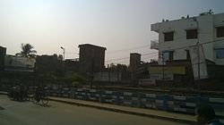
Bangaon
This article needs additional citations for verification. (June 2018) |
Banggun | |
|---|---|
City | |
 Bongaon City | |
| Coordinates: 23°04′N 88°49′E / 23.07°N 88.82°E | |
| Country | |
| State | West Bengal |
| District | North 24 Parganas |
| Government | |
| • Type | Municipality |
| • Body | Bangaon Municipality |
| • Municipality chairman | Shri. Shankar Adhaya[1] |
| Area | |
• Total | 14.27 km2 (5.51 sq mi) |
| Elevation | 7 m (23 ft) |
| Population (2011) | |
• Total | 110,668 |
| • Rank | UA : 30th in West Bengal |
| • Density | 7,800/km2 (20,000/sq mi) |
| Languages | |
| • Official | Bengali, English |
| Time zone | UTC+5:30 (IST) |
| ISO 3166 code | IN-WB |
| Lok Sabha constituency | Bangaon |
| Vidhan Sabha constituency | Bangaon Uttar |
| Website | north24parganas.nic.in |
Bangaon is a city and a municipality in North 24 Parganas district in the state of West Bengal, India. It is the headquarters of the Bangaon subdivision.
Geography
Bangaon is located at 23°04′N 88°49′E / 23.07°N 88.82°E.[3] It has an average elevation of 7 metres (22 feet). Arsenic contamination is a major concern in this area.[4]
Transport
Public transport is provided by the rail, auto and buses. Bangaon is part of the Kolkata Suburban Railway system. It is the last station on the Sealdah-Bangaon section of Eastern Railway, 77 km from Sealdah Station.[5] The Sealdah–Bangaon railway was built between 1882 and 1884. Bangaon is well connected with others major places by buses, like Kolkata, Howrah, Dakshineshwar, Barasat, Habra, Barrackpore, Basirhat, Bagdaha, Kalyani, Krishnanagar, Chakdaha, Ranaghat, Karimpur, Digha, Santragachi etc.[6]
Demographics
In the 2011 census, Bangaon municipality had a population of 110,668, out of which 56,416 were males and 54,252 were females. The 0–6 years population was 8,452. Effective literacy rate for the 7+ population was 90.25 per cent.[7]
Education
Dinabandhu Mahavidyalay is the only degree college in Bangaon which is currently affiliated to West Bengal State University (formerly affiliated to University of Calcutta[8]).[9]
Notable residents
- Jiban Ratan Dhar (1889–1963), politician
- Jogendra Nath Mandal, politician
- Bibhutibhushan Bandyopadhyay, Bengali novelist
- Rakhaldas Bandyopadhyay, archeologist
- Dinabandhu Mitra, Bengali novelist
See also
References
- ^ Bongaon Municipality. Retrieved 24 July 2012
- ^ "Bangaon City".
- ^ Falling Rain Genomics, Inc – Bangaon
- ^ "Groundwater Arsenic contamination in West Bengal-India (19 years study )". Groundwater arsenic contamination status of North 24-Parganas district, one of the nine arsenic affected districts of West Bengal-India. SOES. Archived from the original on 27 September 2007. Retrieved 24 August 2007.
- ^ Eastern Railway time table.
- ^ Chaudhuri, Sukanta, The Railway Comes to Calcutta, in Calcutta, the Living City, Vol. I, edited by Sukanta Chaudhuri, p. 239, Oxford University Press, ISBN 978-0-19-563696-3.
- ^ "Urban Agglomerations/Cities having population 1 lakh and above" (PDF). Provisional Population Totals, Census of India 2011. Retrieved 21 October 2011.
- ^ Dinabandhu Mahavidyalay History Archived 8 July 2012 at the Wayback Machine Retrieved 15 July 2012
- ^ "Affiliated College of West Bengal State University". Archived from the original on 29 October 2012. Retrieved 15 July 2012


