
Danzhou
Danzhou
儋州市 | |
|---|---|
| Baimajing in Danzhou Baimajing in Danzhou | |
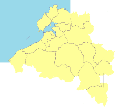
 Map showing entire Danzhou area within Hainan province | |
| Coordinates: 19°30′N 109°35′E / 19.500°N 109.583°E | |
| Country | People's Republic of China |
| Province | Hainan |
| Seat | Nada |
| Population (2010) | |
| • Total | 932,362 |
| Time zone | UTC+8 (China Standard Time) |
| Postal code | 571700[1] |
| ISO 3166 code | CN-HI-04 |
| Website | www |
Danzhou (Chinese: 儋州; pinyin: Dānzhōu) is a prefecture-level city in the northwest of the Chinese island province of Hainan. Although called a "city", Danzhou administers a large area which was called Dan County or Danxian (儋县) until 1993. The administrative seat and urban center of Danzhou is Nada Town, which is often colloquially referred to as Danzhou city. Danzhou was upgraded from a county-level city into a prefecture-level city in February 2015.
Subdivisions
Danzhou is a prefecture-level city of the Hainan province. An uncommon administrative feature is that it has no county-level division. The city government directly administers over 17 towns (镇; zhèn), one state-run institute, and four state-run farms plus an economic development zone:
| Map | ||||||||
|---|---|---|---|---|---|---|---|---|
| Name | Simplified Chinese | Hanyu Pinyin | Population (2010 census) |
Area (km2) |
Density (/km2) |
Division code[2] | Residential communities | Administrative villages |
| Nada [n 1] | 那大镇 | Nàdà Zhèn | 256,652 | 179.2 | 1432.20 | 460400100 | 10 | 20 |
| Heqing | 和庆镇 | HéqìngZhèn | 20,729 | 188.4 | 110.02 | 460400101 | 1 | 11 |
| Nanfeng | 南丰镇 | Nánfēng Zhèn | 23,669 | 260.3 | 90.92 | 460400102 | 1 | 10 |
| Dacheng [n 2] | 大成镇 | Dàchéng Zhèn | 84,620 | 295.4 | 286.45 | 460400103 | 1 | 5 |
| Yaxing [n 3] | 雅星镇 | Yǎxīng Zhèn | 76,427 | 170 | 449.57 | 460400104 | 2 | 12 |
| Lanyang [n 4] | 兰洋镇 | Lányáng Zhèn | 23,711 | 186.9 | 126.86 | 460400105 | 1 | 14 |
| Guangcun | 光村镇 | Guāngcūn Zhèn | 27,803 | 72 | 386.15 | 460400106 | 1 | 10 |
| Mutang | 木棠镇 | Mùtáng Zhèn | 40,373 | 84 | 480.63 | 460400107 | 25 | |
| Haitou | 海头镇 | Hǎitóu Zhèn | 34,648 | 195.8 | 176.95 | 460400108 | 4 | 10 |
| Eman | 峨蔓镇 | Émàn Zhèn | 17,317 | 70.5 | 245.63 | 460400109 | 13 | |
| Sandou [n 5] | 三都镇 | Sāndōu Zhèn | 76,757 | 88 | 872.23 | 460400110 | 9 | |
| Wangwu | 王五镇 | Wángwǔ Zhèn | 24,274 | 126.3 | 192.19 | 460400111 | 1 | 8 |
| Baimajing | 白马井镇 | Báimǎjǐng Zhèn | 59,585 | 54.7 | 1089.30 | 460400112 | 6 | 15 |
| Zhonghe | 中和镇 | Zhōnghé Zhèn | 31,646 | 51.5 | 614.48 | 460400113 | 1 | 11 |
| Paipu | 排浦镇 | Páipǔ Zhèn | 17,577 | 95.8 | 183.47 | 460400114 | 1 | 7 |
| Dongcheng | 东成镇 | Dōngchéng Zhèn | 49,252 | 116.5 | 422.76 | 460400115 | 1 | 21 |
| Xingzhou | 新州镇 | Xīnzhōu Zhèn | 67,316 | 45 | 1495.91 | 460400116 | 12 | 19 |
Demographics
The city's population was 932,362 in 2010. The Han population is 857,342 and the minority population is 75,020.[3]
Transportation
The area will be served by Danzhou Airport, an under-construction airport approximately 25 km (16 mi) northeast of Nada.[4] It will be international-class, built to handle the increasing number of tourists visiting the area. The airport is scheduled for completion in 2015.[5][6][7]
The Hainan Western Ring High-Speed Railway also provides access.
Climate
| Climate data for Danzhou (1981−2010) | |||||||||||||
|---|---|---|---|---|---|---|---|---|---|---|---|---|---|
| Month | Jan | Feb | Mar | Apr | May | Jun | Jul | Aug | Sep | Oct | Nov | Dec | Year |
| Record high °C (°F) | 34.2 (93.6) |
36.2 (97.2) |
38.7 (101.7) |
40.2 (104.4) |
39.2 (102.6) |
37.8 (100.0) |
39.1 (102.4) |
36.6 (97.9) |
35.9 (96.6) |
33.9 (93.0) |
34.0 (93.2) |
31.6 (88.9) |
40.2 (104.4) |
| Mean daily maximum °C (°F) | 22.9 (73.2) |
24.3 (75.7) |
28.0 (82.4) |
31.5 (88.7) |
32.5 (90.5) |
33.1 (91.6) |
33.2 (91.8) |
32.4 (90.3) |
30.7 (87.3) |
28.7 (83.7) |
25.7 (78.3) |
22.6 (72.7) |
28.8 (83.9) |
| Daily mean °C (°F) | 17.9 (64.2) |
19.2 (66.6) |
22.2 (72.0) |
25.5 (77.9) |
27.0 (80.6) |
28.0 (82.4) |
27.9 (82.2) |
27.3 (81.1) |
26.0 (78.8) |
24.4 (75.9) |
21.4 (70.5) |
18.2 (64.8) |
23.8 (74.8) |
| Mean daily minimum °C (°F) | 14.6 (58.3) |
15.9 (60.6) |
18.5 (65.3) |
21.8 (71.2) |
23.5 (74.3) |
24.7 (76.5) |
24.5 (76.1) |
24.1 (75.4) |
23.1 (73.6) |
21.6 (70.9) |
18.5 (65.3) |
15.3 (59.5) |
20.5 (68.9) |
| Record low °C (°F) | 5.2 (41.4) |
6.7 (44.1) |
5.3 (41.5) |
13.0 (55.4) |
16.1 (61.0) |
19.4 (66.9) |
20.6 (69.1) |
21.2 (70.2) |
18.0 (64.4) |
12.2 (54.0) |
8.6 (47.5) |
3.7 (38.7) |
3.7 (38.7) |
| Average precipitation mm (inches) | 15.9 (0.63) |
22.5 (0.89) |
39.7 (1.56) |
77.2 (3.04) |
224.6 (8.84) |
199.4 (7.85) |
242.6 (9.55) |
321.6 (12.66) |
307.9 (12.12) |
256.7 (10.11) |
84.1 (3.31) |
36.5 (1.44) |
1,828.7 (72) |
| Average relative humidity (%) | 84 | 84 | 80 | 78 | 80 | 79 | 79 | 83 | 86 | 85 | 83 | 83 | 82 |
| Source: China Meteorological Data Service Center | |||||||||||||
See also
References
- ^ China Postal Codes - Hainan
- ^ 中华人民共和国县以上行政区划代码 (in Simplified Chinese). Ministry of Civil Affairs.
- ^ 儋州市第六次人口普查主要数据公报 [Danzhou Sixth Population Census Data Bulletin] (in Simplified Chinese).
- ^ http://www.boulter.com/gps/distance/?from=19.696709%2C+109.727247&to=19.51874%2C+109.572238&units=k
- ^ http://centreforaviation.com/profiles/newairports/danzhou-airport
- ^ http://www.whatsonsanya.com/sanya-travel-2213.html
- ^ "儋州机场选址初定梅花岭 张琦严朝君出席会议并讲话" [Zhangzhou Airport Site Selected at Zhangzhou Meihualing - Zhang Qi Yan Chaojun attended the meeting and delivered a speech]. Danzhou Municipal People's Government, Hainan Province. 19 December 2012. Retrieved 21 July 2018.
Hainan topics | |
|---|---|
| General | |
| Geography | |
| Flora and fauna | |
| Media | |
| Transportation | |
| Education | |
| Demographics | |
| Buildings and structures | |
| Cuisine | |
| Visitor attractions | |
County-level divisions of Hainan | ||||||||||||||||||
|---|---|---|---|---|---|---|---|---|---|---|---|---|---|---|---|---|---|---|
| Prefecture-level cities |
|  | ||||||||||||||||
| Provincial administered |
| |||||||||||||||||