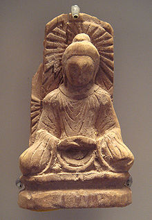
Tumxuk
This is an old revision of this page, as edited by Zanhe (talk | contribs) at 21:09, 17 June 2019 (added Category:Xinjiang Production and Construction Corps using HotCat). The present address (URL) is a permanent link to this revision, which may differ significantly from the current revision.
Tumxuk
图木舒克市 تۇمشۇق شەھىرى | |
|---|---|
 Location of Tumxuk City (red) jurisdiction in Xinjiang | |
| Coordinates: 39°52′N 79°4′E / 39.867°N 79.067°E / 39.867; 79.067 | |
| Country | People's Republic of China |
| Region | Xinjiang |
| Area | |
| • Total | 1,927 km2 (744 sq mi) |
| Population (31 December 2007) | |
| • Total | 110,000 |
| • Density | 57/km2 (150/sq mi) |
| Time zone | UTC+8 (China Standard) |
| Tumxuk | |||||||||||
|---|---|---|---|---|---|---|---|---|---|---|---|
| Chinese name | |||||||||||
| Simplified Chinese | 图木舒克 | ||||||||||
| Traditional Chinese | 圖木舒克 | ||||||||||
| |||||||||||
| Uyghur name | |||||||||||
| Uyghur | تۇمشۇق | ||||||||||
| |||||||||||

Tumxuk[1][2] is a sub-prefecture-level city in the western part of Xinjiang, China, surrounded by Kaxgar Prefecture.
Geography
It covers an area of 1,927 square kilometres (744 sq mi) and is located 1,222 kilometres (759 mi) southwest of Ürümqi.
Tumxuk Airport is under construction 15 kilometers away and will, upon completion, also serve the nearby counties of Maralbexi and Kalpin.
See also
Footnotes
- ^ The official spelling according to Zhōngguó dìmínglù 中国地名录 (Beijing, SinoMaps Press 中国地图出版社 1997); ISBN 7-5031-1718-4
- ^ The official spelling is "Tumxuk" according to Zhōngguó dìmínglù 中国地名录 (Beijing, SinoMaps Press 中国地图出版社 1997); ISBN 7-5031-1718-4; p. 312.
External links
| Current | |
|---|---|
| Under construction | |
| Approved | |
| Former | |
| |||||||||||||||||||||||||||||||||||||||||||||||||||||||||||||||
| |||||||||||||||||||||||||||||||||||||||||||||||||||||||||||||||
| |||||||||||||||||||||||||||||||||||||||||||||||||||||||||||||||
| |||||||||||||||||||||||||||||||||||||||||||||||||||||||||||||||
| |||||||||||||||||||||||||||||||||||||||||||||||||||||||||||||||

